Dighton, Massachusetts

Last updated

Dighton, Massachusetts
View Of North Dighton Village in 1881.jpg
View of North Dighton Village in 1881
Flag of Dighton, Massachusetts.jpg
Seal of Dighton, Massachusetts.png
Bristol County Massachusetts incorporated and unincorporated areas Dighton highlighted.svg
Location in Bristol County in Massachusetts
Coordinates: 41°48′50″N71°07′15″W / 41.81389°N 71.12083°W / 41.81389; -71.12083
Country United States
State Massachusetts
County Bristol
Deeded1672 [1]
Incorporated1712 [1]
Government
  Type Open town meeting
Area
  Total22.6 sq mi (58.5 km2)
  Land22.0 sq mi (57.0 km2)
  Water0.6 sq mi (1.5 km2)
Elevation
19 ft (6 m)
Population
 (2022)
  Total8,101
  Density360/sq mi (140/km2)
Time zone UTC-5 (Eastern)
  Summer (DST) UTC-4 (Eastern)
ZIP code
02715 / 02764 (North Dighton)
Area code 508 / 774
FIPS code 25-16950
GNIS feature ID0618280
Website www.dighton-ma.gov

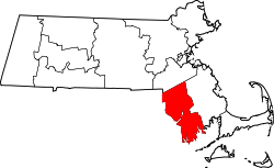
Dighton is a town in Bristol County, Massachusetts, United States. The population was 8,168 at the 2022 census. [2] The town is located on the western shore of the Taunton River in the southeastern part of the state.

Contents

History

Crossroads

Site of Dighton Ferry Landing Dighton Wharves historic marker.jpg
Site of Dighton Ferry Landing

Dighton's location has long made it a crossroads for travel. The "Old Bristol Path" took early settlers from the Pilgrim settlement in Plymouth, Massachusetts to Bristol, Rhode Island, the home of Massasoit. [3] :1 A ferry took travelers across the Taunton River. [3] :34 Later, a stage coach ran through Dighton, connecting Taunton and Bristol. [3] :2 Dighton was also along the route between Fall River and Taunton. [3] :16

Origin

Dighton was originally part of Taunton's South Purchase and other surrounding towns. It was separated in 1672, [1] officially incorporated in 1712. [4] It was named for Frances Dighton Williams, wife of Richard Williams, a town elder. [5] At the time of incorporation, the town included land on both sides of the Taunton River, including the land of Assonet Neck, which includes Dighton Rock, a rock found in the shallows of the river which includes cryptic carvings whose origins are debated to this day. However, in 1799, that land on the east bank of the river was annexed by Berkley, thus giving that town the claim of being the home of the rock.

Molasses Affair

In 1765, shortly after the renewal of the Molasses Act, Dighton's wharves were the site of the "Molasses Affair," a protest of British taxes on molasses similar to the more famous Boston Tea Party. [6] A local ship reported a cargo of 63 casks of molasses to the British custom officials, but the ship actually contained double that number. [6] The customs official ordered the ship's cargo impounded while he departed for Newport for assistance. [6] While he was gone, forty local men with blackened faces stole the cargo, ran the ship aground, and drilled holes in the hull to protest British tax policies. [6]

Revolution

During the time of the American Revolutionary War, Dighton gave refuge to several refugees from Newport, Rhode Island who had fled the British occupation there. These included Ezra Stiles and William Ellery. [3] :104 Stiles kept a diary of his time in Dighton. [3] :104 In January 1778 the town council voted in favor of the Articles of Confederation. [3] :116

Industries

As it was located at the beginning of the tidewater of the river, Dighton was a shipbuilding community, and even had status as a port of call. North of Dighton the Taunton River becomes too shallow for ships to navigate, [3] :152 [6] and this, along with its centralized location, allowed Dighton to become a shipping hub for southeastern Massachusetts. In 1789 Dighton was made a port of entry for the surrounding towns. [3] :151 Ships would unload in Dighton and goods were either transferred to smaller boats or towed by oxen along a tow path on the east side of the river to Taunton. [3] :151

Herring were plentiful in the Taunton River, and at one point Dighton's herring fishery provided more income to the town than any other industry. [3] :144 Fish were preserved in salt and exported as far away as the West Indies. [3] :144

Thomas Coram Cpt. Thomas Coram by W. Nutter, 1796.JPG
Thomas Coram

Shipbuilding started in Dighton as early as 1698. Thomas Coram built Dighton's first shipyard on the west side of the Taunton River. [3] :148 Shipbuilding grew into a significant industry after 1800, peaking around 1850. [3] :149–150 During 1840–1845 twenty-two schooners, two sloops, four brigs, and three barks were built in Dighton. [3] :149–150

There were also cotton mills, paper mills, manufacturers and farming concerns in the town. From before the Civil War to at least 1912, the town was regionally known for its strawberry farms. [3] :233 With time, however, many of these industries left, leaving the town as a rural suburban community with some small farms.

Tricentennial

In 2012, Dighton celebrated its Tricentennial with town selectmen donning historic costumes and crossing the Taunton River to Ferry Landing. Afterwards they held a ceremony at Founders Hall. [7]

Geography

According to the United States Census Bureau, the town has a total area of 22.6 square miles (58.5 km2), of which 22.0 square miles (57.0 km2) is land and 0.58 square miles (1.5 km2), or 2.56%, is water. [8]

Dighton is bordered by Rehoboth to the west, Swansea to the southwest, Somerset to the south, the Taunton River and the town of Berkley to the east, and the city of Taunton to the north. In addition to being bordered by the Taunton River, it also is bordered by the Three Mile River, a tributary which empties into the Taunton along the northeast border of town. The town is also crossed by the Segreganset River, another tributary of the Taunton which flows through the center of town, as well as several smaller brooks. The highest point in the town is in its northwest corner, where the elevation rises above 236 feet (72 m) above sea level. [9]

New two-lane bridge, opened August 2015 Berkley-Dighton Bridge 2015.jpg
New two-lane bridge, opened August 2015

Dighton is the site of the Berkley–Dighton Bridge, originally a one-lane bridge built in the 1890s as a link between Center Street in Dighton and Elm Street in Berkley. It is the only span crossing the Taunton River between the Brightman Street Bridge between Somerset and Fall River, and the Plain Street Bridge in Taunton, a drive of 12+12 miles (20 km) (and 4 mi or 6 km south of the Plain Street Bridge). In 2010, the old bridge was demolished and a temporary bridge handled traffic as a new bridge was built. In August 2015 a new two-lane bridge opened to traffic.

Dighton's localities are Chestnut Tree Corner, Dighton, Dighton Rock State Park, North Dighton, Segreganset, South Dighton and Wheeler's Corner.

Demographics

Historical population
YearPop.±%
1850 1,641    
1860 1,733+5.6%
1870 1,817+4.8%
1880 1,791−1.4%
1890 1,880+5.0%
1900 1,802−4.1%
1910 2,235+24.0%
1920 2,574+15.2%
1930 3,147+22.3%
1940 2,983−5.2%
1950 2,950−1.1%
1960 3,769+27.8%
1970 4,667+23.8%
1980 5,352+14.7%
1990 5,631+5.2%
2000 6,175+9.7%
2010 7,086+14.8%
2020 8,101+14.3%
2022*8,168+0.8%

Source: United States census records and Population Estimates Program data. [10] [11] [12] [13] [14] [15] [16] [17] [18] [19] [20]

As of the census [21] of 2000, there were 6,175 people, 2,201 households, and 1,718 families residing in the town. The population density was 275.9 inhabitants per square mile (106.5/km2). There were 2,280 housing units at an average density of 101.9 per square mile (39.3/km2). The racial makeup of the town was 97.80% White, 0.53% African American, 0.19% Native American, 0.49% Asian, 0.02% Pacific Islander, 0.28% from other races, and 0.70% from two or more races. Hispanic or Latino of any race were 1.07% of the population.

There were 2,201 households, out of which 37.4% had children under the age of 18 living with them, 64.5% were married couples living together, 9.9% had a female householder with no husband present, and 21.9% were non-families. 18.8% of all households were made up of individuals, and 9.7% had someone living alone who was 65 years of age or older. The average household size was 2.78 and the average family size was 3.17.

In the town, the population was spread out, with 26.1% under the age of 18, 6.3% from 18 to 24, 30.4% from 25 to 44, 24.3% from 45 to 64, and 12.8% who were 65 years of age or older. The median age was 38 years. For every 100 females, there were 96.8 males. For every 100 females age 18 and over, there were 92.4 males.

The median income for a household in the town was $58,600, and the median income for a family was $64,792. Males had a median income of $41,427 versus $28,250 for females. The per capita income for the town was $22,600. About 1.0% of families and 2.6% of the population were below the poverty line, including 3.8% of those under age 18 and 1.2% of those age 65 or over.

Arts and culture

Annual cultural events

Dighton is home of the Cow Chip Festival. The Dighton Lions Club hosts the event. Every June a traveling carnival comes and sets up behind the Town Hall. Fireworks have been a recent addition to the festival. There are rides and a carnival mid-way along with food, musical performances, a lawn tractor pull, woodsman competition pony rides and the chicken BBQ. The name was given to it because they set up squares on the field behind the town hall. They place cows out on the enclosed squares. People then place bets on the square that they believe will be defecated on first by one of the cows. [22]

Parks and recreation

Sweets Knoll State Park Sweets Knoll State Park sign, Dighton Massachusetts.jpg
Sweets Knoll State Park

Sweets Knoll State Park is a fifty-six acre park located in Dighton. [23] It was purchased in June 2009, and includes two miles of old railroad bed which may be adapted into a walking and biking path, picnic areas, a small boat launch, and fishing. [23]

Tricentennial Park, a small waterfront park along the Taunton River, was created as an Eagle Scout project by a young resident in honor of the town's tricentennial in 2012.

Government

Dighton is governed by an open town meeting led by a board of selectmen. Currently serving on the Board of Selectmen are: Leonard Hull (Chairman), Peter Caron (Clerk), and Nicole Mello. The town has a central police station along Route 138 by the banks of the Segreganset River, separate post offices and fire departments near the center of town and North Dighton, and the Dighton Public Library at the center of town. Dighton has a conservation area and a small park next to the town hall near the intersection of Center Street and Route 138.

Dighton Town Hall Dighton Town Hall, Massachusetts.jpg
Dighton Town Hall

Dighton is located in the Fifth Bristol state representative district, which includes Somerset and parts of Swansea and Taunton. The town is represented in the state senate in the First Plymouth and Bristol district, which includes the towns of Berkley, Bridgewater, Carver, Marion, Middleborough, Raynham, Taunton and Wareham. Dighton is patrolled by the Middleboro Barracks (D4) of the Massachusetts State Police. On the national level, the town is part of Massachusetts Congressional District 4, which is represented by Jake Auchincloss. The state's junior (Class I) Senator is Ed Markey and the state's senior (Class II) Senator is Elizabeth Warren.

Climate

In a typical year, Dighton, Massachusetts temperatures fall below 50 °F (10 °C) for 164 days per year. Annual precipitation is typically 47.6 inches (1,210 mm) per year (a high amount for the US) and snow covers the ground 40 days per year or 11.0% of the year (moderate in the US). It may be helpful to understand the yearly precipitation by imagining 9 straight days of moderate rain per year. The humidity is below 60% for approximately 39.8 days or 10.9% of the year. [24]

Education

Bristol County Agricultural High School Bristol County Agricultural High School.jpg
Bristol County Agricultural High School

Dighton and its neighboring town Rehoboth comprise one school district, the Dighton-Rehoboth School District. It was founded in 1987 to oversee the schools of both towns. The high school, Dighton-Rehoboth Regional High School, was founded in 1958 to serve both towns. The school itself is located in North Dighton, mere yards away from the Rehoboth town line. Its athletics teams are known as the Falcons, and its colors are green and gold. The Dighton Middle and Elementary Schools are located near the corner of Center Street and Somerset Avenue (Route 138) at the center of town. [25] [26]

The town is also the home of Bristol County Agricultural High School. The school operates a large farm along the banks of the Taunton River at its Center Street location. [27] The town does not have any affiliation with a regional vocational school system, the closest one being Bristol-Plymouth Regional Technical School, located in Taunton, Massachusetts. [28]

Library

Dighton Public Library DightonMA PublicLibrary.jpg
Dighton Public Library

Dighton is served by the Dighton Public Library. As of December 2009, the Library Director was Jocelyn Tavares. [29]

Historic places

Notable people

See also

Related Research Articles

<span class="mw-page-title-main">Bristol County, Massachusetts</span> County in Massachusetts, United States

Bristol County is a county in the Commonwealth of Massachusetts. As of the 2020 census, the population was 579,200. The shire town is Taunton. Some governmental functions are performed by the Commonwealth of Massachusetts, others by the county, and others by local towns and cities.

<span class="mw-page-title-main">Berkley, Massachusetts</span> Town in Massachusetts, United States

Berkley is a town in Bristol County, Massachusetts, United States, located south of Boston and east of Providence, Rhode Island. The population was 6,764 according to the 2020 census, making it the least populated town in the county.

<span class="mw-page-title-main">Freetown, Massachusetts</span> Town in Massachusetts, United States

Freetown is a town in Bristol County, Massachusetts, United States. The population was 9,206 at the 2020 census.

<span class="mw-page-title-main">Raynham, Massachusetts</span> Town in Massachusetts, United States

Raynham is a town in Bristol County, Massachusetts, United States, located approximately 32 miles (51 km) south of Boston and 22 miles (35 km) northeast of Providence, Rhode Island. The population was 15,082 at the 2020 census. It has one village, Raynham Center.

<span class="mw-page-title-main">Rehoboth, Massachusetts</span> Town in Massachusetts, United States

Rehoboth is a historic town in Bristol County, Massachusetts. Established in 1643, Rehoboth is one of the oldest towns in Massachusetts. The population was 12,502 at the 2020 census. Rehoboth is a mostly rural community with many historic sites, including 53 historic cemeteries.

<span class="mw-page-title-main">Seekonk, Massachusetts</span> Town in Massachusetts, United States

Seekonk is a town in Bristol County, Massachusetts, United States, on the Massachusetts border with Rhode Island. It was incorporated in 1812 from the western half of Rehoboth. The population was 15,531 at the 2020 census. Until 1862, the town of Seekonk also included what is now the City of East Providence, Rhode Island, as well as the section of the City of Pawtucket, Rhode Island east of the Blackstone River. The land in the western half of the town was given to Rhode Island by the United States Supreme Court as part of a longstanding boundary dispute with Massachusetts.

<span class="mw-page-title-main">Swansea, Massachusetts</span> Town in Massachusetts, United States

Swansea is a town in Bristol County in southeastern Massachusetts. It is located at the mouth of the Taunton River, just west of Fall River, 47 miles (76 km) south of Boston, and 12 miles (19 km) southeast of Providence, Rhode Island. The population was 17,144 at the 2020 census. The villages of Hortonville, Barneyville and Ocean Grove are located in the town.

<span class="mw-page-title-main">Taunton, Massachusetts</span> City in Massachusetts, United States

Taunton is a city in Bristol County, Massachusetts, United States. It is the seat of Bristol County. Taunton is situated on the Taunton River which winds its way through the city on its way to Mount Hope Bay, 10 miles (16 km) to the south. At the 2020 census, the city had a population of 59,408. Shaunna O'Connell is the mayor of Taunton.

<span class="mw-page-title-main">Carver, Massachusetts</span> Town in Massachusetts, United States

Carver is a town in Plymouth County, Massachusetts, United States. The population was 11,645 at the 2020 census. It is named for John Carver, the first governor of the Plymouth Colony. The town features two popular tourist attractions: Edaville USA theme park and King Richard's Faire, the largest and longest-running renaissance fair in New England.

<span class="mw-page-title-main">Lakeville, Massachusetts</span> Town in Massachusetts, United States

Lakeville is a town in Plymouth County, Massachusetts, United States. The population was 11,523 at the 2020 census.

<span class="mw-page-title-main">Marion, Massachusetts</span> Town in Massachusetts, United States

Marion is a town in Plymouth County, Massachusetts, United States. The population was 5,347 at the 2020 census.

<span class="mw-page-title-main">Somerset, Massachusetts</span> Town in Massachusetts, United States

Somerset is a town in Bristol County, Massachusetts, United States. The population was 18,303 at the 2020 census. It is the birthplace and hometown of Clifford Milburn Holland (1883–1924), the chief engineer and namesake of the Holland Tunnel in New York City.

<span class="mw-page-title-main">Greater Taunton Area</span>

The Greater Taunton Area is the suburban area surrounding the city of Taunton, in northeastern Bristol County, Massachusetts. It comprises various present-day municipalities that were once under the jurisdiction of Taunton in Colonial America. These present-day municipalities include the towns of Berkley, Dighton, Norton, and Raynham.

<span class="mw-page-title-main">Berkley–Dighton Bridge</span> Bridge in Berkley and Dighton, Massachusetts

The fourth Berkley–Dighton Bridge is a four-span concrete arch bridge with closed spandrel walls of cast-in-place concrete, using pile-supported abutments and piers. The bridge was made such that it appears to be constructed of stone masonry rather than concrete. The two end spans are 74 feet (23 m) and the two center spans are 92 feet (28 m) for a total bridge length of approximately 350 feet (110 m).

<span class="mw-page-title-main">Greater Attleboro Taunton Regional Transit Authority</span>

The Greater Attleboro Taunton Regional Transit Authority (GATRA) oversees and coordinates public and medical transportation in the areas of Attleboro and Taunton, Massachusetts and 24 nearby areas. It operates daily fixed bus routes, commuter shuttle services and Dial-A-Ride services for seniors and persons with disabilities within communities in Bristol, Norfolk, and Plymouth counties. GATRA is based at the Bloom Bus Terminal in Taunton.

<span class="mw-page-title-main">Massachusetts's 10th congressional district</span> Former U.S. House district from 1795 to 2013

Massachusetts's 10th congressional district is an obsolete district that was active during 1795–2013. It was first located in the District of Maine during 1795–1803, then located in several different areas of Massachusetts. It was most recently eliminated in 2013 as district lines were redrawn to accommodate the loss of the seat due to reapportionment as a result of the 2010 census.

<span class="mw-page-title-main">Massachusetts's 15th congressional district</span>

Massachusetts's 15th congressional district is an obsolete district that was first active 1803–1821 in the District of Maine, and again active 1913–1943 in Southeastern Massachusetts. It was last eliminated in 1943 after the 1940 Census. Its last Congressman was Charles L. Gifford, who was redistricted into the ninth district.

<span class="mw-page-title-main">Norton, Massachusetts</span> Town in Massachusetts, United States

Norton is a town in Bristol County, Massachusetts, United States, and contains the villages of Norton Center and Chartley. The population was 19,202 at the 2020 census. Home of Wheaton College, Norton hosts the Dell Technologies Championship, a tournament of the PGA Tour held annually on the Labor Day holiday weekend at the TPC Boston golf club.

The Taunton Daily Gazette is a daily newspaper founded in 1848. Based in Taunton, Massachusetts, its coverage area also includes Berkley, Rehoboth, Dighton, Lakeville, Norton, and Raynham.

<span class="mw-page-title-main">Massachusetts Senate's 1st Plymouth and Bristol district</span> American legislative district

Massachusetts Senate's 1st Plymouth and Bristol district in the United States is one of 40 legislative districts of the Massachusetts Senate. It covers 15.1% of Bristol County and 17.8% of Plymouth County population. Democrat Marc Pacheco of Taunton has represented the district since 1993.

References

  1. 1 2 3 "Dighton Massachusetts Town Website". Dighton Massachusetts Town Website. Archived from the original on March 14, 2012. Retrieved December 5, 2012.
  2. "Census - Geography Profile: Dighton town, Bristol County, Massachusetts". U.S. Census Bureau. Retrieved November 11, 2021.
  3. 1 2 3 4 5 6 7 8 9 10 11 12 13 14 15 16 17 Lane, Helen (1962). History of the town of Dighton, Massachusetts: The South Purchase. History of Dighton, Mass. Dighton, Massachusetts: Town of Dighton. Retrieved April 15, 2018.
  4. "Dighton Massachusetts". City-Data.com. Retrieved November 10, 2012.
  5. Gannett, Henry (1905). The Origin of Certain Place Names in the United States. Govt. Print. Off. pp.  106.
  6. 1 2 3 4 5 "NRHP nomination form and MACRIS inventory record for Dighton Wharves Historic District". Commonwealth of Massachusetts. Retrieved July 31, 2015.
  7. Nichols, Christopher (May 11, 2012). "Dighton Tricentennial marks town's Founder's Day Saturday". Taunton Daily Gazette. Retrieved April 16, 2018.
  8. "Geographic Identifiers: 2010 Demographic Profile Data (G001): Dighton town, Bristol County, Massachusetts". U.S. Census Bureau, American Factfinder. Archived from the original on February 12, 2020. Retrieved February 5, 2013.
  9. U.S. Geological Survey Taunton, MA 7.5 by 15-minute quadrangle, 1987.
  10. "Total Population (P1), 2010 Census Summary File 1". American FactFinder, All County Subdivisions within Massachusetts. United States Census Bureau. 2010.
  11. "Massachusetts by Place and County Subdivision - GCT-T1. Population Estimates". United States Census Bureau. Retrieved July 12, 2011.
  12. "1990 Census of Population, General Population Characteristics: Massachusetts" (PDF). US Census Bureau. December 1990. Table 76: General Characteristics of Persons, Households, and Families: 1990. 1990 CP-1-23. Retrieved July 12, 2011.
  13. "1980 Census of the Population, Number of Inhabitants: Massachusetts" (PDF). US Census Bureau. December 1981. Table 4. Populations of County Subdivisions: 1960 to 1980. PC80-1-A23. Retrieved July 12, 2011.
  14. "1950 Census of Population" (PDF). Bureau of the Census. 1952. Section 6, Pages 21-10 and 21-11, Massachusetts Table 6. Population of Counties by Minor Civil Divisions: 1930 to 1950. Retrieved July 12, 2011.
  15. "1920 Census of Population" (PDF). Bureau of the Census. Number of Inhabitants, by Counties and Minor Civil Divisions. Pages 21-5 through 21-7. Massachusetts Table 2. Population of Counties by Minor Civil Divisions: 1920, 1910, and 1920. Retrieved July 12, 2011.
  16. "1890 Census of the Population" (PDF). Department of the Interior, Census Office. Pages 179 through 182. Massachusetts Table 5. Population of States and Territories by Minor Civil Divisions: 1880 and 1890. Retrieved July 12, 2011.
  17. "1870 Census of the Population" (PDF). Department of the Interior, Census Office. 1872. Pages 217 through 220. Table IX. Population of Minor Civil Divisions, &c. Massachusetts. Retrieved July 12, 2011.
  18. "1860 Census" (PDF). Department of the Interior, Census Office. 1864. Pages 220 through 226. State of Massachusetts Table No. 3. Populations of Cities, Towns, &c. Retrieved July 12, 2011.
  19. "1850 Census" (PDF). Department of the Interior, Census Office. 1854. Pages 338 through 393. Populations of Cities, Towns, &c. Retrieved July 12, 2011.
  20. "City and Town Population Totals: 2020-2022". United States Census Bureau . Retrieved October 29, 2023.
  21. "U.S. Census website". United States Census Bureau . Retrieved January 31, 2008.
  22. Cow Chip festival classic for Dighton - Taunton, MA - The Taunton Gazette
  23. 1 2 Miller, Kendra Leigh (July 18, 2010). "'Idyllic' spot in Dighton is now a state park". The Herald News. GateHouse Media, Inc. Retrieved December 1, 2012.
  24. "Climate in Dighton, Massachusetts" . Retrieved May 2, 2023.
  25. "Dighton-Rehoboth Regional School District". Dighton-Rehoboth Regional School District. Retrieved November 10, 2012.
  26. "Dighton-Rehoboth Regional School District". Massachusetts School Building Authority. Retrieved November 10, 2012.
  27. "Dighton-Rehoboth Regional School District". Bristol County Agricultural High School. Archived from the original on May 15, 2012. Retrieved November 10, 2012.
  28. "Bristol-Plymouth Regional Technical School". Bristol-Plymouth Regional Technical School. Archived from the original on November 5, 2012. Retrieved November 10, 2012.
  29. Library staff Archived February 3, 2010, at the Wayback Machine , retrieved 2009-12-19
  30. "SHAW, Samuel, (1768 - 1827)". Biographical Directory of the United States Congress. Retrieved November 14, 2012.
  31. "Rhode Island Historical Society". www.rihs.org. Archived from the original on April 12, 2003. Retrieved June 3, 2021.