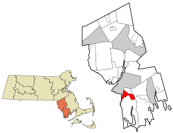
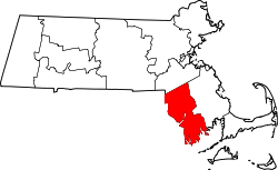
North Westport, Massachusetts | |
---|---|
Coordinates: 41°39′38″N71°5′18″W / 41.66056°N 71.08833°W | |
Country | United States |
State | Massachusetts |
County | Bristol |
Town | Westport |
Area | |
• Total | 6.18 sq mi (16.00 km2) |
• Land | 5.19 sq mi (13.44 km2) |
• Water | 0.99 sq mi (2.56 km2) |
Elevation | 138 ft (42 m) |
Population (2020) | |
• Total | 4,720 |
• Density | 909.44/sq mi (351.16/km2) |
Time zone | UTC-5 (Eastern (EST)) |
• Summer (DST) | UTC-4 (EDT) |
ZIP Code | 02790 (Westport) |
FIPS code | 25-49710 |
GNIS feature ID | 1867310 |
North Westport is a census-designated place (CDP) in the town of Westport in Bristol County, Massachusetts, United States. The population was 4,571 at the 2010 census. [2]
North Westport is located at 41°39′38″N71°5′18″W / 41.66056°N 71.08833°W (41.660495, -71.088407). [3]
According to the United States Census Bureau, the CDP has a total area of 15.9 km2 (6.2 mi2), of which 13.4 km2 (5.2 mi2) is land and 2.5 km2 (1.0 mi2) (15.61%) is water.
Census | Pop. | Note | %± |
---|---|---|---|
2020 | 4,720 | — | |
U.S. Decennial Census [4] |
As of the census [5] of 2000, there were 4,533 people, 1,742 households, and 1,299 families residing in the CDP. The population density was 337.2/km2 (873.9/mi2). There were 1,806 housing units at an average density of 134.4/km2 (348.2/mi2). The racial makeup of the CDP was 97.66% White, 0.24% African American, 0.09% Native American, 0.64% Asian, 0.02% Pacific Islander, 0.40% from other races, and 0.95% from two or more races. Hispanic or Latino of any race were 0.75% of the population.
There were 1,742 households, out of which 27.7% had children under the age of 18 living with them, 59.2% were married couples living together, 10.6% had a female householder with no husband present, and 25.4% were non-families. 21.2% of all households were made up of individuals, and 10.2% had someone living alone who was 65 years of age or older. The average household size was 2.60 and the average family size was 3.01.
In the CDP, the population was spread out, with 21.0% under the age of 18, 7.2% from 18 to 24, 28.4% from 25 to 44, 27.9% from 45 to 64, and 15.6% who were 65 years of age or older. The median age was 41 years. For every 100 females, there were 94.8 males. For every 100 females age 18 and over, there were 93.9 males.
The median income for a household in the CDP was $45,433, and the median income for a family was $55,881. Males had a median income of $40,532 versus $30,125 for females. The per capita income for the CDP was $20,790. About 3.4% of families and 6.7% of the population were below the poverty line, including 8.5% of those under age 18 and 9.0% of those age 65 or over.
The village of North Westport, is the oldest village out of seven villages located in the town of Westport, Massachusetts. The village of North Westport and Westport Factory were the headquarters of the Westport Manufacturing Company which was established in 1854 on the banks of the east branch of the Westport River. The village had many schools, churches, offices, and stores, which provided many jobs for residents in the area at that time. The electric trolley services, which was built in 1894, connected the cities of Fall River and New Bedford as well as making stops at the factory and nearby Lincoln Park which was an amusement park that provided entertainment for people, especially in the summer months. The village went into decline during the mid to late 20th century, as the Westport Manufacturing Company went bankrupt and with the closing of Lincoln Park in 1987. Today, the village has become a quiet neighborhood and is still home to many small businesses and stores along U.S. Route 6.
Acushnet Center is a census-designated place (CDP) in the town of Acushnet in Bristol County, Massachusetts, United States. The population was 3,030 at the 2020 census, which was 28.7% of the population of the entire town.
North Attleborough Center is the central developed area in the town of North Attleborough in Bristol County, Massachusetts, United States. It was a census-designated place at the 2000 census, at which time its population was 16,796. It was not delineated as a census-designated place in 2010.
North Seekonk is a census-designated place (CDP) in the town of Seekonk in Bristol County, Massachusetts, United States. The population was 2,643 at the 2010 census.
Raynham Center is a census-designated place (CDP) in the town of Raynham in Bristol County, Massachusetts, United States. The population was 4,100 at the 2010 census.
East Pepperell is a village and census-designated place (CDP) in the town of Pepperell in Middlesex County, Massachusetts, United States. The population was 2,120 at the 2020 census.
Marion Center is a census-designated place (CDP) in the town of Marion in Plymouth County, Massachusetts, United States. The population was 1,111 at the 2010 census.
Middleborough Center is a census-designated place (CDP) in the town of Middleborough in Plymouth County, Massachusetts, United States. The population was 7,319 at the 2010 census.
North Lakeville is a census-designated place (CDP) in the town of Lakeville in Plymouth County, Massachusetts, United States. The population was 2,630 at the 2010 census.
North Plymouth is a census-designated place (CDP) in the town of Plymouth in Plymouth County, Massachusetts, United States. The population was 3,600 at the 2010 census. It is best known as the location of Cordage Park, a small village where the Plymouth Cordage Company was once headquartered. The village is now home to Cordage Commerce Center, a large retail development that consists of offices and stores.
Wareham Center is a census-designated place (CDP) in the town of Wareham in Plymouth County, Massachusetts, United States. The population was 2,896 at the 2010 census.
West Wareham is a census-designated place (CDP) in the town of Wareham in Plymouth County, Massachusetts, United States. The population was 2,064 at the 2010 census.
Weweantic is a census-designated place (CDP) in the town of Wareham in Plymouth County, Massachusetts, United States. The population was 2,105 at the 2010 census.
South Lancaster is a census-designated place (CDP) in the town of Lancaster and close to the Town of Clinton in Worcester County, Massachusetts, United States. The population was 1,642 at the 2020 census.
Harrisville is a census-designated place (CDP) and village in the town of Burrillville in Providence County, Rhode Island, United States. The population was 1,605 at the 2010 census. Much of the community composes a historic district listed on the National Register of Historic Places. The village was named after nineteenth century manufacturer Andrew Harris. Previously, the village was named Rhodesville, after Captain William Rhodes, an eighteenth century privateer.
Sandwich is a village and census-designated place (CDP) in the town of Sandwich in Barnstable County, Massachusetts, United States. The population was 2,962 at the 2010 census, out of a total of 20,675 people in the town of Sandwich.
Sharon is a census-designated place (CDP) in the town of Sharon in Norfolk County, Massachusetts, United States. The population was 6,184 at the 2020 census.
Oxford is a census-designated place (CDP) in the town of Oxford in Worcester County, Massachusetts, United States. The population was 6,103 at the 2010 census.
Rutland is a census-designated place (CDP) in the town of Rutland in Worcester County, Massachusetts, United States. The population was 2,111 at the 2010 census.
Webster is a census-designated place (CDP) in the town of Webster in Worcester County, Massachusetts, United States. The population was 11,412 at the 2010 census.
Pepperell is a census-designated place (CDP) comprising the main village in the town of Pepperell in Middlesex County, Massachusetts, United States. The population was 2,390 at the 2020 census, out of 11,604 in the entire town of Pepperell.