Berkley-Dighton Bridge | |
|---|---|
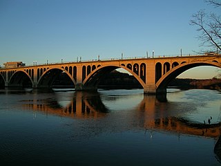
 View from Berkley shore, October 2015 | |
| Coordinates | 41°50′5.83″N71°6′29.28″W / 41.8349528°N 71.1081333°W Coordinates: 41°50′5.83″N71°6′29.28″W / 41.8349528°N 71.1081333°W |
| Carries | vehicular and pedestrian traffic |
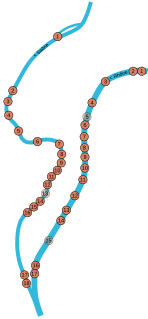
| Crosses | Taunton River |
| Locale | Berkley and Dighton, Massachusetts |
| Preceded by | Weir St. Bridge |
| Followed by | Veterans Memorial Bridge |
| Characteristics | |
| Design | concrete arch bridge with closed spandrels |
| Total length | approximately 350 feet (110 m) |
| Width | 32 feet (9.8 m) |
| Longest span | 2 × 92 feet (28 m) |
| No. of spans | 4 |
| Clearance below | 12 feet (3.7 m) |
| History | |
| Construction start | July 2012 [1] |
| Construction end | August 2015 [2] |
| Replaces | Berkley–Dighton Bridge (1896) |
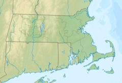 Berkley-Dighton Bridge Location in Massachusetts | |
The fourth Berkley–Dighton Bridge is a four-span concrete arch bridge with closed spandrel walls of cast-in-place concrete, using pile-supported abutments and piers. The bridge was made such that it appears to be constructed of stone masonry rather than concrete. The two end spans are 74 feet (23 m) and the two center spans are 92 feet (28 m) for a total bridge length of approximately 350 feet (110 m). [3] [4]

An arch bridge is a bridge with abutments at each end shaped as a curved arch. Arch bridges work by transferring the weight of the bridge and its loads partially into a horizontal thrust restrained by the abutments at either side. A viaduct may be made from a series of arches, although other more economical structures are typically used today.
Contents
Bridges at this location are the only crossing over the Taunton River between the Veterans Memorial Bridge in Fall River and the Weir Street Bridge in Taunton.

The Taunton River, is a river in southeastern Massachusetts in the United States. It arises from the confluence of the Town River and Matfield River, in the town of Bridgewater. From there it meanders through the towns of Halifax, Middleborough and Raynham, through the city of Taunton for which it is named, the towns of Berkley, Dighton, Somerset, and the Assonet section of Freetown, to Fall River where it joins Mount Hope Bay, an arm of Narragansett Bay.

The Veterans Memorial Bridge is a bascule bridge connecting Somerset, Massachusetts and Fall River, Massachusetts. The bridge carries U.S. Route 6 and Route 138 over the Taunton River, with connecting ramps to Route 79, and includes a bike path on its north side. The $290 million bridge was dedicated to area veterans on September 11, 2011. The bike path was also dedicated in a separate ceremony that same day in honor of Pvt. Michael E. Bouthot, who was killed in action in Iraq in 2006.
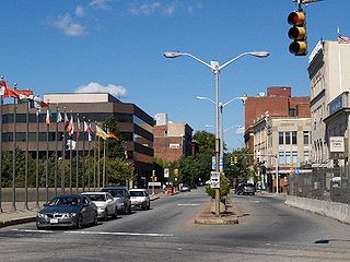
Fall River is a city in Bristol County, Massachusetts, United States. The City of Fall River is located approximately 53 miles (85 km) south of Boston, 17 miles (27 km) southeast of Providence, Rhode Island, 20 miles (32 km) south of Taunton, 12 miles (19 km) west of New Bedford, 20 miles (32 km) north of Newport, Rhode Island, and 200 miles (320 km) northeast of New York City. The City of Fall River's population was 87,103 at the 2010 census, making it the tenth-largest city in the state.
Beginning in August 2010, a temporary bridge was in place while the new bridge was being built. Construction on the bridge began in July 2012. [1] The new bridge opened to traffic on August 28, 2015. [2] [4]