U6 is a 19.9 km (12.4 mi) long rapid transit line on the Berlin U-Bahn with 29 stations. It runs in a north-south direction from the Berlin locality of Tegel in the north via Friedrichstraße to Mariendorf, a locality in the southern part of the city. It is one of the five large profile ("Großprofil") lines.
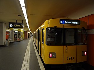
The U7 is a rail line on the Berlin U-Bahn. It runs completely underground for a length of 31.8 kilometres (19.8 mi) through 40 stations and connects Spandau, via Neukölln, to Gropiusstadt and Rudow. The U7 was originally the south-eastern branch of the Nord-Süd-Bahn (U6) that ran between the branching point at Belle-Alliance-Straße (Mehringdamm) and Grenzallee; however, in the 1960s, this stretch was separated from the rest of the line and extended at each end to form a new line.
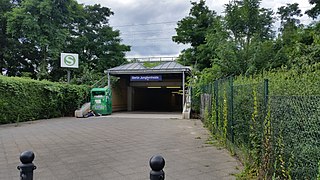
Berlin Jungfernheide is a railway station located at Charlottenburg-Nord, in the Charlottenburg-Wilmersdorf district of Berlin, served by the S-Bahn lines S41 and S42, the U-Bahn line U7 and Regional-Express trains of the Deutsche Bahn. Its name literally translates into "maidens' heathland"; it was named after the Jungfernheide, a former large forest in the proximity of this station.

U55 was an U-Bahn line in the German capital city of Berlin. It connected the new Berlin Hauptbahnhof, or main railway station, to an interchange with the S-Bahn at Brandenburger Tor. It had only three stations, did not connect to any other U-Bahn line, and was operated as a shuttle line using a single train.

Kurt-Schumacher-Platz is a station on the U6 line of the Berlin U-Bahn. There had been a bus link outside the station connecting Berlin's Tegel International Airport to the U-Bahn network. The station was opened on 3 May 1956 and named after famous German politician Kurt Schumacher.

Märkisches Viertel is a German locality (Ortsteil) in the borough (Bezirk) of Reinickendorf in Berlin. Its name refers to the March of Brandenburg.

Alt-Tegel is a Berlin U-Bahn station located on the U6. It was constructed by B. Grimmek and opened as "Tegel" station in 1958. In 1992, the station was renamed to Alt-Tegel. Nearby, indeed nearly 600 meters to walk, is the S-Bahn station Berlin-Tegel, and the renaming perhaps occurred to avoid confusion.

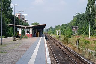
Otisstraße is a Berlin U-Bahn station located on the U6 line.

Platz der Luftbrücke is a Berlin U-Bahn station located on the U6. It is located under Platz der Luftbrücke and the south end of Mehringdamm on the border between Kreuzberg and Tempelhof, near the former Tempelhof International Airport, and is now named for the square there with its memorial to the victims of the Berlin Airlift.

Paradestraße is a Berlin U-Bahn station on the U6 line. It was opened in 1927 as Flughafen (airport) and at that time provided the world's first direct connection between a metro system and an airport.

Tempelhof is a railway station in the district of Berlin with the same name. It is served by the S-Bahn lines S41, S42, S45 and S46 and the U-Bahn line U6. The S-Bahn station is on an embankment at the junction of Tempelhofer Damm and Bundesautobahn 100, about 1 km south of the entrance to the former Tempelhof Airport. The U-Bahn station, officially called Tempelhof (Südring), is under Tempelhofer Damm immediately south of the S-Bahn station.
Alt-Tempelhof is a Berlin U-Bahn station on the U6. It is located under Tempelhofer Damm in the centre of the former village of Tempelhof, now a Berlin district within the borough of Tempelhof-Schöneberg. The station opened on 28 February 1966.

Heinrich-Heine-Straße is a Berlin U-Bahn station on the U8, located under the street of the same name in Mitte, and protected as an architectural landmark. The street and the station were called Neanderstraße until 1960.

Berlin Hermannstraße is a railway station in the Neukölln district of Berlin. It is served by the S-Bahn lines S41, S42, S45, S46 and S47 and the U-Bahn line U8, of which it is the southern terminus. It was formerly also possible to transfer there to the Neukölln-Mittenwalde railway line, which is now only used for goods traffic.

Berlin Gesundbrunnen station is a railway station in Berlin, Germany. It is situated in the Gesundbrunnen district, part of the central Mitte borough, as an interconnection point between the northern Ringbahn and Nord-Süd Tunnel lines of the Berlin S-Bahn, as well as a regional and long distance station of the Deutsche Bahn network. The station is operated by the DB Station&Service subsidiary of Deutsche Bahn AG and is classified as a Category 1 station, one of 21 in Germany and four in Berlin, the others being Berlin Hauptbahnhof, Berlin Südkreuz and Berlin Ostbahnhof.
Berlin-Schönholz railway station is a railway station in Berlin, Germany. It is located on the Berlin Northern Railway line in the district of Reinickendorf, though it is named after the adjacent Schönholz quarter of the neighbouring Pankow district. From here, the Kremmen Railway branch line leads to Hennigsdorf and Kremmen. The station is served by S-Bahn trains and local bus lines, and is protected as a listed monument.

Berlin Bornholmer Straße is a railway station in the Prenzlauer Berg district of Berlin, Germany. It is served by the Berlin S-Bahn and the M13 and 50 lines of the Berlin Straßenbahn.

Berlin Nordbahnhof is a railway station in the Mitte district of Berlin, Germany. It is served by the Berlin S-Bahn and local bus and tram lines. Until 1950, the station was known as Stettiner Bahnhof.

Hennigsdorf is a railway station in the Oberhavel district of Brandenburg, located in the town of Hennigsdorf. It is the northern terminus of the S-Bahn line S25 as well as a station for regional passenger trains and freight services.

The North–South S-Bahn Tunnel is the central section of the North–South transversal Berlin S-Bahn connection crossing the city centre. It is not to be confused with the Tunnel Nord-Süd-Fernbahn, the central tunnel part of the North–South main line used by intercity and regional trains. The S-Bahn North–South line encompasses the route from Bornholmer Straße and Gesundbrunnen via Friedrichstraße and Anhalter Bahnhof to Papestraße and Schöneberg.