
Bærum is a municipality in the Greater Oslo Region in Norway. It is part of the electoral district and historical county of Viken County. The administrative centre of the municipality is the town of Sandvika. Bærum was established as a municipality on 1 January 1838. A suburb of Oslo, Bærum is located on the west coast of the city.
Furuset is residential and suburban area, situated in the northeast of Oslo, Norway. It was a separate borough of Oslo up to January 1, 2004, when it became part of the new borough of Alna. Furuset is a suburb in eastern Groruddalen, consisting of both residential blocks and houses.

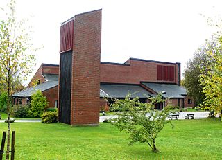
Ullern is a borough of the city of Oslo, Norway.

Sinsen is a mixed residential and commercial area in Grünerløkka borough of Oslo, Norway. The westernmost part of Sinsen is part of the borough Nordre Aker.
Bygdøy or Bygdø is a peninsula situated on the western side of Oslo, Norway. Administratively, Bygdøy belongs to the borough of Frogner; historically Bygdøy was part of Aker Municipality and became part of Oslo in 1948.

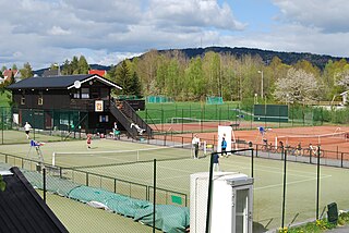
Holmenkollen is a neighborhood in the Vestre Aker borough of Oslo, Norway.

Lysaker is an area in Bærum Municipality, Akershus County, Norway. Lysaker is the easternmost part of Bærum and borders Oslo proper. Lysaker was initially a farming community, later becoming a residential area. Today it is primarily known as a business and trade area, and a public transport hub. It is considered part of Stor-Oslo, and is home to offices of numerous domestic and international businesses.

Stabekk is a suburban centre in the municipality of Bærum, Norway, west of Oslo. It is predominantly a residential area, with many residents commuting to Oslo. As of 2005 the population was 6,261.
Aker is a former independent municipality in Akershus, Norway, that constitutes the vast majority of the territory of the modern city of Oslo.

Skøyen Station is a railway station located at Skøyen in Oslo, Norway. It is situated on the Drammen Line, 4.36 kilometers (2.71 mi) from Oslo Central Station. It is served by regional trains and the Oslo Commuter Rail, operated by Vy, as well as by the Airport Express Train. The station is elevated and has two island platforms and four tracks.
Eiksmarka ("Oakfield") is an affluent suburb of the Norwegian municipality of Bærum in the Greater Oslo Region with around 4,000 inhabitants. It is located just west of the border of Oslo municipality, but within the contiguous urban area of Oslo as well as within the Diocese of Oslo. It is served by Eiksmarka station of the Oslo Metro as well as bus lines.
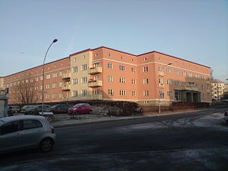
Etterstad is a neighborhood in Oslo, located between the river Alna and Strømsveien, north of Vålerenga. It was incorporated into Oslo in 1946, two years before the merger of Oslo and Aker. The area is mainly residential.
Bestum is a former light rail station on the Oslo Tramway.
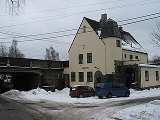
Bestun Station was a railway station situated at Bestum of the Ullern area of Oslo, Norway, on the Drammen Line. The station, located 4.31 kilometers (2.68 mi) from Oslo West Station (Oslo V), was served by Oslo Commuter Rail trains of the Norwegian State Railways.

The Fjord City is an urban renewal project for the waterfront part of the center of Oslo, Norway. The first redevelopment was at Aker Brygge during the 1980s. Bjørvika and Tjuvholmen followed up during the 2000s, while the remaining parts of the Port of Oslo will be developed in the 2010s. The port will be relocated to Sørhavna. The planning is performed by the Oslo Waterfront Planning Office. Major investments in the area include a new Central Railway Station, an already completed Oslo Opera House, and the commercial buildings in the Barcode Project. Several large cultural institutions will be moved to Bjørvika, including moving the Oseberg Ship, Oslo Public Library, and the Munch Museum. The main barrier between the city and the fjord will disappear when European Route E18 is relocated to the Bjørvika Tunnel.

Vettakollen is a hill and neighbourhood in the borough of Vestre Aker in Oslo, Norway.
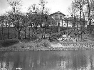
Berg is a neighbourhood in the North End of Oslo. It is located in the borough Nordre Aker, and is surrounded by the neighbourhoods Nordberg in the north, Tåsen in the east and Ullevål Hageby in the southwest. Berg is named after an abandoned farm with the same name. Berg is mainly a residential area, and is served by the station Berg on the Sognsvann Line.
Jomfrubråten is a residential area of Nordstrand in Oslo, Norway. It is located approximately 3 kilometres (1.9 mi) away from the city centre. The area was disintegrated from Ekeberg in 1920, and made a residential area when the Ekeberg Line opened in 1917. A station with the same name serves the area on the Ekeberg Line, and formerly on the Simensbråten Line, but the latter line was closed in 1967.
Blå ("Blue") is a jazz club in Grünerløkka, Oslo, Norway.
Kværnerparken is a park in the Kvaerner neighborhood of Oslo, Norway.
