Kolar district is a district in the state of Karnataka, India.

Raichur District is an administrative district in the Indian state of Karnataka. It is located in the northeast part of the state and is bounded by Yadgir district in the north, Bijapur and Bagalkot district in the northwest, Koppal district in the west, Bellary district in the south, Jogulamba Gadwal district of Telangana and Kurnool district of Andhra Pradesh in the east.

Penna is a river of southern India. This is a unique river in world where after originating from Nandi hills, it flows as two different streams, one in North and South directions. The Penna rises in the Nandi Hills in Chikkaballapur District of Karnataka state, and runs north and east through the states of Karnataka and Andhra Pradesh to empty into bay of bengal in Andhra Pradesh. It is 597 kilometres (371 mi) long, with a drainage basin covering 55,213 km2: 6,937 km2 in Karnataka and 48,276 km2 in Andhra Pradesh. Along with this main stream there is another stream south towards Tamilnadu with the name Then Pennai or south Pennar which further moves towards the east to empty into the Bay of Bengal.The Penna river basin lies in the rain shadow region of Eastern Ghats and receives 500 mm average rainfall annually.
The South Pennar River is a river in India. Bangalore, Hosur, Krishnagiri,Kaveripattinam, and Cuddalore are the important cities on the banks of South Pennar river. It is the second longest river in Tamil Nadu, with a length of 497 km, after the Kaveri. Chandapura, Anekal, Hosur, Bagalur, and Chengam are the major industrial settlements on its banks. The river is severely polluted by industrial waste as it flows through major industrial areas in the eastern suburbs of Bangalore, and the industrial parks of Hosur and Chengam.

Palar is a river of southern India. It rises in the Nandi Hills in Chikkaballapura district of Karnataka state, and flows 93 kilometres (58 mi) in Karnataka, 33 kilometres (21 mi) in Andhra Pradesh and 222 kilometres (138 mi) in Tamil Nadu before reaching its confluence into the Bay of Bengal at Vayalur about 75 kilometres (47 mi) south of Chennai. It flows as an underground river for a long distance only to emerge near Bethamangala town, from where, gathering water and speed, it flows eastward down the Deccan Plateau. The Towns of Bethamangala, Santhipuram, Kuppam,Mottur, Ramanaickenpet, Vaniyambadi, Ambur, Melpatti, Gudiyatham, Pallikonda, Anpoondi, Melmonavoor, Vellore, Katpadi, Melvisharam, Arcot, Ranipet, Walajapet, Kanchipuram, Walajabad, Chengalpattu, Kalpakkam, and Lattur are located on the banks of the Palar River. Of the seven tributaries, the chief tributary is the Cheyyar River.

The Tungabhadra River is a river in India that starts and flows through the state of Karnataka during most of its course, Andhra Pradesh and ultimately joining the Krishna River near Murvakonda in Andhra Pradesh
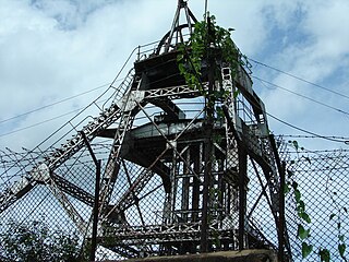
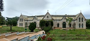
Kolar Gold Fields (K.G.F.) is a mining region in K.G.F. taluk (township), Kolar district, Karnataka, India. It is headquartered in Robertsonpet, where employees of Bharat Gold Mines Limited (BGML) and BEML Limited and their families live. K.G.F. is about 30 kilometres (19 mi) from Kolar, 100 kilometres (62 mi) from Bengaluru, capital of Karnataka. Over a century, the town has been known for gold mining. The mine closed on 28 February 2001 due to a fall in gold prices, despite gold still being present there. One of India's first power-generation units was built in 1889 to support mining operations. The mine complex hosted some particle physics experiments between the 1960s and 1992.

Avani is a small village in Mulabaagilu taluk, Kolara district in Karnataka, India, about ten miles from Kolar Gold Fields. The village is located at 32 km from Kolara, the district centre and 13 km from Mulabaagilu, the Taluk headquarters. It is a popular location for rock climbing.
Hulkuru or Guttahalli is a small village in the Kolar Gold Fields Taluk of Kolar district in Karnataka, India. It is situated about 15 kilometers from Kolar Gold Fields.

Budikote or Budhikote is a village situated in Bangarapet taluk of Kolar district in the Indian state of Karnataka. It is located about 15 mi (24 km) from the district headquarters Kolar Gold Fields, the nearest city; Bangarpet the nearest town is 12 km (7.5 mi) away and Bangalore is 125 km (78 mi). It is a gram panchayat and covers an area of 355.65 ha. According to the 2011 census data, Budikote village has a population of 3,347—of which 1,743 are male and 1,604 are female—and a household count of 600.
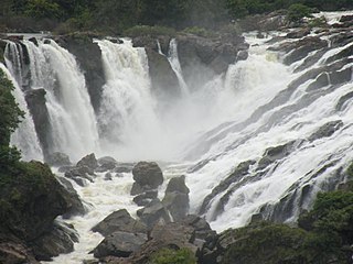
Shivanasamudra Falls is a cluster of waterfalls on the borders of Malavalli, Mandya and Kollegala, Chamarajanagara, in Karnataka, India, situated along the river Kaveri. The falls form the contour between the districts of Chamarajanagara and Mandya. The Bharachukki Falls in Kollegala, with a height of 69 metres, and the Gaganachukki Falls in Malavalli, with a height of 90 metres, collectively form the Shivanasamudra Falls.
Thigala is a social group found in Karnataka and Tamil Nadu, India, particularly the city of Bengaluru and in Southern Karnataka. Thigala people where mainly involved in Horticulture and Gardening, Hyder Ali deployed Thigala people for the development of Lalbagh gardening then they played major role in making Bangalore as Flower City.

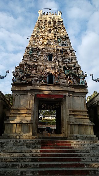
Kolar or Kolara is a city in the Indian state of Karnataka. It is the headquarters of Kolar district. The city is known for its milk production and gold mines. It is also known for the Someshwara and Kolaramma temples.
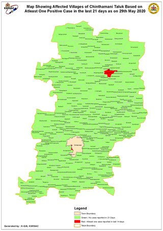
Chintamani is a Taluk Headquarters in the Indian state of Karnataka. Located on the Deccan Plateau in the south-eastern part of Karnataka. Chintamani is one of the well planned and developed Towns in the District of Kolar and presently Chikkaballapur. Chintamani is known for its silk and tomato production and their largest markets in Karnataka.

Karnataka, the sixth largest state in India, has been ranked as the third most popular state in the country for tourism in 2014. It is home to 507 of the 3600 centrally protected monuments in India, second only to Uttar Pradesh. The State Directorate of Archaeology and Museums protects an additional 752 monuments and another 25,000 monuments are yet to receive protection.

The Indian State of Karnataka is located between 11°30' North and 18°30' North latitudes and between 74° East and 78°30' East longitude.It is situated on a tableland where the Western Ghats and Eastern Ghats converge into the complex, in the western part of the Deccan Peninsular region of India. The State is bounded by Maharashtra and Goa States in the north and northwest; by the Lakshadweep Sea in the west; by Kerala in the south-west and Tamil Nadu in the south and south-east, Andhra Pradesh in the south-east and east and Telangana in the north-east. Karnataka extends to about 850 km (530 mi) from north to south and about 450 km (280 mi) from east to west.

Shimsha is a river that flows in the state of Karnataka, India. It is one of the tributaries of the river Kaveri, which is one of the major rivers of South India. The river originates in the southern part of the Devarayanadurga hill in the Tumkur district of Karnataka and flows for about 221 km (137 mi). before joining the river Kaveri.

Mahendravadi is a historical ancient 6th Century Pallava Dynasty Town during Mahendra Varman 1, in Nemili taluk, Tamil Nadu, in northern Tamil Nadu of India.
Hanamsagar, also spelled as Hanumasagara is a village in the Kushtagi taluk of Koppal district in Karnataka state, India.