Bethel Township, Bladen County, North Carolina

Last updated

Bethel Township, Bladen County,
North Carolina
Bethel Township.png
Location of Bethel Township in Bladen County
Map of North Carolina highlighting Bladen County.svg
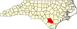
Location of Bladen County in North Carolina
CountryUnited States
State North Carolina
County Bladen
Area
[1]
  Total
43.33 sq mi (112.22 km2)
Highest elevation150 ft (46 m)
Lowest elevation43 ft (13 m)
Population
 (2010)
  Total
4,467 [3]
  Density106.35/sq mi (41.06/km2)
Time zone UTC-4 (EST)
  Summer (DST) UTC-5 (EDT)
Area codes 910, 472

Bethel Township is one of fifteen townships in Bladen County, North Carolina. At the 2010 census, the population of the township was 4,467.

Geography

Bethel Township is 43.33 square miles (112.2 km2) [1] in size and is located in western Bladen County. The town of Dublin is within Bethel Township.

The west side of Bethel Township is drained by Black Swamp, Reedy Meadow Swamp, and Bear Ford Swamp which drain to the Lumber River. The east side is drained by Bakers Creek, a tributary of the Cape Fear River.

References

  1. 1 2 "NC OneMap". www.nconemap.gov. State of North Carolina. Retrieved September 13, 2020.
  2. 1 2 "The National Map - Service Endpoints". viewer.nationalmap.gov. US Geological Survey. Archived from the original on October 16, 2020. Retrieved September 13, 2020.
  3. "US Census Bureau". data.census.gov. US Census Bureau. Retrieved September 13, 2020.

34°39′29″N78°44′34″W / 34.65797°N 78.74276°W / 34.65797; -78.74276