Related Research Articles
Northeim is a district in Lower Saxony, Germany. It is bounded by the districts of Holzminden, Hildesheim, Goslar and Göttingen, and the state of Hesse.

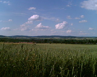
Dassel is a town in southern Lower Saxony, Germany, located in the district Northeim. It is located near the hills of the Solling mountains.

The Holzberg is a small range of hills up to 444.5 m above sea level (NHN) in south Lower Saxony, Germany.
The Weper is a long, high ridge of hills up to 379 m above sea level (NN) located in the district of Northeim in the German state of Lower Saxony.

The Ahlsburg is a range of bunter sandstone hills, relatively small in area and up to 411.4 m above sea level (NN), in the southern part of Lower Saxony, Germany. It lies within the Solling foreland and is part of the Weser-Leine Uplands.
The Elfas is a range of hills up to 409.6 m above sea level (NN) in the districts of Holzminden and Northeim in Lower Saxony (Germany). Its name is derived from the Lower Saxon word Fast, which means an area of upland that descends on two sides.

Wietze is a river in the South Lüneburg Heath, in Lower Saxony, Germany, 25 kilometres (16 mi) long, a tributary of the Örtze.
At 527.8 m (1,732 ft) above sea level, the Große Blöße is the highest hill in the Solling-Vogler Nature Park, the Solling and the Weser Uplands.

The Altenau is a small river of Lower Saxony, Germany. It rises in the Elm, northeast of Eitzum, a district of Schöppenstedt, and discharges from the right into the Oker near Halchter, a district of Wolfenbüttel.
The Ilme is a left-bank, western tributary of the River Leine in Lower Saxony, Germany. It is 33.0 km (20.5 mi) long.
Suilbergau, also known as Suilbergi, and Sülberggau, was an early medieval county in the province of Eastphalia, in the Duchy of Saxony.
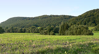
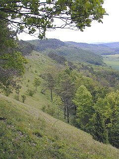
The Amtsberge are a relatively small ridge, up to 392.2 m above sea level (NN),
near Dassel in southern Lower Saxony in Germany.
Hunnesrück Castle was a hilltop castle built in the 13th century. Its ruins are located in the Amtsberge hills near Dassel in the district of Northeim in south Lower Saxony in Germany.
Allerbach is the name of several rivers and streams in Germany:

Ellensen Forest is a low mountain range in the Leine Uplands, sited at the ciy of Dassel in South Lower Saxony, Germany. It is named for Ellensen, a district of Dassel.

Einbeck-Salzderhelden station is the most important station in Einbeck in the German state of Lower Saxony. It is classified by Deutsche Bahn as a category 5 station and is located in the district of Einbeck of Salzderhelden.
Allerbach is a river of Lower Saxony, Germany.
Spüligbach is a river of Lower Saxony, Germany.
Spüligbach may refer to: