Dassel

Last updated
Dassel
Ehemaliger Turm in der Stadtmauer der Stadt Dassel am Solling.jpg
Medieval wall and timbered houses in Dassel
Flagge Dassel.svg
Dasselwappen.png
Location of Dassel within Northeim district
Dassel in NOM.svggemeindefreies Gebiet Solling
Germany adm location map.svg
Red pog.svg
Dassel
Lower Saxony location map.svg
Red pog.svg
Dassel
Coordinates: 51°48′12″N9°41′25″E / 51.80333°N 9.69028°E / 51.80333; 9.69028 Coordinates: 51°48′12″N9°41′25″E / 51.80333°N 9.69028°E / 51.80333; 9.69028
Country Germany
State Lower Saxony
District Northeim
Subdivisions18 districts
Government
   Mayor (202126) Sven Wolter [1] (Ind.)
Area
  Total113.02 km2 (43.64 sq mi)
Elevation
160 m (520 ft)
Population
 (2020-12-31) [2]
  Total9,510
  Density84/km2 (220/sq mi)
Time zone UTC+01:00 (CET)
  Summer (DST) UTC+02:00 (CEST)
Postal codes
37586
Dialling codes 05562, 05564
Vehicle registration NOM
Website www.stadt-dassel.de

Dassel is a town in southern Lower Saxony, Germany, located in the district Northeim. It is located near the hills of the Solling mountains.

Contents

Geography

The city covers an area of 43.64 square miles (113.0 km2). Buildings and streets make up about 10% of this area while 26% are covered with forests like Ellensen Forest and 62% are in agricultural usage, especially for cereals and rapeseed cultivation. For this, the local soil horizon provides suitable conditions as sediments below the soil layer are made up of loess. Dassel is located in the temperate climate zone.

History

Dassel dates back to the year 860 when it was mentioned in a deed of the Imperial Abbey of Corvey. In 1022, Henry II, Holy Roman Emperor, in another deed referred to Dassel church. By about 1113, Dassel became a base of the counts of Dassel, whose name is derived from the name of the settlement. As the county of Dassel ceased to exist in 1310, Dassel was sold to Siegfried II, bishop of the diocese of Hildesheim. Shortly thereafter, in 1315, he provided his acquisition with town rights because the surrounding region belonged to the principality of Brunswick-Wolfenbüttel, thus to enemies of the bishop of Hildesheim. Once given town rights, inhabitants of Dassel built a defensive wall. Town administration operated from Hunnesrück Castle, on a nearby hill. That caste was occupied by the dukes of Brunswick-Wolfenbüttel as a result of the Hildesheim Diocesan Feud in 1521. Duke Eric I ordered to tear down Hunnesrück castle and had the Erichsburg castle built instead. Dassel was administrated from there until 1643. As a result of the Thirty Years' War, Dassel was merged with the diocese of Hildesheim in 1643. The bishops had new administration buildings built in a place called Hunnesrück, situated between the destroyed Hunnesrück castle and the Erichsburg. Throughout those centuries, these circumstances restrained Dassel from proper development and it was thus overcome by the neighboring city of Einbeck that was founded later than Dassel. In addition, parts of the city were destroyed in fires in the 19th century. In that time, some inhabitants started to weave linen or to trade with it, while others emigrated to USA. At the beginning of the 20th century Dassel had 1462 inhabitants. [3] Around 1920 the number of inhabitants amounted to 1601. [4] During World War II the town remained undamaged. Therefore, several expellees settled in Dassel. On March 1, 1974, Dassel was merged with several other small municipalities of the Ilme valley. The new borough now covers the area of the historic County of Dassel, which ceased to exist in 1310. On 15 April 2010 Dassel and its incorporated villages had 11434 inhabitants of whom 2597 lived in the historic town of Dassel itself.

Main Sights

Education

The Gymnasium (college preparatory school) in Dassel is named after Paul Gerhardt. The other general schools are two primary schools (elementary schools), and a secondary school ( Realschule ), which is named after Rainald von Dassel.

Notable people

Wilhelm Busch 1894 Wilhelm busch.png
Wilhelm Busch 1894

Transportation

Dassel was the endpoint of a private railway line from Einbeck since 1883. Its length amounted to 13.1 km. In 1975, the line was closed for passenger transport, and in 2003 for goods as well. Afterwards the railway line was replaced by a bus line. The former train station which was transformed into a residential building is well preserved.

Dassel is easily accessible by bus from the neighbouring towns of Einbeck and Stadtoldendorf.

Related Research Articles

Hildesheim City in Lower Saxony, Germany

Hildesheim is a city in Lower Saxony, Germany with 101,693 inhabitants. It is in the district of Hildesheim, about 30 km (19 mi) southeast of Hanover on the banks of the Innerste River, a small tributary of the Leine River.

Alfeld Town in Lower Saxony, Germany

Alfeld is a town in the state of Lower Saxony, Germany. Located on the Leine river, it is the second biggest city in the district of Hildesheim in southern Lower Saxony and part of the Metropolitan region Hannover-Braunschweig-Göttingen-Wolfsburg. Alfeld is a member of the Leinebergland region and on the German Timber-Frame Road. With the Fagus Factory, Alfeld became a UNESCO World Heritage Site in 2011.

Salzgitter Place in Lower Saxony, Germany

Salzgitter is an independent city in southeast Lower Saxony, Germany, located between Hildesheim and Braunschweig. Together with Wolfsburg and Braunschweig, Salzgitter is one of the seven Oberzentren of Lower Saxony. With 101,079 inhabitants and 223.92 square kilometres (86.46 sq mi), its area is the largest in Lower Saxony and one of the largest in Germany. Salzgitter originated as a conglomeration of several small towns and villages, and is today made up of 31 boroughs, which are relatively compact conurbations with wide stretches of open country between them. The main shopping street of the young city is in the borough of Lebenstedt, and the central business district is in the borough of Salzgitter-Bad. The city is connected to the Mittellandkanal and the Elbe Lateral Canal by a distributary. The nearest metropolises are Braunschweig, about 23 kilometres to the northeast, and Hanover, about 51 km to the northwest. The population of the City of Salzgitter has exceeded 100,000 inhabitants since its foundation in 1942, when it was still called Watenstedt-Salzgitter. Beside Wolfsburg, Leverkusen and Eisenhüttenstadt, Salzgitter is one of the few cities in Germany founded during the 20th century.

Einbeck Town in Lower Saxony, Germany

Einbeck is a town in the district Northeim, in southern Lower Saxony, Germany, on the German Timber-Frame Road.

Northeim Town in Lower Saxony, Germany

Northeim is a town in Lower Saxony, Germany, seat of the district of Northeim, with, in 2011, a population of 29,000. It lies on the German Half-Timbered House Road.

Peine Town in Peine district, Lower Saxony, Germany

Peine is a town in Lower Saxony, Germany, capital of the district Peine. It is situated on the river Fuhse and the Mittellandkanal, approximately 25 km (16 mi) west of Braunschweig, and 40 km (25 mi) east of Hanover.

Bad Salzdetfurth Town in Lower Saxony, Germany

Bad Salzdetfurth  is a town on the banks of the River Lamme in the district of Hildesheim, in Lower Saxony, Germany.

Liebenburg Place in Lower Saxony, Germany

Liebenburg is a municipality in the district of Goslar, in Lower Saxony, Germany.

Coppenbrügge Municipality in Lower Saxony, Germany

Coppenbrügge is a municipality in the Hamelin-Pyrmont district, in Lower Saxony, Germany. It is situated approximatively 15 km east of Hamelin.

Schöppenstedt Town in Lower Saxony, Germany

Schöppenstedt is a small town in the district of Wolfenbüttel, in Lower Saxony, Germany. It is the administrative seat of the Samtgemeinde of Elm-Asse.

Heiningen, Lower Saxony Municipality in Lower Saxony, Germany

Heiningen is a municipality in the district of Wolfenbüttel, in Lower Saxony, Germany. It is part of the Samtgemeinde Oderwald.

Hann. Münden Town in Lower Saxony, Germany

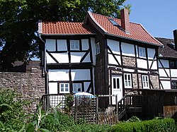
Hann. Münden is a town in Lower Saxony, Germany. Münden lies in the district of Göttingen at the confluence of the Fulda and Werra rivers, which join to form the Weser. It has about 24,000 inhabitants (2013). It is famous for its half-timbered houses, some of them more than 600 years old.

Historic Market Place, Hildesheim

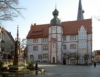
The Historic Market Place is a historical structure in the city of Hildesheim in Lower Saxony, Germany

Marienburg Castle (Hildesheim)

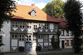
Marienburg Castle is a well-preserved Romanesque castle in Hildesheim, a city in Lower Saxony, Germany.

Steuerwald Castle

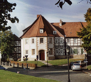
Steuerwald Castle is a Romanesque castle in Hildesheim, a city in Lower Saxony, Germany.

Eric I, Duke of Brunswick-Lüneburg

Eric I, the Elder was Duke of Duke of Brunswick-Lüneburg from 1495 and the first reigning prince of Calenberg-Göttingen.

County of Dassel

The County of Dassel emerged shortly after the turn of the 11th and 12th centuries when, after the extinction of the male line of the Billungs, its seat in Suilbergau, north of the Solling hills was divided into the domains of Einbeck and Dassel. Reinold of Dassel was able to secure rights similar to comital rights. The county lasted about 200 years, till it was abandoned in 1310 when there were no heirs. The most prominent member of the comital family was Rainald of Dassel, chancellor to Emperor Frederick Barbarossa and Archbishop of Cologne.

Erichsburg Lowland castle (Niederungsburg) in Dassel-Erichsburg

The Ericsburg in the village of the same name in the borough of Dassel in Lower Saxony, Germany, is a castle that was built in the 16th century within the Principality of Calenberg. It is currently (2007) in a poor state of repair.

St. Nicholas Chapel, Hildesheim Church building in Hildesheim, Germany

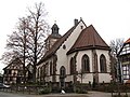
St. Nicholas' Chapel is a former Roman Catholic parish church in the city of Hildesheim in Lower Saxony, Germany. It is dedicated to Saint Nicholas and is located in the southern part of the old city centre, opposite St. Godehard.

Mackensen (Dassel)

Mackensen is a village of about 450 inhabitants which is incorporated into the city of Dassel since 1974.

References

  1. "Direktwahlen in Niedersachsen vom 12. September 2021" (PDF). Landesamt für Statistik Niedersachsen. 13 October 2021.
  2. Landesamt für Statistik Niedersachsen, LSN-Online Regionaldatenbank, Tabelle A100001G: Fortschreibung des Bevölkerungsstandes, Stand 31. Dezember 2020.
  3. W. Keil: Neumanns Orts- und Verkehrslexikon, Bd. 1, S.166. Leipzig 1905.
  4. Josef Habbel. Habbels Konversationslexikon, Bd. 1, S. 779. Regensburg 1922.
  5. "Home". ferienhaus-am-solling.de.
  6. "Home". weserbergland-ferienhaus.de.
  7. Some brilliant historic picture of this house, the last medieval tower of Dassel