
Marnal (Maranal) is a panchayat village in Shorapur taluka of Yadgir district in Karnataka state, India. Marnal is 4 km southwest of Bardevanhal. The nearest railhead is in Yadgir.
Katarki-Gudlanur is a panchayat village in the southern state of Karnataka, India. Administratively, Katarki-Gudlanur is under Koppal Taluka of Koppal District in Karnataka. The village of Katarki-Gudlanur is 19 km by road south of the town of Koppal and 33 km by road east of Mundargi. Katarki-Gudlanur is on the north shore of the Tungabhadra Reservoir.
Agni is a panchayat village in the southern state of Karnataka, India. Administratively, Agni is under Shorapur Taluka of Yadgir District in Karnataka. The village of Agni is 1.5 km by road west of the village of Agthirth and 14 km by road north of the village of Hunasagi. The nearest railhead is in Yadgir.
Azalapur is a panchayat village in the southern state of Karnataka, India. Administratively, Azalapur is under Yadgir Taluka of Yadgir District in Karnataka. The village of Azalapur is 3.5 km by road northwest of the village of Ujjelli in Andhra Pradesh, and 20 km by road east of the census town of Saidapur in Yadgir Taluka. The nearest railhead is in Yadgir.
Saidapur is a census town and panchayat village in the southern state of Karnataka, India. Administratively, Saidapur is under Yadgir Taluka of Yadgir District in Karnataka. The village of Saidapur is 14 km by road west of the village of Badepalli, and 33 km by road south of the town of Yadgir. Saidapur has its own railway station which comes on Bangalore-Mumbai and Mumbai-Chennai main corridor.
Yelahar is a panchayat village in the southern state of Karnataka, India. Administratively, Yelahar is under Yadgir Taluka of Yadgir District in Karnataka. The village of Yelahar is 6 km by road west of the village of Konkal, and 10 km by road south-southeast of the village of Paspool. The nearest railhead is in Yadgir.
Rastapur is a panchayat village in the southern state of Karnataka, India. Administratively, Rastapur is under Shahapur Taluka of Yadgir district in Karnataka. Rastapur is 6 km by road east of the village of Sagar and 6.5 km by road northwest of the village of Hattigudur. The nearest railhead is in Yadgir.

Chas is a panchayat village in the state of Maharashtra, India, on the left (east) bank of the Bhima River. Administratively, Chas is under Khed Taluka of Pune District in Maharashtra. There is only the single village of Chas in the Chas gram panchayat. The village of Chas is 16 km southeast of the Chas-Kaman Dam, and 14 km by road northwest of the town of Rajgurunagar (Khed).
Shikrapur is a panchayat village in the state of Maharashtra, India, on the left (north) bank of the Vel River. Administratively, Shikrapur is under Shirur Taluka of Pune District in Maharashtra. There is only the single village of Shikrapur in the Shikrapur gram panchayat. The village of Shikrapur lies next to the intersection of State Highway 60 and State Highway 55. It is 10 km by road northeast of the town of Koregaon Bhima, and 32 km by road southeast of the town of Chakan.
Talegaon Dhamdhere is a panchayat village in the state of Maharashtra, India, on the right (south) bank of the Vel River. Administratively, Talegaon Dhamdhere is under Shirur Taluka of Pune District in Maharashtra. There is only the single village of Talegaon Dhamdhere in the Talegaon Dhamdhere gram panchayat. The village of Talegaon Dhamdhere is 4 km by road southeast of the village of Shikrapur, and 6 km by road north of the village of Vittalwadi.
Malchapur is a panchayat village in Bidar District, Karnataka, India. Administratively, it is under Bhalki Taluka of Bidar District. The village of Malchapur is 18 km by road west of the city of Bidar.

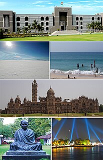
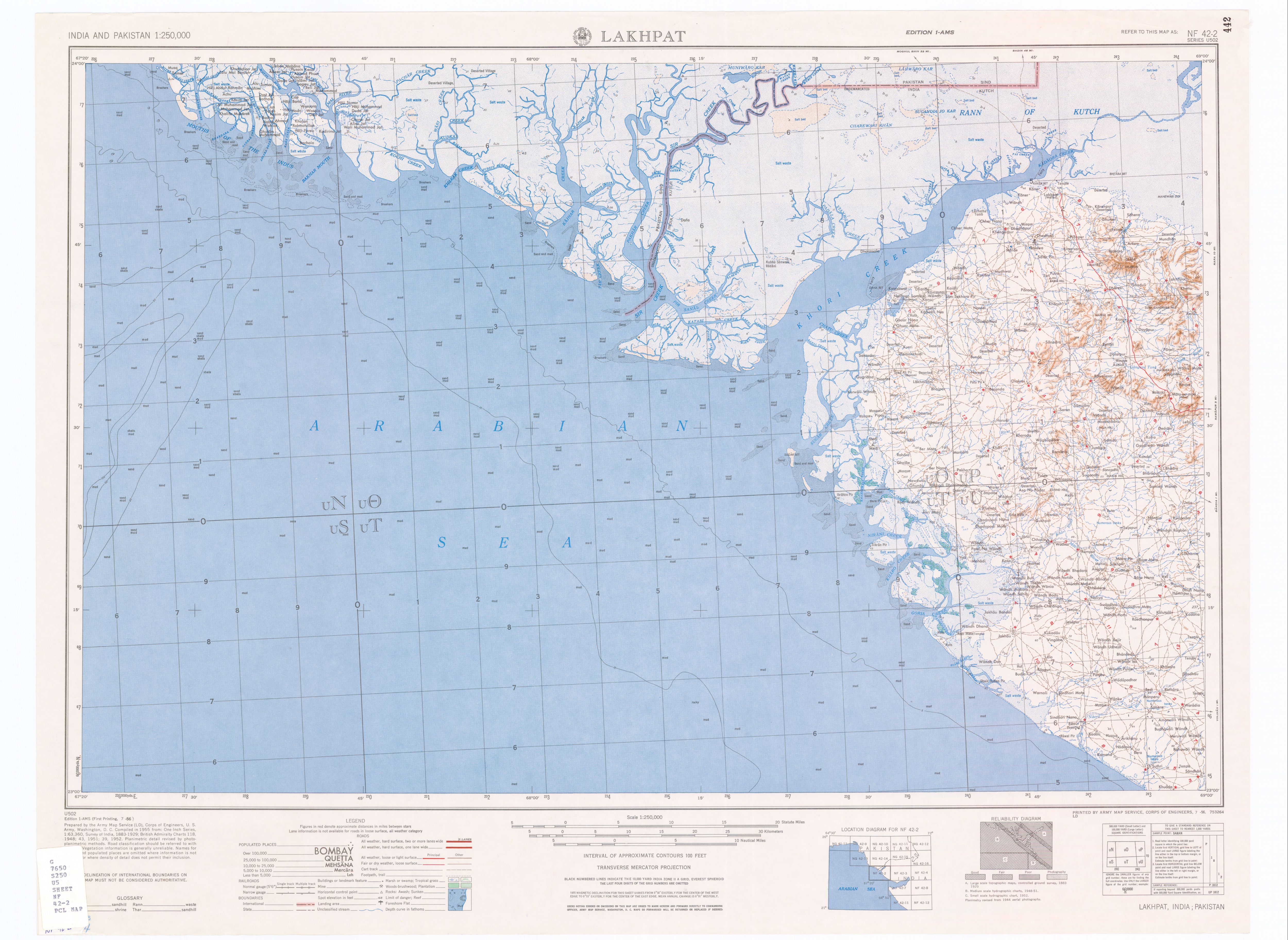
Netra is a panchayat village in Gujarat, India. Administratively it is under Nakhatrana Taluka in Kutch District, Gujarat.
Nakhatrana Taluka is a taluka in Kutch District, Gujarat, India. Its administrative centre is the village of Nakhatrana. The taluka covers 2,135.14 square kilometres (824 sq mi).
Fulay is a panchayat village in Gujarat, India. Administratively it is under Nakhatrana Taluka, Kutch District, Gujarat.
Fulay is a small village in Gujarat, India. Administratively it is under Kotay Gram Panchayat, Bhuj Taluka, Kutch District, Gujarat. Much of the village has been abandoned. Fulay is 1.5 km by road east of the village of Kotay, and 30 km by road northeast of the city of Bhuj.
Fulay is a panchayat village in Gujarat, India. Administratively it is under Abdasa Taluka, Kutch District, Gujarat. Fulay is 19 km by road northwest of the town of Naliya.
Mothala is a panchayat village in Gujarat, India. Administratively it is under Abdasa Taluka, Kutch District, Gujarat. Mothala is 23 km by road northeast of the village of Kothara, and 33 km by road southwest of the village of Nakhatrana. Mothala is located on the rail line from Bhuj to Naliya; formerly military only, it now carries commercial freight and passengers, and is scheduled to be upgraded from metre to broad gauge.
Ber Moti is a village in Gujarat, western India. Administratively, it is under Abdasa Taluka, Kutch District, of Gujarat. The Golay River, an intermittent stream, runs just east of the village. There is an old fort, Maniyara Fort, on the hill (68 m) across the river to the east of the village, on the highest point, 2 km east-northeast of the village center. There is a smaller old fort on the rise just next (500 m) to the village. Ber Moti is 39 km by road northwest of Naliya, the taluka headquarters.
Dumara is a panchayat village in Gujarat, India. Administratively it is under Abdasa Taluka, Kutch District, Gujarat. The village of Dumara sits on the left (west) bank of the Chok River, an intermittent stream. It is 20 km (12 mi) by road southeast of the village of Kothara along National Highway 8A, and 38 km (24 mi) along the same road northwest of the town of Mandvi.


