Bhogamguda

Last updated
Bhogamguda
village
CountryFlag of India.svg  India
State Chhattisgarh
District Bijapur
Population (2011) [1]
  Total 152
Languages
  Official Hindi, Chhattisgarhi
Time zone IST (UTC+5:30)

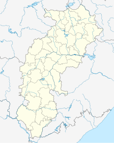
Bhogamguda is a village in the central state of Chhattisgarh, India. It is located in the Bijapur taluk of Bijapur district. [2]
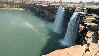
Chhattisgarh Central-east state in India

Chhattisgarh is one of the 29 states of India, located in the centre-east of the country. It is the tenth-largest state in India, with an area of 135,191 km2 (52,198 sq mi). With a 2011 population of 25.5 million, Chhattisgarh is the 16th-most populated state in the country. A resource-rich state, it is a source of electricity and steel for the country, accounting for 15% of the total steel produced. Chhattisgarh is one of the fastest-developing states in India.

India Country in South Asia

India, also known as the Republic of India, is a country in South Asia. It is the seventh largest country by area and with more than 1.3 billion people, it is the second most populous country as well as the most populous democracy in the world. Bounded by the Indian Ocean on the south, the Arabian Sea on the southwest, and the Bay of Bengal on the southeast, it shares land borders with Pakistan to the west; China, Nepal, and Bhutan to the northeast; and Bangladesh and Myanmar to the east. In the Indian Ocean, India is in the vicinity of Sri Lanka and the Maldives, while its Andaman and Nicobar Islands share a maritime border with Thailand and Indonesia.
Bijapur, Chhattisgarh town in Chhattisgarh, India

Bijapur is a town in Bijapur district, Chhattisgarh, India. It is the seat of the district and one of the 4 taluks in Bijapur district. The Bijapur taluk has an area of 928 km2 and 60,055 inhabitants. It is situated on the National Highway 16 which connects Nizamabad in Telangana with Jagdalpur in southeastern Chhattisgarh.
Demography

In the 2011 census, Bhogamguda had 30 houses with a population of 152, consisting of 67 males and 85 females. [1] The population of children aged 0–6 was 24, making up 15.79% of the total population of the village. [1] The average sex ratio was 1,269 out of 1000, which is higher than the state average of 991 out of 1000. [1] The child sex ratio in the village was 1000 out of 1000, which is higher than the average of 969 out of 1000 in the state of Chhattisgarh. [1] The total Scheduled Castes and Scheduled Tribes population in the town was 0 people and none were Scheduled Castes. There are 152 people of the Scheduled Tribe in the village. [2]

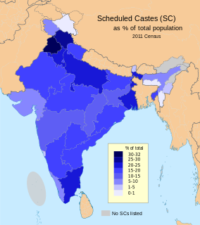
Scheduled Castes and Scheduled Tribes official designations given to various groups indigenous people in India

The Scheduled Castes (SCs) and Scheduled Tribes (STs) are officially designated groups of historically disadvantaged people in India. The terms are recognised in the Constitution of India and the groups are designated in one or other of the categories. For much of the period of British rule in the Indian subcontinent, they were known as the Depressed Classes. The people in scheduled castes are essentially the lowest part of Hindu society.

Related Research Articles

Anda, Chhattisgarh Place in Chhattisgarh, India

Anda is a village located in Durg Tehsil of Durg district in the Indian state of Chhattisgarh. The village population is estimated to be at 4,169.

Bhaini Gahi Village in Punjab, India

Bhaini Gahi is a village located in the Ludhiana East tehsil, of Ludhiana district, Punjab.

Barsam Village in Bihar, India

Barsam is a Village, with population of 2533 is Simri Bakhtiarpur sub district's the 23rd least populous village, located in Simri Bakhtiarpur sub district of Saharsa district in the state Bihar in India. Total geographical area of Barsam village is 2 km2 and it is the 23rd smallest village by area in the sub district. Population density of the village is 1230 persons per km2. Nearest town of the village is Saharsa and distance from Barsam village to Saharsa is 12 km. The village comes under Khajuri panchayat. Simri Bakhtiarpur is the sub district headquarters and the distance from the village is 12 km. District headquarters of the village is Saharsa which is 12 km away.

Rajpuri, Mawal Village in Maharashtra, India

Rajpuri is a village in India. It is situated in the Mawal taluka of Pune District in the state of Maharashtra.

Sadapur Village in Maharashtra, India

Sadapur (Marathi:सैदापूर) is a village in India. It is situated in the Mawal taluka of Pune District in the state of Maharashtra.

Sangise Village in Maharashtra, India

Sangise (Marathi:संगीसे) is a village in India. It is situated in the Mawal taluka of Pune District in the state of Maharashtra.

Sawale Village in Maharashtra, India

Sawale (Marathi:सावळे) is a village in India. It is situated in the Mawal taluka of Pune District in the state of Maharashtra.

Shilimb Village in Maharashtra, India

Shilimb (Marathi:शिलिंब) is a village in India. It is situated in the Mawal taluka of Pune District in the state of Maharashtra.

Shindgaon Village in Maharashtra, India

Shindgaon (Marathi:शिंडगाव) is a village in India. It is situated in the Mawal taluka of Pune District in the state of Maharashtra.

Shirdhe Village in Maharashtra, India

Shirdhe (Marathi:शिर्ध्ये) is a village in India. It is situated in the Mawal taluka of Pune District in the state of Maharashtra.

Shivane, Maval Village in Maharashtra, India

Shivane (Marathi:शिवाने) is a village in India. It is situated in the Mawal taluka of Pune District in the state of Maharashtra.

Thakursai Village in Maharashtra, India

Thakursai (Marathi:ठाकूरसाई) is a village in India. It is situated in the Mawal taluka of Pune District in the state of Maharashtra.

Baloke Village in Punjab, India

Baloke is a village situated in the Barnala district, Punjab, India. As of the 2011 census, it had a population of 1,303 persons.

Bhor Garh is a census town in North West district in the Indian territory of Delhi.

Khera Kalan is a census town in North West district in the Indian territory of Delhi.

Darya Pur Kalan is a census town in North West district in the Indian territory of Delhi.

Bankauli is a census town in North West district in the Indian territory of Delhi.

Arjunagi is a village in the southern state of Karnataka, India. It is located in the Bijapur taluk of Bijapur district.

Aaded is a village in the central state of Chhattisgarh, India. It is located in the Bijapur taluk of Bijapur district.

Aded is a village in the central state of Chhattisgarh, India. It is located in the Bijapur taluk of Bijapur district.

References

  1. 1 2 3 4 5 "Census 2011, Bhogamguda village Data".
  2. 1 2 "Bhogamguda village". censusindia.co.in. Retrieved 5 December 2017.

Coordinates: 18°14′N81°38′E / 18.233°N 81.633°E / 18.233; 81.633

Geographic coordinate system Coordinate system

A geographic coordinate system is a coordinate system that enables every location on Earth to be specified by a set of numbers, letters or symbols. The coordinates are often chosen such that one of the numbers represents a vertical position and two or three of the numbers represent a horizontal position; alternatively, a geographic position may be expressed in a combined three-dimensional Cartesian vector. A common choice of coordinates is latitude, longitude and elevation. To specify a location on a plane requires a map projection.