
Majdan Kozłowiecki is a village in the administrative district of Gmina Lubartów, within Lubartów County, Lublin Voivodeship, in eastern Poland. It lies approximately 6 kilometres (4 mi) south of Lubartów and 19 km (12 mi) north of the regional capital Lublin.
Wandzin is a village in the administrative district of Gmina Lubartów, within Lubartów County, Lublin Voivodeship, in eastern Poland. It lies approximately 6 kilometres (4 mi) south-west of Lubartów and 22 km (14 mi) north-west of the regional capital Lublin. Moreover Wandzin produce Easter palms.
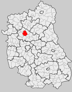
Gmina Firlej is a rural gmina in Lubartów County, Lublin Voivodeship, in eastern Poland. Its seat is the village of Firlej, which lies approximately 12 kilometres (7 mi) north-west of Lubartów and 35 km (22 mi) north of the regional capital Lublin.

Gmina Michów is a rural gmina in Lubartów County, Lublin Voivodeship, in eastern Poland. Its seat is the village of Michów, which lies approximately 21 kilometres (13 mi) west of Lubartów and 36 km (22 mi) north-west of the regional capital Lublin.
Abramów is a village in Lubartów County, Lublin Voivodeship, in eastern Poland. It is the seat of the gmina called Gmina Abramów. It lies approximately 21 kilometres (13 mi) west of Lubartów and 30 km (19 mi) north-west of the regional capital Lublin.
Amelin is a village in the administrative district of Gmina Kamionka, within Lubartów County, Lublin Voivodeship, in eastern Poland. It lies approximately 8 kilometres (5 mi) south-west of Kamionka, 17 km (11 mi) west of Lubartów, and 25 km (16 mi) north-west of the regional capital Lublin.
Ciemno is a village in the administrative district of Gmina Kamionka, within Lubartów County, Lublin Voivodeship, in eastern Poland. It lies approximately 4 kilometres (2 mi) north of Kamionka, 12 km (7 mi) west of Lubartów, and 30 km (19 mi) north of the regional capital Lublin.
Dąbrówka is a village in the administrative district of Gmina Kamionka, within Lubartów County, Lublin Voivodeship, in eastern Poland. It lies approximately 11 kilometres (7 mi) south of Kamionka, 12 km (7 mi) south-west of Lubartów, and 16 km (10 mi) north of the regional capital Lublin.
Kierzkówka is a village in the administrative district of Gmina Kamionka, within Lubartów County, Lublin Voivodeship, in eastern Poland. It lies approximately 4 kilometres (2 mi) north-west of Kamionka, 13 km (8 mi) west of Lubartów, and 29 km (18 mi) north of the regional capital Lublin.
Kierzkówka-Kolonia is a village in the administrative district of Gmina Kamionka, within Lubartów County, Lublin Voivodeship, in eastern Poland. It lies approximately 3 kilometres (2 mi) north-west of Kamionka, 13 km (8 mi) west of Lubartów, and 28 km (17 mi) north of the regional capital Lublin.
Kozłówka is a village in the administrative district of Gmina Kamionka, within Lubartów County, Lublin Voivodeship, in eastern Poland. It lies approximately 4 kilometres (2 mi) south-east of Kamionka, 8 km (5 mi) west of Lubartów, and 23 km (14 mi) north of the regional capital Lublin. The village has a population of 820.
Rudka Gołębska is a village in the administrative district of Gmina Kamionka, within Lubartów County, Lublin Voivodeship, in eastern Poland. It lies approximately 4 kilometres (2 mi) west of Kamionka, 13 km (8 mi) west of Lubartów, and 27 km (17 mi) north-west of the regional capital Lublin.
Samoklęski is a village in the administrative district of Gmina Kamionka, within Lubartów County, Lublin Voivodeship, in eastern Poland. It lies approximately 4 kilometres (2 mi) south-west of Kamionka, 12 km (7 mi) west of Lubartów, and 25 km (16 mi) north-west of the regional capital Lublin.
Siedliska is a village in the administrative district of Gmina Kamionka, within Lubartów County, Lublin Voivodeship, in eastern Poland. It lies approximately 2 kilometres (1 mi) east of Kamionka, 9 km (6 mi) west of Lubartów, and 25 km (16 mi) north of the regional capital Lublin.
Stanisławów Duży is a village in the administrative district of Gmina Kamionka, within Lubartów County, Lublin Voivodeship, in eastern Poland. It lies approximately 6 kilometres (4 mi) west of Kamionka, 16 km (10 mi) west of Lubartów, and 28 km (17 mi) north-west of the regional capital Lublin.
Syry is a village in the administrative district of Gmina Kamionka, within Lubartów County, Lublin Voivodeship, in eastern Poland. It lies approximately 7 kilometres (4 mi) south-west of Kamionka, 15 km (9 mi) west of Lubartów, and 24 km (15 mi) north-west of the regional capital Lublin.
Wólka Krasienińska is a village in the administrative district of Gmina Kamionka, within Lubartów County, Lublin Voivodeship, in eastern Poland. It lies approximately 7 kilometres (4 mi) south of Kamionka, 10 km (6 mi) south-west of Lubartów, and 20 km (12 mi) north of the regional capital Lublin.
Zofian is a village in the administrative district of Gmina Kamionka, within Lubartów County, Lublin Voivodeship, in eastern Poland. It lies approximately 9 kilometres (6 mi) south of Kamionka, 15 km (9 mi) south-west of Lubartów, and 20 km (12 mi) north-west of the regional capital Lublin.
Aleksandrówka is a village in the administrative district of Gmina Michów, within Lubartów County, Lublin Voivodeship, in eastern Poland. It lies approximately 8 kilometres (5 mi) south-east of Michów, 14 km (9 mi) west of Lubartów, and 29 km (18 mi) north-west of the regional capital Lublin.
Rozkopaczew is a village in the administrative district of Gmina Ostrów Lubelski, within Lubartów County, Lublin Voivodeship, in eastern Poland. It lies approximately 9 kilometres (6 mi) south of Ostrów Lubelski, 19 km (12 mi) east of Lubartów, and 27 km (17 mi) north-east of the regional capital Lublin.


