Dailekh District a part of Karnali Province, is one of the 77 districts of Nepal. The district, with Dailekh as its district headquarters, covers an area of 1,502 km2 (580 sq mi) and had a population of 225,201 in 2001 and 261,770 in 2011.
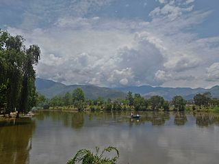
Surkhet District is a district in Karnali Province of mid-western Nepal. Surkhet is the one of the ten districts of Karnali located about 600 kilometres (373 mi) west of the national capital Kathmandu. The district's area is 2,489 square kilometres (961 sq mi). It had 288,527 population in 2001 and 350,804 in 2011 which male comprised 169,461 and female 181,381. Its district headquarters, Birendranagar, is also the capital of Karnali Province.

Kohalpur is a municipality in Banke District of Lumbini province of Nepal. The municipality was established on 18 May 2014 merging the existing two Village Development Committees i.e. Rajhena and Kohalpur. The town is in East-West highway and one of the fastest developing places in Nepal. A neighboring city Nepalgunj is on South (16 km), with Ghorahi city (135 km) to west in Dang District and further 6 km is the Indian border. In fact it is a growing city in the western region of Nepal. It has a junction to diverse the roadway transport to east, west, north and south from the city.
Birendranagar officially Birendranagar Sub-Metropolitan city is a city in Surkhet District in Karnali Province of Nepal.

A Village Development Committee (VDC) in Nepal was the lower administrative part of its Ministry of Federal Affairs and Local Development. Each district had several VDCs, similar to municipalities but with greater public-government interaction and administration. There were 3,157 village development committees in Nepal. Each VDC was further divided into several wards depending on the population of the district, the average being nine wards.

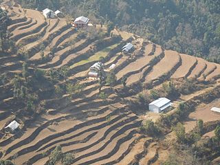
Agragaun is a village development committee in Surkhet District in Karnali Province of mid-western Nepal. At the time of the 1991 Nepal census it had a population of 2370 people living in 381 individual households.
Bijaura is a village development committee in Surkhet District in Karnali Province of mid-western Nepal. At the time of the 1991 Nepal census it had a population of 3841 people living in 637 individual households.
Dahachaur is a village development committee in Surkhet District in the Karnali Province of mid-western Nepal. At the time of the 1991 Nepal census it had a population of 2746 people living in 477 individual households.
Dandakhali is a village development committee in Surkhet District in Karnali Province of mid-western Nepal. At the time of the 1991 Nepal census it had a population of 2596 people living in 412 individual households.
Garpan is a village development committee in Surkhet District in the Bheri Zone of mid-western Nepal. At the time of the 1991 Nepal census it had a population of 1953 people living in 354 individual households.
Ghoreta is a village development committee in Surkhet District in the Bheri Zone of mid-western Nepal. At the time of the 1991 Nepal census it had a population of 1936 people living in 308 individual households.
Gumi is a village development committee in Surkhet District in the Bheri Zone of mid-western Nepal. At the time of the 1991 Nepal census it had a population of 5683 people living in 965 individual households.
Kunathari is a village development committee in Surkhet District in the Bheri Zone of mid-western Nepal. At the time of the 1991 Nepal census it had a population of 4681 people living in 781 individual households.
Lekhparajul is a village development committee in Surkhet District in the Bheri Zone of mid-western Nepal. At the time of the 1991 Nepal census it had a population of 4567 people living in 739 individual households.
Malarani is a village development committee in Surkhet District in the Bheri Zone of mid-western Nepal. At the time of the 1991 Nepal census it had a population of 4170 people living in 678 individual households.
Matela is a village development committee in Surkhet District in the Bheri Zone of mid-western Nepal. At the time of the 1991 Nepal census it had a population of 4049 people living in 638 individual households.
Mehelkuna is a village development committee in Surkhet District in the Bheri Zone of mid-western Nepal. At the time of the 1991 Nepal census it had a population of 7649 people living in 1404 individual households. Pavitra Bazzar is the largest town in this VDC. There are two Higher Secondary Schools.
Neta is a village development committee in Surkhet District in the Bheri Zone of mid-western Nepal. At the time of the 1991 Nepal census it had a population of 3106 people living in 473 individual households.
Rakam is a village development committee in Surkhet District in the Bheri Zone of mid-western Nepal. At the time of the 1991 Nepal census it had a population of 2363 people living in 423 individual households.
Ranibas is a village development committee in Surkhet District in the Bheri Zone of mid-western Nepal. At the time of the 1991 Nepal census it had a population of 2695 people living in 443 individual households.

