Dailekh District a part of Karnali Pradesh, is one of the seventy-seven districts of Nepal. The district, with Dailekh as its district headquarters, covers an area of 1,502 km2 (580 sq mi) and had a population of 225,201 in 2001 and 261,770 in 2011.
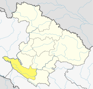
Surkhet District a part of Karnali province, is one of the ten districts of Karnali located about 600 kilometres (373 mi) west of the national capital Kathmandu. The district's area is 2,488.64 square kilometres (960.87 sq mi)which is longest in Nepal. It had 288,527 population in 2001 and 350,804 in 2011 which male comprised 169,461 and female 181,381. It is the district headquarters of surkhet and commercial hub of the Karnali state of the new federal republic.
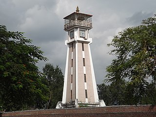
Birendranagar is a city in Surkhet District in Karnali province of Nepal.

Betan is a village development committee in Surkhet District in Karnali Pradesh of mid-western Nepal. At the time of the 1991 Nepal census it had a population of 2644 people living in 407 individual households.
Bidyapur is a village development committee in Surkhet District in Karnali Pradesh of mid-western Nepal. At the time of the 1991 Nepal census it had a population of 4053 people living in 707 individual households.
Bijaura is a village development committee in Surkhet District in Karnali Pradesh of mid-western Nepal. At the time of the 1991 Nepal census it had a population of 3841 people living in 637 individual households.
Dharapani, Bheri is a village development committee in Surkhet District in Karnali Pradesh of mid-western Nepal. At the time of the 1991 Nepal census it had a population of 2542 people living in 445 individual households.
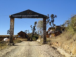
Ghoreta is a village development committee in Surkhet District in the Bheri Zone of mid-western Nepal. At the time of the 1991 Nepal census it had a population of 1936 people living in 308 individual households.
Lekhpharsa (लेखफर्सा) is a village development committee in Surkhet District in the Bheri Zone of mid-western Nepal. At the time of the 1991 Nepal census it had a population of 4809 people living in 805 individual households.
Lekhgaun, Bheri is a village development committee in Surkhet District in the Bheri Zone of mid-western Nepal. At the time of the 1991 Nepal census it had a population of 3999 people living in 651 individual households.
Mehelkuna is a village development committee in Surkhet District in the Bheri Zone of mid-western Nepal. At the time of the 1991 Nepal census it had a population of 7649 people living in 1404 individual households. Pavitra Bazzar is the largest town in this VDC. There are two Higher Secondary Schools.
Neta is a village development committee in Surkhet District in the Bheri Zone of mid-western Nepal. At the time of the 1991 Nepal census it had a population of 3106 people living in 473 individual households.
Pamka is a village development committee in Surkhet District in the Bheri Zone of mid-western Nepal. At the time of the 1991 Nepal census it had a population of 1981 people living in 287 individual households.
Rajeni is a village development committee in Surkhet District in the Bheri Zone of mid-western Nepal. At the time of the 1991 Nepal census it had a population of 2730 people living in 430 individual households.
Rakam is a village development committee in Surkhet District in the Bheri Zone of mid-western Nepal. At the time of the 1991 Nepal census it had a population of 2363 people living in 423 individual households.
Ranibas is a village development committee in Surkhet District in the Bheri Zone of mid-western Nepal. At the time of the 1991 Nepal census it had a population of 2695 people living in 443 individual households.
Taranga is a village development committee in Surkhet District in the Bheri Zone of mid-western Nepal. At the time of the 1991 Nepal census it had a population of 3917 people living in 708 individual households.
Tatopani is a village development committee in Surkhet District in the Bheri Zone of mid-western Nepal. At the time of the 1991 Nepal census it had a population of 3973 people living in 759 individual households.
Birendranagar is a village development committee (VDC) in Chitwan District in the Narayani Zone of southern Nepal. At the time of the 1991 Nepal census it had a population of 10,482 people living in 1932 individual households. However, the population now increased by more than three times and reached about 30 thousand. This VDC is located in about 150 km from Kathmandu in the south west direction from the capitalcity of Nepal, i.e. Kathmandu. Chitwan is the district where it falls in the eastern part, which is surrounded by six VDCs: Khairahani, Chainpur, Siddhi, Korak, Bhandara and Kathar. It is about two times bigger than Bhandara and Khairahani and similar in area as Chainpur. The village is divided into nine wards, which are further subdivided into one to seven groups.

Karnali Pradesh is one of the seven federal provinces of Nepal formed by the new constitution which was adopted on 20 September 2015. The total area of the province is 27,984 square kilometres (10,805 sq mi), making it the largest province in Nepal. According to the 2011 Nepal census, the population of the province was 1,570,418, making it the least populous province in Nepal. It borders the Tibet Autonomous Region of China to the north, Gandaki Pradesh to the east, Sudurpashchim Pradesh to the west, and Province No. 5 to the south. Birendranagar with a population of 47,914 is both the province's capital and largest city.

