The Cheptsa is a river in the north part of Udmurtian Republic (Udmurtia) and eastern Kirov Oblast, in Russia. It flows through the city Glazov and flows into the Vyatka River in Kirovo-Chepetsk, east of Kirov.

Ariany is a village in the administrative district of Gmina Waganiec, within Aleksandrów County, Kuyavian-Pomeranian Voivodeship, in north-central Poland. It lies 2 kilometres (1 mi) south of Waganiec, 13 km (8 mi) south-east of Aleksandrów Kujawski, and 31 km (19 mi) south-east of Toruń.

Krzewica is a village in the administrative district of Gmina Międzyrzec Podlaski, within Biała Podlaska County, Lublin Voivodeship, in eastern Poland. It lies approximately 12 kilometres (7 mi) north-west of Międzyrzec Podlaski, 31 km (19 mi) west of Biała Podlaska, and 91 km (57 mi) north of the regional capital Lublin.
Rudka is a village in the administrative district of Gmina Wojnicz, within Tarnów County, Lesser Poland Voivodeship, in southern Poland.

Bugaj is a village in the administrative district of Gmina Gnojno, within Busko County, Świętokrzyskie Voivodeship, in south-central Poland. It lies approximately 7 kilometres (4 mi) south-west of Gnojno, 12 km (7 mi) north-east of Busko-Zdrój, and 40 km (25 mi) south of the regional capital Kielce.
Daleszec is a village in the administrative district of Gmina Secemin, within Włoszczowa County, Świętokrzyskie Voivodeship, in south-central Poland.

Jakubów is a village in the administrative district of Gmina Goszczyn, within Grójec County, Masovian Voivodeship, in east-central Poland. It lies approximately 5 kilometres (3 mi) north-west of Goszczyn, 13 km (8 mi) south of Grójec, and 53 km (33 mi) south of Warsaw.
Kostusin is a village in the administrative district of Gmina Dzierzgowo, within Mława County, Masovian Voivodeship, in east-central Poland.
Nowe Draganie is a village in the administrative district of Gmina Stara Biała, within Płock County, Masovian Voivodeship, in east-central Poland.
Nowy Przeradz is a village in the administrative district of Gmina Lutocin, within Żuromin County, Masovian Voivodeship, in east-central Poland.
Józefów is a village in the administrative district of Gmina Godziesze Wielkie, within Kalisz County, Greater Poland Voivodeship, in west-central Poland.

Trzy Góry is a settlement in the administrative district of Gmina Ryczywół, within Oborniki County, Greater Poland Voivodeship, in west-central Poland. It lies approximately 5 kilometres (3 mi) east of Ryczywół, 18 km (11 mi) north of Oborniki, and 45 km (28 mi) north of the regional capital Poznań.
Dębina is a settlement in the administrative district of Gmina Wągrowiec, within Wągrowiec County, Greater Poland Voivodeship, in west-central Poland.
Mościce is a village in the administrative district of Gmina Witnica, within Gorzów County, Lubusz Voivodeship, in western Poland.
Wilenko is a village in the administrative district of Gmina Szczaniec, within Świebodzin County, Lubusz Voivodeship, in western Poland.

Pod Łąg is a village in the administrative district of Gmina Czersk, within Chojnice County, Pomeranian Voivodeship, in northern Poland. It lies approximately 4 kilometres (2 mi) east of Czersk, 34 km (21 mi) east of Chojnice, and 75 km (47 mi) south-west of the regional capital Gdańsk.
Jaśkowo-Leśniczówka is a village in the administrative district of Gmina Pisz, within Pisz County, Warmian-Masurian Voivodeship, in northern Poland.

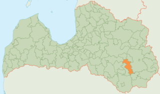
Riebiņi Municipality is a municipality in Latgale, Latvia. The municipality was formed in 2004 by merging Galēni parish, Riebiņi parish, Rušona parish, Silajāņi parish, Sīļukalns parish and Stabulnieki parish, the administrative centre being Riebiņi.
Gulou District is a district of the city of Kaifeng, Henan province, China.
Tounounga is a village and rural commune in Niger.


