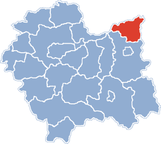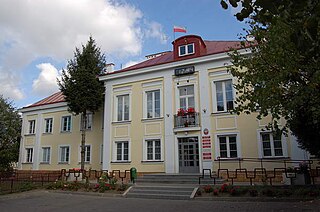
Dąbrowa Tarnowska is a town in Poland, in Lesser Poland Voivodeship, about 16 kilometres (10 mi) north of Tarnów. It is the capital of Dąbrowa County. Before reorganization Dąbrowa Tarnowska was part of Tarnów Voivodeship (1975–1998). Population is 11,402 (2008). Dąbrowa Tarnowska has a rail station on the minor line which joins Tarnów and Szczucin.

Czarże is a village in the administrative district of Gmina Dąbrowa Chełmińska, within Bydgoszcz County, Kuyavian-Pomeranian Voivodeship, in north-central Poland. It lies 4 kilometres (2 mi) north of Dąbrowa Chełmińska, 23 km (14 mi) north-east of Bydgoszcz, and 30 km (19 mi) north-west of Toruń.
Nowy Dwór is a village in the administrative district of Gmina Dąbrowa Chełmińska, within Bydgoszcz County, Kuyavian-Pomeranian Voivodeship, in north-central Poland. It lies 7 kilometres (4 mi) south-west of Dąbrowa Chełmińska, 15 km (9 mi) east of Bydgoszcz, and 30 km (19 mi) north-west of Toruń.
Rafa is a village in the administrative district of Gmina Dąbrowa Chełmińska, within Bydgoszcz County, Kuyavian-Pomeranian Voivodeship, in north-central Poland. It lies 6 kilometres (4 mi) west of Dąbrowa Chełmińska, 18 km (11 mi) north-east of Bydgoszcz, and 33 km (21 mi) north-west of Toruń.
Krzekotowo is a village in the administrative district of Gmina Dąbrowa, within Mogilno County, Kuyavian-Pomeranian Voivodeship, in north-central Poland. It lies approximately 14 kilometres (9 mi) north of Mogilno and 39 km (24 mi) south of Bydgoszcz.
Mokre is a village in the administrative district of Gmina Dąbrowa, within Mogilno County, Kuyavian-Pomeranian Voivodeship, in north-central Poland. It lies approximately 13 kilometres (8 mi) north of Mogilno and 40 km (25 mi) south of Bydgoszcz.
Wola Potocka is a village in the administrative district of Gmina Potok Wielki, within Janów Lubelski County, Lublin Voivodeship, in eastern Poland. It lies approximately 16 kilometres (10 mi) west of Janów Lubelski and 59 km (37 mi) south-west of the regional capital Lublin.
Zwierzyniec Mały is a village in the administrative district of Gmina Dąbrowa Białostocka, within Sokółka County, Podlaskie Voivodeship, in north-eastern Poland. It lies approximately 9 kilometres (6 mi) west of Dąbrowa Białostocka, 36 km (22 mi) north-west of Sokółka, and 62 km (39 mi) north of the regional capital Białystok.
Morzychna is a village in the administrative district of Gmina Dąbrowa Tarnowska, within Dąbrowa County, Lesser Poland Voivodeship, in southern Poland. It lies approximately 3 kilometres (2 mi) west of Dąbrowa Tarnowska and 74 km (46 mi) east of the regional capital Kraków.
Okręg is a village in the administrative district of Gmina Gręboszów, within Dąbrowa County, Lesser Poland Voivodeship, in southern Poland. It lies approximately 18 kilometres (11 mi) west of Dąbrowa Tarnowska and 61 km (38 mi) east of the regional capital Kraków.
Adamierz is a village in the administrative district of Gmina Olesno, within Dąbrowa County, Lesser Poland Voivodeship, in southern Poland. It lies approximately 3 kilometres (2 mi) south-west of Olesno, 8 km (5 mi) north-west of Dąbrowa Tarnowska, and 71 km (44 mi) east of the regional capital Kraków.

Olesno is a village in Dąbrowa County, Lesser Poland Voivodeship, in southern Poland. It is the seat of the gmina called Gmina Olesno. It lies approximately 7 kilometres (4 mi) north-west of Dąbrowa Tarnowska and 74 km (46 mi) east of the regional capital Kraków.
Dąbrowica is a village in the administrative district of Gmina Szczucin, within Dąbrowa County, Lesser Poland Voivodeship, in southern Poland. It lies approximately 5 kilometres (3 mi) north-east of Szczucin, 20 km (12 mi) north-east of Dąbrowa Tarnowska, and 89 km (55 mi) east of the regional capital Kraków.
Łęka Szczucińska is a village in the administrative district of Gmina Szczucin, within Dąbrowa County, Lesser Poland Voivodeship, in southern Poland. It lies approximately 7 kilometres (4 mi) north-east of Szczucin, 22 km (14 mi) north-east of Dąbrowa Tarnowska, and 91 km (57 mi) east of the regional capital Kraków.
Maniów is a village in the administrative district of Gmina Szczucin, within Dąbrowa County, Lesser Poland Voivodeship, in southern Poland. It lies approximately 7 kilometres (4 mi) north-east of Szczucin, 22 km (14 mi) north-east of Dąbrowa Tarnowska, and 91 km (57 mi) east of the regional capital Kraków.
Dąbrowa Szlachecka is a village in the administrative district of Gmina Czernichów, within Kraków County, Lesser Poland Voivodeship, in southern Poland. It lies approximately 7 kilometres (4 mi) east of Czernichów and 15 km (9 mi) south-west of the regional capital Kraków.
Draminek is a village in the administrative district of Gmina Raciąż, within Płońsk County, Masovian Voivodeship, in east-central Poland. It lies approximately 7 kilometres (4 mi) east of Raciąż, 19 km (12 mi) north-west of Płońsk, and 81 km (50 mi) north-west of Warsaw.
Dąbrowa is a village in the administrative district of Gmina Koniecpol, within Częstochowa County, Silesian Voivodeship, in southern Poland. It lies approximately 7 kilometres (4 mi) north-east of Koniecpol, 46 km (29 mi) east of Częstochowa, and 84 km (52 mi) north-east of the regional capital Katowice.
Skarbiszów is a village in the administrative district of Gmina Dąbrowa, within Opole County, Opole Voivodeship, in south-western Poland. It lies approximately 6 kilometres (4 mi) north of Dąbrowa and 14 km (9 mi) north-west of the regional capital Opole.
Zakrzów Turawski is a village in the administrative district of Gmina Turawa, within Opole County, Opole Voivodeship, in south-western Poland. It lies approximately 11 kilometres (7 mi) east of Turawa and 23 km (14 mi) north-east of the regional capital Opole.