Zalipie is a village in Poland, in Gmina Olesno, Dąbrowa County, Lesser Poland Voivodeship. It is approximately 7 kilometres (4 mi) west of Olesno, 13 km (8 mi) north-west of Dąbrowa Tarnowska, and 68 km (42 mi) east of the regional capital Kraków.

Wroczyńszczyzna is a village in the administrative district of Gmina Dąbrowa Białostocka, within Sokółka County, Podlaskie Voivodeship, in north-eastern Poland. It lies approximately 8 kilometres (5 mi) south-west of Dąbrowa Białostocka, 30 km (19 mi) north-west of Sokółka, and 56 km (35 mi) north of the regional capital Białystok.
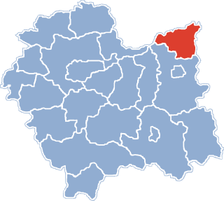
Morzychna is a village in the administrative district of Gmina Dąbrowa Tarnowska, within Dąbrowa County, Lesser Poland Voivodeship, in southern Poland. It lies approximately 3 kilometres (2 mi) west of Dąbrowa Tarnowska and 74 km (46 mi) east of the regional capital Kraków.
Bieniaszowice is a village in the administrative district of Gmina Gręboszów, within Dąbrowa County, Lesser Poland Voivodeship, in southern Poland. It lies approximately 17 kilometres (11 mi) west of Dąbrowa Tarnowska and 62 km (39 mi) east of the regional capital Kraków.

Borusowa is a village in the administrative district of Gmina Gręboszów, within Dąbrowa County, Lesser Poland Voivodeship, in southern Poland. It lies approximately 19 kilometres (12 mi) north-west of Dąbrowa Tarnowska and 67 km (42 mi) east of the regional capital Kraków.
Kozłów is a village in the administrative district of Gmina Gręboszów, within Dąbrowa County, Lesser Poland Voivodeship, in southern Poland. It lies approximately 4 kilometres (2 mi) north-east of Gręboszów, 17 km (11 mi) north-west of Dąbrowa Tarnowska, and 67 km (42 mi) east of the regional capital Kraków.
Lubiczko is a village in the administrative district of Gmina Gręboszów, within Dąbrowa County, Lesser Poland Voivodeship, in southern Poland. It lies approximately 2 kilometres (1 mi) south-east of Gręboszów, 17 km (11 mi) north-west of Dąbrowa Tarnowska, and 64 km (40 mi) east of the regional capital Kraków.
Okręg is a village in the administrative district of Gmina Gręboszów, within Dąbrowa County, Lesser Poland Voivodeship, in southern Poland. It lies approximately 18 kilometres (11 mi) west of Dąbrowa Tarnowska and 61 km (38 mi) east of the regional capital Kraków.
Ujście Jezuickie is a village in the administrative district of Gmina Gręboszów, within Dąbrowa County, Lesser Poland Voivodeship, in southern Poland. It lies approximately 20 kilometres (12 mi) north-west of Dąbrowa Tarnowska and 62 km (39 mi) east of the regional capital Kraków.

Żelichów is a village in the administrative district of Gmina Gręboszów, within Dąbrowa County, Lesser Poland Voivodeship, in southern Poland. It lies approximately 14 kilometres (9 mi) north-west of Dąbrowa Tarnowska and 66 km (41 mi) east of the regional capital Kraków.
Wólka Grądzka is a village in the administrative district of Gmina Mędrzechów, within Dąbrowa County, Lesser Poland Voivodeship, in southern Poland. It lies approximately 10 kilometres (6 mi) north of Dąbrowa Tarnowska and 77 km (48 mi) east of the regional capital Kraków.
Adamierz is a village in the administrative district of Gmina Olesno, within Dąbrowa County, Lesser Poland Voivodeship, in southern Poland. It lies approximately 3 kilometres (2 mi) south-west of Olesno, 8 km (5 mi) north-west of Dąbrowa Tarnowska, and 71 km (44 mi) east of the regional capital Kraków.
Ćwików is a village in the administrative district of Gmina Olesno, within Dąbrowa County, Lesser Poland Voivodeship, in southern Poland. It lies approximately 4 kilometres (2 mi) north-west of Olesno, 10 km (6 mi) north-west of Dąbrowa Tarnowska, and 72 km (45 mi) east of the regional capital Kraków.
Dąbrówki Breńskie is a village in the administrative district of Gmina Olesno, within Dąbrowa County, Lesser Poland Voivodeship, in southern Poland. It lies approximately 4 kilometres (2 mi) north of Olesno, 10 km (6 mi) north of Dąbrowa Tarnowska, and 76 km (47 mi) east of the regional capital Kraków.
Niwki is a village in the administrative district of Gmina Olesno, within Dąbrowa County, Lesser Poland Voivodeship, in southern Poland. It lies approximately 6 kilometres (4 mi) west of Olesno, 12 km (7 mi) north-west of Dąbrowa Tarnowska, and 68 km (42 mi) east of the regional capital Kraków.
Małec is a village in the administrative district of Gmina Radgoszcz, within Dąbrowa County, Lesser Poland Voivodeship, in southern Poland. It lies approximately 14 kilometres (9 mi) north-east of Dąbrowa Tarnowska and 87 km (54 mi) east of the regional capital Kraków.
Dąbrowica is a village in the administrative district of Gmina Szczucin, within Dąbrowa County, Lesser Poland Voivodeship, in southern Poland. It lies approximately 5 kilometres (3 mi) north-east of Szczucin, 20 km (12 mi) north-east of Dąbrowa Tarnowska, and 89 km (55 mi) east of the regional capital Kraków.
Łęka Szczucińska is a village in the administrative district of Gmina Szczucin, within Dąbrowa County, Lesser Poland Voivodeship, in southern Poland. It lies approximately 7 kilometres (4 mi) north-east of Szczucin, 22 km (14 mi) north-east of Dąbrowa Tarnowska, and 91 km (57 mi) east of the regional capital Kraków.
Maniów is a village in the administrative district of Gmina Szczucin, within Dąbrowa County, Lesser Poland Voivodeship, in southern Poland. It lies approximately 7 kilometres (4 mi) north-east of Szczucin, 22 km (14 mi) north-east of Dąbrowa Tarnowska, and 91 km (57 mi) east of the regional capital Kraków.
Ulesie is a village in the administrative district of Gmina Dąbrowa Zielona, within Częstochowa County, Silesian Voivodeship, in southern Poland. It lies approximately 6 kilometres (4 mi) south of Dąbrowa Zielona, 33 km (21 mi) east of Częstochowa, and 74 km (46 mi) north-east of the regional capital Katowice.