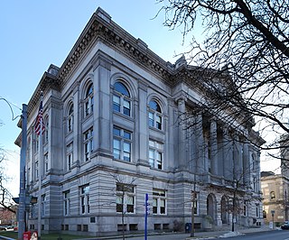
Rensselaer County is a county in the U.S. state of New York. As of the 2020 census, the population was 161,130. Its county seat is Troy. The county is named in honor of the family of Kiliaen van Rensselaer, the original Dutch owner of the land in the area. The county is part of the Capital District region of the state.

Berlin is a town in Rensselaer County, New York, United States. The population was 1,808 at the 2020 census. The town is named after Berlin in Germany, although natives pronounce the name differently, with the accent on the first syllable.

Grafton is a town in Rensselaer County, New York, United States. The population was 2,051 at the 2020 census. It is believed that the town received its name from Grafton, Vermont, where the first town supervisor, Nathaniel Dumbleton, was originally from. The town is an interior town near the north-central part of the county. NY Route 2 passes across the town.

Sand Lake is a town in south-central part of Rensselaer County, New York, United States. Sand Lake is about 13 miles east of Albany, New York. As of the 2020 census, the population was 8,348. Within the town are three hamlets: Averill Park, Glass Lake and the hamlet of Sand Lake. Its four lakes are a source of recreation. Many commercial enterprises of the 19th century and into the 20th century relied on power generated from the Wynants Kill Creek and Burden Lake mills. The area is known for its fertile soil for grazing and agriculture.

The Ozarks, also known as the Ozark Mountains, Ozark Highlands or Ozark Plateau, is a physiographic region in the U.S. states of Missouri, Arkansas, and Oklahoma, as well as a small area in the southeastern corner of Kansas. The Ozarks cover a significant portion of northern Arkansas and most of the southern half of Missouri, extending from Interstate 40 in central Arkansas to Interstate 70 in central Missouri.

Otsego Lake is a 4,046-acre (16.37 km2) lake located in Otsego County in the U.S. state of New York. It is the source of the Susquehanna River and largest lake in Otsego County. The Village of Cooperstown is located at the lake's southern end. Glimmerglass State Park is located on the lake's northeastern shore, and includes Hyde Hall, a large mansion constructed in 1817, that overlooks the lake. The Glimmerglass Opera, opened in June 1987, is located on the western shore.

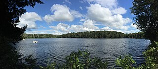
Spring Lake is a small glacial lake in the Town of Berlin, Rensselaer County, New York, United States. The lake is privately administered by the Spring Lake Association, which consists of the owners of cottages around the perimeter. There is no public access. The lake is located on a geologic formation known as the Rensselaer Plateau.

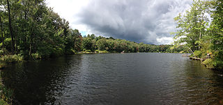
The Rensselaer Plateau is a small plateau located in the central portion of Rensselaer County, New York; it generally encompasses significant parts of the towns of Berlin, Stephentown, Sand Lake, Poestenkill, and Grafton, along with small sections of several other nearby towns. Many glacial lakes, including Big Bowman Pond, Little Bowman Pond, Round Pond and Spring Lake are located on the plateau. Elevations on the plateau range from 1,000 to 2,000 feet above sea level. Vegetation on the plateau is more similar to that found in the Adirondack Mountains to the northwest, with abundant Eastern White Pine, Eastern Hemlock, Red Spruce, and Balsam Fir, along with more limited occurrences of Red Pine and Tamarack. While most to all of the plateau was logged late in the 19th century and early in the 20th century, little farming was undertaken afterwards due to extremely poor and rocky soils, allowing much of the forest to regenerate.

Orson is a village in Preston Township, Pennsylvania, United States, situated in the Lake Region of the Poconos. It was once an important depot of the Scranton Division of the New York, Ontario & Western (O&W) Railway, but today, when it is known outside of its immediate vicinity, it is largely for being the site of the intersection of two state roads, Belmont Turnpike and Crosstown Highway, or as the location of Independent Lake Camp (ILC), since ILC's reputation and commercial reach, like those of most rural American summer camps, extend beyond the community in which the camp is physically located.

Bowman Creek is a tributary of the Susquehanna River in Luzerne County and Wyoming County, in Pennsylvania, in the United States. It is approximately 26 miles (42 km) long and flows through Ross Township and Lake Township in Luzerne County and Noxen Township, Monroe Township, and Eaton Township in Wyoming County. The watershed of the creek has an area of 120 square miles (310 km2). The creek is not designated as an impaired waterbody and its pH is close to neutral, although it has experienced some problems with acid rain. It has low concentrations of dissolved solids like calcium. The creek is relatively small in its upper reaches, but by Noxen, its width is 40 to 60 feet. It is also relatively shallow in many reaches. Rock formations in the watershed include the Catskill Formation, the Huntley Mountain Formation, Burgoon Sandstone, the Mauch Chunk Formation, the Pottsville Group, and the Pocono Formation. Soil associations in the creek's watershed include the Wellsboro-Morris-Oquaga association, the Oquaga-Lackawanna-Arnot association, the Mardin-Bath-Volusia association, and the Wyoming-Pope association.

Poyntelle is a village that is located in Preston Township, Wayne County, Pennsylvania, United States, in the Lake Region of the Poconos.

The Poesten Kill is a 26.2-mile-long (42.2 km) creek in Rensselaer County, Upstate New York. It flows westerly from its source at Dyken Pond, located in the town of Berlin, to its mouth at the Hudson River in the city of Troy. The creek was historically used as a source of water for the local farmers and residents. During the Industrial Revolution, the creek became an important source of water power, and many mills and factories sprung up along its banks.

Taborton is a hamlet located within the town of Sand Lake in Rensselaer County, New York, United States. It is served by the Taborton Fire Department. Two large ponds, Big Bowman Pond and Little Bowman Pond, are in the immediate vicinity.
Bean Run is a tributary of Bowman Creek in Luzerne County, Pennsylvania, in the United States. It is approximately 1.3 miles (2.1 km) long and flows through Ross Township. The watershed of the stream has an area of 1.69 square miles (4.4 km2). The stream's watershed is designated as a High-Quality Coldwater Fishery and a Migratory Fishery.
North Branch Bowman Creek is a tributary of Bowman Creek in Luzerne County, Pennsylvania, in the United States. It is approximately 3.2 miles (5.1 km) long and flows through Fairmount Township and Ross Township. The watershed of the creek has an area of 2.63 square miles (6.8 km2). The creek is not designated as an impaired waterbody. The surficial geology in its vicinity includes Wisconsinan Till, alluvial fan, Boulder Colluvium, alluvium, bedrock, and a peat bog. The creek is mostly in Pennsylvania State Game Lands and Ricketts Glen State Park.

Round Pond is a small glacial lake in the Town of Berlin, Rensselaer County, New York, United States. The lake is located on a geologic formation known as the Rensselaer Plateau.

Little Bowman Pond is a small glacial lake in the Taborton section of the Town of Sand Lake, Rensselaer County, New York, United States. The lake is located on a geologic formation known as the Rensselaer Plateau.
Dyken Pond is a 134-acre (54 ha) lake in the towns of Grafton and Berlin in Rensselaer County, New York. The pond gets water primarily from precipitation and outflows westward into the Poesten Kill, a tributary of the Hudson River. It is located in northwest Berlin, south of Grafton Lakes State Park.

The Canajoharie Creek is a river that flows into the Mohawk River in the Village of Canajoharie in the U.S. State of New York. The name "Canajoharie" is a Mohawk language term meaning "the pot that washes itself", referring to the "Canajoharie Boiling Pot", a 20-foot (6.1 m) wide and 10-foot (3.0 m) deep pothole in the Canajoharie Creek, just south of the village of Canajoharie. Bowmans Creek is one main tributary that enters the creek east of the Hamlet of Sprout Brook. The other main tributary is Brimstone Creek which enters the creek north-northwest of the Village of Ames.


