
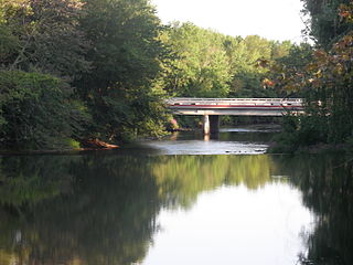
The Au Sable River in Michigan, United States runs approximately 138 miles (222 km) through the northern Lower Peninsula, through the towns of Grayling and Mio, and enters Lake Huron at Au Sable. It is considered one of the best brown trout fisheries east of the Rockies and has been designated a blue ribbon trout stream by the Michigan Department of Natural Resources. In French, au sable literally means "at the sand." A 1795 map calls it the Beauais River.

The Red Cedar River is a tributary of the Grand River in central Michigan in the United States. The river is approximately 51.1 miles (82.2 km) long and drains a watershed of approximately 461 square miles (1,190 km2) in the Lansing–East Lansing metropolitan area and suburban and rural areas to the east.

The Blue River is a tributary of the Colorado River, approximately 65 miles (105 km) long, in the U.S. state of Colorado.
The Battle Creek River is a river in the U.S. state of Michigan. It is a tributary of the Kalamazoo River, joining it at Battle Creek, Michigan. The Kalamazoo River empties into Lake Michigan.

The Yellow Dog River flows through Marquette County in the Upper Peninsula of the U.S. state of Michigan. It is 31.6 miles (50.9 km) in length, with about 85 miles (137 km) of tributaries. The main branch begins at the outflow from Bulldog Lake in the Ottawa National Forest on the boundary between Baraga and Marquette counties. The river's mouth is on Lake Independence, near Big Bay, Michigan, and is part of the Lake Superior watershed.
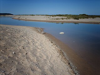
The Platte River is located in the northern part of the Lower Peninsula of Michigan. Its mouth is located in Sleeping Bear Dunes National Lakeshore and much of the rest is in the Pere Marquette State Forest.
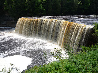
The Tahquamenon River is an 89.1-mile-long (143.4 km) blackwater river in the U.S. state of Michigan that flows in a generally eastward direction through the eastern end of the Upper Peninsula. It drains approximately 820 square miles (2,120 km2) of the Upper Peninsula, including large sections of Luce County and Chippewa County. It begins in the Tahquamenon Lakes in northeast Columbus Township of Luce County and empties into Lake Superior near the village of Paradise. M-123 runs alongside a portion of the river.
Carp River is a 40.2-mile-long (64.7 km) river in Chippewa and Mackinac counties in the U.S. state of Michigan. 21.7 miles (34.9 km) of the river were added to the National Wild and Scenic Rivers System in 1992.
The Galien River is a 30.0-mile-long (48.3 km) stream in the southwest region of the U.S. state of Michigan. The river begins at the outlet of Dayton Lake and flows in a predominantly westerly direction until it enters southeastern Lake Michigan at New Buffalo. The South Branch Galien River rises just north of the border with Indiana, at the confluence of Spring Creek and the Galena River, the latter rising in LaPorte County, Indiana.
The Manistique River is a 71.2-mile-long (114.6 km) river in the U.S. state of Michigan that winds southward through the central Upper Peninsula from its headwaters near Lake Superior to its mouth in Lake Michigan. It drains approximately 1,461 square miles (3,780 km2) of the Upper Peninsula, including most of Schoolcraft County and small portions of Alger County, Delta County, Luce County, and Mackinac County. The river rises at the outlet of Manistique Lake in the southwest corner of Luce County, and after flowing through the Seney National Wildlife Refuge, empties into Lake Michigan at Manistique, Michigan. M-77, a north-south highway, serves much of the Manistique River's drainage and crosses the river and its tributaries several times.
Big Sucker Creek is an 18.2-mile-long (29.3 km) river in St. Louis County, Minnesota, United States. It flows into Lake Superior.

The Bad River is a 44.3-mile-long (71.3 km) river in Michigan. It rises in Newark Township near the city of Ithaca in Gratiot County and flows in a north-easterly direction into Saginaw County, and through the village of St. Charles, before emptying into the Shiawassee River within the bounds of the Shiawassee National Wildlife Refuge.
The Big Iron River is a 28.3-mile-long (45.5 km) river in western Ontonagon County on the Upper Peninsula of Michigan in the United States. It flows northwards, entering Lake Superior at the village of Silver City.
The Big Siskiwit River is an 8.1-mile-long (13.0 km) river on Isle Royale in Lake Superior, in the U.S. state of Michigan. It flows west to east in the southern part of the island, entering Lake Superior at Siskiwit Bay.
The Dead River is a 43.2-mile-long (69.5 km) river in Marquette County, Michigan. Its watershed is approximately 400 square miles (1,000 km2) in size. The river flows southeasterly from western Marquette County to its mouth on Lake Superior.
The Little Garlic River is a 10.6-mile-long (17.1 km) tributary of Lake Superior in Marquette County on the Upper Peninsula of Michigan in the United States.

The Pilgrim River is a 12.9-mile-long (20.8 km) river in Portage Township, Houghton County, Michigan, in the United States. The river flows near the Portage Lake Golf Course and empties into the Keweenaw Waterway, which connects to Lake Superior.

Sycamore Creek is a tributary of the Red Cedar River in the state of Michigan in the United States. The stream is 26.5 miles (42.6 km) long and drains an area of 106.1 square miles (275 km2) on the central Lower Peninsula, in and around the city of Lansing. Via the Red Cedar River, it is part of the watershed of the Grand River, which flows to Lake Michigan. Via Lake Michigan and the Great Lakes system, it is part of the larger watershed of the St. Lawrence River.

The Pigeon River is a small river flowing to Lake Michigan on the western Lower Peninsula of the U.S. state of Michigan. The river is approximately 12.9 miles (20.8 km) long and drains an area of 61.7 square miles (160 km2) in a generally rural area situated between the cities of Holland and Grand Haven. Via Lake Michigan and the larger Great Lakes system, it is part of the watershed of the St. Lawrence River.


