Big Island Dam | |
---|---|
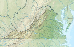
Location | Bedford County, Virginia / Amherst County, Virginia, U.S. |
Coordinates | 37°32′10.39″N79°21′24.71″W / 37.5362194°N 79.3568639°W Coordinates: 37°32′10.39″N79°21′24.71″W / 37.5362194°N 79.3568639°W |
Purpose | Hydroelectric |
Status | In use |
Opening date | 1850 |
Owner(s) | GP Big Island, LLC (Georgia Pacific Corporation) |
Operator(s) | GP Big Island, LLC (Georgia Pacific Corporation) |
Dam and spillways | |
Type of dam | Gravity |
Impounds | James River |
Height | 15 ft (4.6 m) |
Length | 657 ft (200 m) |
Power Station | |
Operator(s) | GP Big Island, LLC (Georgia Pacific Corporation) |
Hydraulic head | 18 ft (5.5 m) |
Installed capacity | 480 KW [1] |
FERC Number: P-2902 [2] |
The Big Island Dam is a hydroelectric generation facility on the James River near the community of Big Island, Virginia. The project includes a gravity dam spanning the left side of river and a power house on the right bank which contain hydroelectric generation equipment. [3] The dam is located adjacent to and integrated with the large Georgia Pacific paper mill at this location.
The dam is located downstream of the nearby Bedford Hydropower Project and is the last in a series of three dams within the span of five miles as the river crosses the Blue Ridge Mountains.
Rock Island Dam is a hydroelectric dam on the Columbia River, in the U.S. state of Washington. Chelan County Public Utility District's Rock Island Dam and Hydro Project was the first dam to span the Columbia, having been built from 1929 to 1933. It is located near the geographical center of Washington, about 12 miles (19 km) downstream from the city of Wenatchee. By river, the dam is 235 miles (378 km) south of the Canada–US border and 453 miles (729 km) above the mouth of the river at Astoria, Oregon. The dam's reservoir is called Rock Island Pool.
Priest Rapids Dam is a hydroelectric, concrete gravity dam; located on the Columbia River, between the Yakima Firing Range and the Hanford Nuclear Reservation, and bridges Yakima County and Grant County, in the U.S. state of Washington. The dam is 24 miles south of the town of Vantage, and 47 miles northwest of the city of Richland. It is located at mile marker 397.1 from the mouth of the Columbia. It is owned by the Grant County Public Utility District (PUD). Priest Rapids, for which the dam was named, are now submerged beneath the dam's reservoir.
Jennings Randolph Lake is a reservoir of 952 acres (3.85 km2) located on the North Branch Potomac River in Garrett County, Maryland and Mineral County, West Virginia. It is approximately eight miles upstream of Bloomington, Maryland, and approximately five miles north of Elk Garden, West Virginia.
The Bull Run Hydroelectric Project was a Portland General Electric (PGE) development in the Sandy River basin in the U.S. state of Oregon. Originally built between 1908 and 1912 near the town of Bull Run, it supplied hydroelectric power for the Portland area for nearly a century, until it was removed in 2007 and 2008. The project used a system of canals, tunnels, wood box flumes and diversion dams to feed a remote storage reservoir and powerhouse. The entire project was removed because of rising environmental costs. Marmot Dam on the Sandy River was demolished in 2007, and the Little Sandy Dam on the Little Sandy River was taken down in 2008.
Condit Hydroelectric Project was a development on the White Salmon River in the U.S. state of Washington. It was completed in 1913 to provide electrical power for local industry, and is listed in the National Register of Historic Places as an engineering and architecture landmark.
York Haven Dam is a low head, run-of-the river, dam and hydroelectric plant on the Susquehanna River, United States. The dam is 12 miles (19 km) south of Harrisburg, Pennsylvania, at the Conewago Falls impounding about 8,000 feet (2,400 m) of the river to the west side of Three Mile Island, where the river drops 19 feet (5.8 m) in 1⁄4 mile (0.40 km). When the dam was completed in 1904, it was the third largest in the world.
The Tinker Dam is a hydroelectric dam built in Tinker on the Aroostook River in the Canadian province of New Brunswick, and operated jointly by WPS Energy and NB Power. Its power house has a capacity of 34 megawatts.
Lower Baker Dam is a dam across the Baker River one mile north of Concrete, Washington. It forms a reservoir called Lake Shannon which stretches 7.5 miles (12.1 km) upstream. The dam is operated by Puget Sound Energy as part of the Baker River Hydroelectric Project.
The Pensacola Dam, also known as the Grand River Dam, is a multiple-arch buttress dam on the Grand River in-between Disney and Langley in the U.S. state of Oklahoma. The dam is operated by the Grand River Dam Authority and creates Grand Lake o' the Cherokees. After decades of vision and planning, it was constructed between 1938 and 1940 for the purposes of hydroelectric power generation, flood control and recreation. It is Oklahoma's first hydroelectric power plant and is referred to as the longest multiple-arch dam in the world.
Power Plant and Dam No. 4 is a historic hydroelectric power generation station on the Potomac River, located near Shepherdstown on the county line between Berkeley and Jefferson County, West Virginia. The power plant is a tall one-story, limestone building on a high stone foundation. It is five bays long and has a gable roof. Dam 4 uses horizontal shaft turbines connected by rope drives to horizontal shaft generators. This plant is probably the last commercially operated rope-driven hydroelectric plant in the United States. The building is built into a hillside, so the main floor is the top floor. The power plant was originally built by the Martinsburg Electric Company.
The Big Creek Hydroelectric Project is an extensive hydroelectric power scheme on the upper San Joaquin River system, in the Sierra Nevada of central California. The project is owned and operated by Southern California Edison (SCE). The use and reuse of the waters of the San Joaquin River, its South Fork, and the namesake of the project, Big Creek – over a vertical drop of 6,200 ft (1,900 m) – have over the years inspired a nickname, "The Hardest Working Water in the World".
The Hydropower Regulatory Efficiency Act of 2013 is a bill that was introduced into the United States House of Representatives of the 113th United States Congress on January 15, 2013. It passed the House on February 13, 2013 by a vote of 422-0. President Obama signed the Act into law on August 9, 2013.
The Yuba–Bear Hydroelectric Project is a complex hydroelectric scheme in the northern Sierra Nevada in California, tapping the upper Yuba River and Bear River drainage basins. The project area encompasses approximately 400 square miles (1,000 km2) in Nevada, Placer, and Sierra Counties. Owned by the Nevada Irrigation District, it consists of 16 storage dams plus numerous diversion and regulating dams, and four generating stations producing 425 million kilowatt hours of electricity each year. The Yuba–Bear Hydroelectric Project consists of the Bowman development, Dutch Flat No. 2 development, Chicago Park development, and Rollins development.
The Koma Kulshan Project is a 13.3 MW run-of-the-river hydroelectric generation facility on the slopes of Mount Baker, a stratovolcano in Washington state's North Cascades. The project commenced commercial operation in October 1990, and is owned by a Covanta Energy–Atlantic Power joint venture. It supplies Puget Sound Energy via a Power Supply Agreement (PSA) contract. Its single turbine is a Pelton wheel supplied by Sulzer Escher Wyss.
The Cushaw Hydroelectric Project is a 7.5 megawatt (MW) dam and power house facility owned and operated by Virginia Electric Power Company, operating as Dominion Virginia Power.
The Bedford Hydropower Project (Snowden) is a hydroelectric generation facility on the James River near the community of Big Island, Virginia. The project includes a low head structure completely spanning the river; river flow is split into a concrete canal leading to the hydroelectric generation facility and the natural river course.
The Holcomb Rock Dam is a concrete dam across the James River near Lynchburg, Virginia. The project consists of a concrete dam across the river, an earthen embankment canal on the right bank, and a power house where water is discharged to generate electricity. Per the 2008 annual generation report, the project generated 6,089,209 KW-hours.
The Reusens Dam is a 12.5 MW hydroelectric generation facility on the James River near the city of Lynchburg, Virginia. The project includes a concrete gravity dam spanning the left side of river which incorporates eight 16 3/4-foot-high flood gates, a 125 feet long by 25 feet tall concrete arch dam segment with 7 1/4-foot-high flashboards, and two separate power houses towards the right bank which contain hydroelectric generation equipment. The A and B power houses have installed capacities of 7.5 MW with three turbines and 5.0 MW with two turbines, respectively. The plant is used in a peaking capacity. The dam is located downstream of the smaller Holcomb Rock Dam and upstream of the Scotts Mill Dam. The typically submerged Bosher Dam near Richmond lies further downstream.
The Coleman Falls Dam is a hydroelectric generation facility on the James River near the community of Coleman Falls, Virginia. The project includes a gravity dam spanning the left side of river and a power house on the right bank which contain hydroelectric generation equipment.
St. Anthony Falls in Minneapolis, Minnesota, is the only natural falls on the Mississippi River. Since almost the beginning of settlement in the area by European descendants, the St. Anthony Falls have been used for waterpower. The first allowed settlers were at Ft. Snelling, where construction began in 1820. A sawmill was operating 1821 and a flour mill in 1823. As soon as the land at the sides of the falls became available it was purchased with the intent of using the waterpower of the falls. First lumber mills covered the falls, cutting lumber floated down the Mississippi. After 1870 flour mills started to dominate the area. From 1880 to 1930 the area was the number one flour producer in the US. In later years, some of the power came from steam, but in 1923 half of the waterpower used was for flour milling. Other industries have also used the waterpower.