
Lake Michigan is one of the five Great Lakes of North America. It is the second-largest of the Great Lakes by volume and the third-largest by surface area, after Lake Superior and Lake Huron. To the east, its basin is conjoined with that of Lake Huron through the 3+1⁄2-mile (5.6-kilometer) wide, 295-foot deep Straits of Mackinac, giving it the same surface elevation as its easterly counterpart; the two are geologically a single lake.

Cook County is the easternmost county in the U.S. state of Minnesota. As of the 2020 census, the population was 5,600, making it Minnesota's seventh-least populous county. Its county seat is Grand Marais. The Grand Portage Indian Reservation is in the county.

Mecosta County is a county located in the U.S. state of Michigan. As of the 2020 Census, the population was 39,714. The county seat is Big Rapids.

Leelanau County is a county located in the U.S. state of Michigan. As of the 2020 Census, the population was 22,301. Since 2008, the county seat has been located within Suttons Bay Township, one mile east of the unincorporated village of Lake Leelanau. Before 2008, Leelanau County's seat was Leland. Leelanau County is included in the Traverse City Micropolitan Statistical Area of Northern Michigan. The largest settlement in Leelanau County by population is Greilickville, itself a suburb of Traverse City.

Aroostook County is a county in the U.S. state of Maine along the Canada–United States border. As of the 2020 census, the population was 67,105. Its county seat is Houlton, with offices in Caribou and Fort Kent.

Eastport is a city and archipelago in Washington County, Maine, United States. The population was 1,288 at the 2020 census, making Eastport the least-populous city in Maine. The principal island is Moose Island, which is connected to the mainland by a causeway. Eastport is the easternmost city in the continental United States.
Grand Lake Stream is a plantation in Washington County, Maine, United States. The population was 125 at the 2020 census.

Pittsburg is a town in Coös County, New Hampshire, United States. The population was 800 at the 2020 census. It is the northernmost town in New Hampshire and the largest town by area in New England. U.S. Route 3 is the only major highway in the town, although the northern terminus of New Hampshire Route 145 also lies within Pittsburg.

Whitefield is a town in Coös County, New Hampshire, United States, in the White Mountains Region. The population was 2,490 at the 2020 census. Situated on the northern edge of the White Mountains, Whitefield is home to the Mount Washington Regional Airport and the White Mountains Regional High School.

The Columbia Basin Project in Central Washington, United States, is the irrigation network that the Grand Coulee Dam makes possible. It is the largest water reclamation project in the United States, supplying irrigation water to over 670,000 acres (2,700 km2) of the 1,100,000 acres (4,500 km2) large project area, all of which was originally intended to be supplied and is still classified irrigable and open for the possible enlargement of the system. Water pumped from the Columbia River is carried over 331 miles (533 km) of main canals, stored in a number of reservoirs, then fed into 1,339 miles (2,155 km) of lateral irrigation canals, and out into 3,500 miles (5,600 km) of drains and wasteways. The Grand Coulee Dam, powerplant, and various other parts of the CBP are operated by the Bureau of Reclamation. There are three irrigation districts in the project area, which operate additional local facilities.

The Allagash River is a tributary of the Saint John River, approximately 65 miles (105 km) long, in northern Maine in the United States. It drains in a remote and scenic area of wilderness in the Maine North Woods north of Mount Katahdin. The name "Allagash" comes from the Abenaki language, a dialect of the Algonquin languages, spoken by the Penobscot Tribe. The word, /walakéskʸihtəkʸ/, means "bark stream".

Western Maryland, also known as the Maryland Panhandle, is the portion of the U.S. state of Maryland that typically consists of Washington, Allegany, and Garrett counties. The region is bounded by Preston County, West Virginia, to the west, the Mason–Dixon line (Pennsylvania) to the north, and the Potomac River and West Virginia to the south. At one point, at the town of Hancock, the northern and southern boundaries are separated by just 1.8 miles, the narrowest stretch in the state.
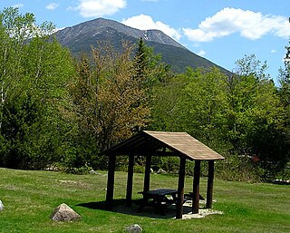
Baxter State Park is a large wilderness area permanently preserved as a state park in Northeast Piscataquis, Piscataquis County in north-central Maine, United States. It is in the North Maine Woods region and borders the Katahdin Woods and Waters National Monument on the east.

The Elk River is a tributary of the Kanawha River, 172 miles (277 km) long, in central West Virginia in the United States. Via the Kanawha and Ohio rivers, it is part of the watershed of the Mississippi River.

The Grand Ditch, also known as the Grand River Ditch and originally known as the North Grand River Ditch, is a water diversion project in the Never Summer Mountains, in northern Colorado in the United States. It is 14.3 miles (23.0 km) long, 20 feet (6.1 m) wide, and 3 feet (0.91 m) deep on average. Streams and creeks that flow from the highest peaks of the Never Summer Mountains are diverted into the ditch, which flows over the Continental Divide at La Poudre Pass at 10,175 feet (3,101 m), delivering the water into Long Draw Reservoir and the Cache La Poudre River for eastern plains farmers. The water would otherwise have gone into the Colorado River that flows west towards the Pacific; instead, the Cache La Poudre River goes East and through the Mississippi River discharges into the Gulf of Mexico.

Harris Station Dam is a hydroelectric dam in Northeast Somerset, Somerset County, Maine. Also known as the Indian Pond Project, the dam was built from 1952 to 1954 as the largest hydroelectric dam in the state of Maine. It impounds the Kennebec River at the southern end of the natural Indian Pond, about 12 miles (19 km) downstream from Moosehead Lake.
Nicatous Lake is a body of water in Hancock County, Maine. Covering 5,165 acres (2,090 ha), it is the second largest lake in Hancock County and one of the largest in the state of Maine. The lake is very long and narrow with many islands scattered throughout. It is also a very shallow lake with low oxygen. The maximum depth is 56 feet (17 m) in the south basin area. The principal fisheries include landlocked salmon, brown trout, smallmouth bass, white perch and chain pickerel.
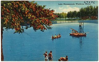
Maranacook Lake is a lake in Kennebec County, Maine located in the towns of Readfield and Winthrop. The lake covers 1,673 acres (677 ha) with a maximum depth of 118 feet (36 m) and a mean depth of 30 feet (9.1 m). It is one of the major bodies of water in the Winthrop Lakes Region.
Baskahegan Lake is a body of water in Washington County, Maine, United States. The lake, which covers 6,815 acres (2,758 ha), is the third largest lake in Washington County and one of the largest statewide. It is located in the town of Topsfield, Maine, the former township of Brookton. The picturesque lake is known for its warm water fishery and very high water quality.
The Clermont chain of lakes is a chain of lakes centered on Clermont, Florida. The chain is orientated from southeast to northwest and fed primarily by streams and groundwater flow. They make up the middle part of the Palatlakaha River watershed which forms the headwaters of the Ocklawaha River. The lakes are notable for their red to tea-colored water from tannic acid.

