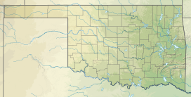
Pushmataha County is a county in the southeastern part of the U.S. state of Oklahoma. As of the 2020 census, the population was 10,812. Its county seat is Antlers.

Antlers is a city in and the county seat of Pushmataha County, Oklahoma, United States. The population was 2,221 as of the 2020 United States census. The town was named for a kind of tree that becomes festooned with antlers shed by deer, and is taken as a sign of the location of a spring frequented by deer.

Rattan is a town in Pushmataha County, Oklahoma, United States. The population was 276 at the 2020 census.

U.S. Route 271 is a north–south United States highway. Never a long highway, it went from bi-state route to a tri-state route. Its southern terminus is in Tyler, Texas, at an intersection with State Highway 31 and SH 155. The highway's northern terminus is in Fort Smith, Arkansas, at an intersection with Business U.S. Route 71 and Highway 255. It enters Arkansas from Oklahoma as a controlled-access highway, but the highway continues as Interstate 540 when US 271 exits toward downtown after one-half mile (800 m) in Arkansas.

The Kiamichi River is a river in southeastern Oklahoma, United States of America. A tributary of the Red River of the South, its headwaters rise on Pine Mountain in the Ouachita Mountains near the Arkansas border. From its source in Polk County, Arkansas, it flows approximately 177 miles (285 km) to its confluence with the Red River at Hugo, Oklahoma.

The Rincon Mountains are a significant mountain range east of Tucson, Pima County, Arizona, in the United States. The Rincon Mountains are one of five mountain ranges surrounding the Tucson valley. The other ranges include the most prominent, the Santa Catalina Mountains to the north, the Santa Rita Mountains to the south, the Tucson Mountains to the west, and the Tortolita Mountains to the northwest. Redington Pass separates the Rincon Mountains from the Santa Catalina Mountains. The Rincon Mountains are generally less rugged than the Santa Catalina Mountains and Santa Rita Mountains. The Rincon Mountains are also included in the Madrean sky island mountain ranges of southeast Arizona, extreme southwest New Mexico, and northern Sonora Mexico.

Tuskahoma is an unincorporated community and census-designated place in northern Pushmataha County, Oklahoma, United States, four miles east of Clayton. It was the former seat of the Choctaw Nation government prior to Oklahoma statehood. The population was 102 as of the 2020 United States census.
Moyers is an unincorporated community located in Pushmataha County, Oklahoma, United States.

State Highway 2, abbreviated SH-2 or OK-2, is a designation for two distinct highways maintained by the U.S. state of Oklahoma. Though they were once connected, the middle section of highway was concurrent with three different U.S. highways, so the middle section was decommissioned for reasons of redundancy.

The Kiamichi Mountains are a mountain range in southeastern Oklahoma. A subrange within the larger Ouachita Mountains that extend from Oklahoma to western Arkansas, the Kiamichi Mountains sit within Le Flore, Pushmataha and McCurtain counties near the towns of Poteau, Albion and Smithville. The foothills of the Kiamichi Mountains sit within Haskell County, Northern Latimer County and Northern Pittsburg County. Its peaks, which line up south of the Kiamichi River, reach 2,500 feet in elevation. The range was the namesake of Kiamichi Country, the official tourism designation for southeastern Oklahoma, until the designation was changed to Choctaw Country.
Kosoma is a ghost town and former railroad station in Pushmataha County, Oklahoma, United States. It is located just off Oklahoma State Highway 2, approximately 10 miles (16 km) north of Antlers.
Rodney Mountain is located in Pushmataha County, Oklahoma, approximately five miles northwest of Antlers, Oklahoma. It is a part of the Kiamichi Mountains, a subrange of the Ouachita Mountains, and forms its southwest-most extremity. Its summit is 767 feet above sea level. It is found at GPS coordinates 34.2984336 and −95.6410833.
Dunbar is a community in Pushmataha County, Oklahoma, United States, 17 miles north of Antlers.
Honobia is an unincorporated community on the border between western LeFlore County and eastern Pushmataha County, Oklahoma, United States, 15 miles southeast of Talihina.
Jumbo is an unincorporated community in western Pushmataha County, Oklahoma, United States, 10 miles north of Miller.
Cedar County was a political subdivision of the Choctaw Nation in the Indian Territory. The county formed part of the nation’s Apukshunnubbee District, or Second District, one of three administrative super-regions.
Johns Valley is a geographic feature and place name located in the Kiamichi Mountains in northwestern Pushmataha County, Oklahoma. The valley is formally classified by geologists as a "basin" due to its complete encirclement by mountains.
The Pushmataha County Historical Society is a historical society devoted to collecting and preserving the history of Pushmataha County, Oklahoma, United States. It is headquartered in the historic Frisco Depot in Antlers, Oklahoma, which it operates as a public museum.
Tobias William Frazier, Sr. (1892–1975) was a full-blood Choctaw Indian who was a member of the famous fourteen Choctaw Code Talkers. The Code Talkers pioneered the use of American Indian languages as military code during war. Their initial exploits took place during World War I, and were repeated by other Native American tribes during World War II.

The AT6 Monument is a granite memorial to Royal Air Force cadets who were killed while on a training flight during World War II. It stands on Big Mountain, north of Moyers, Oklahoma, in the United States, and was dedicated on February 20, 2000—the 57th anniversary of the deadly crashes.