Broken Bow is a city in McCurtain County, Oklahoma, United States. The population was 4,120 at the 2010 census. It is named after Broken Bow, Nebraska, the former hometown of the city's founders, the Dierks brothers. Other Dierks-associated legacies in town include Dierks Elementary School, Dierks Street, and Dierks Train #227 which is preserved in Broken Bow.

Antlers is a city in and the county seat of Pushmataha County, Oklahoma, United States. The population was 2,221 as of the 2020 United States census. The town was named for a kind of tree that becomes festooned with antlers shed by deer, and is taken as a sign of the location of a spring frequented by deer.

Cavanal Hill, located near Poteau, Oklahoma, is described by a sign at its base as the "'World's Highest Hill' – Elevation: 1,999 feet". The actual summit elevation is 2,385 feet (727 m) above sea level; the difference in elevation between the summit and the Poteau River 3 miles (5 km) to the north is 1,960 feet (600 m).

The Kiamichi River is a river in southeastern Oklahoma, United States of America. A tributary of the Red River of the South, its headwaters rise on Pine Mountain in the Ouachita Mountains near the Arkansas border. From its source in Polk County, Arkansas, it flows approximately 177 miles (285 km) to its confluence with the Red River at Hugo, Oklahoma.

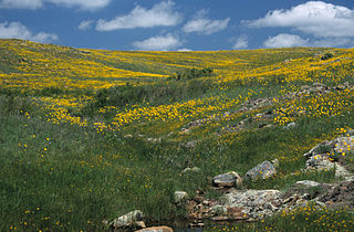
Wichita Mountains Wildlife Refuge, located in southwestern Oklahoma near Lawton, has protected unique wildlife habitats since 1901 and is the oldest managed wildlife facility in the United States Fish and Wildlife Service system. The refuge's location in the geologically unique Wichita Mountains and its areas of undisturbed mixed grass prairie make it an important conservation area. The Wichita Mountains are approximately 500 million years old. Measuring about 59,020 acres (238.8 km2), the refuge hosts a great diversity of species: 806 plant species, 240 species of birds, 36 fish, and 64 reptiles and amphibians are present.

Tuskahoma is an unincorporated community and census-designated place in northern Pushmataha County, Oklahoma, United States, four miles east of Clayton. It was the former seat of the Choctaw Nation government prior to Oklahoma statehood. The population was 102 as of the 2020 United States census.
Moyers is an unincorporated community located in Pushmataha County, Oklahoma, United States.

The Lost River Range is a high mountain range of the Rocky Mountains, located in Central Idaho, in the Northwestern United States.
Winding Stair Mountain National Recreation Area is a United States national recreation area in the Ouachita National Forest. State Highway 1, known as the Talimena Scenic Byway in this area, bisects the recreation area. U. S. Highway 271 loops up through the summit. Winding Stair Mountain National Recreation Area and the nearby Upper Kiamichi River and Black Fork Mountain Wilderness areas were created by an act of Congress on October 18, 1988.
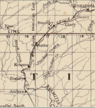
Kosoma is a ghost town and former railroad station in Pushmataha County, Oklahoma, United States. It is located just off Oklahoma State Highway 2, approximately 10 miles (16 km) north of Antlers.
Dunbar is a community in Pushmataha County, Oklahoma, United States, 17 miles north of Antlers.
Honobia is an unincorporated community on the border between western LeFlore County and eastern Pushmataha County, Oklahoma, United States, 15 miles southeast of Talihina.
Kiamichi is a former community in northern Pushmataha County, Oklahoma, United States. It is six miles east of Tuskahoma.
Sardis was a community in northern Pushmataha County, Oklahoma. United States. The location is six miles northwest of Clayton.

Stanley is an unincorporated community in northern Pushmataha County, Oklahoma, United States. The community is on Oklahoma State Highway 2 seven miles southwest of Clayton. The Kiamichi River flows past the southeast side of the site.
Johns Valley is a geographic feature and place name located in the Kiamichi Mountains in northwestern Pushmataha County, Oklahoma. The valley is formally classified by geologists as a "basin" due to its complete encirclement by mountains.
Big Mountain is a mountain in Pushmataha County, Oklahoma. It is part of the Kiamichi Mountains, a subrange of the Ouachita Mountains.

Pinnacle Mountain is a 1,011-foot (308 m) summit and the second-highest natural point in Pulaski County, Arkansas, United States; it is also the primary attraction of the 2,356-acre (953 ha) Pinnacle Mountain State Park. Located in the foothills of the Ouachita Mountains approximately 13 miles (21 km) northwest of downtown Little Rock, Arkansas, Pinnacle Mountain is one of the most iconic landforms of the U.S. Interior Highlands.


