Related Research Articles

Roanoke is an independent city in Virginia, United States. It is located in Southwest Virginia along the Roanoke River, in the Blue Ridge range of the greater Appalachian Mountains. Roanoke is approximately 50 miles (80 km) north of the Virginia–North Carolina border and 250 miles (400 km) southwest of Washington, D.C., along Interstate 81. At the 2020 census, Roanoke's population was 100,011, making it the most-populous city in Virginia west of the state capital Richmond. It is the primary population center of the Roanoke metropolitan area, which had a population of 315,251 in 2020.
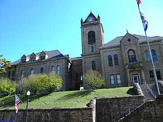
McDowell County is a county in the State of West Virginia. As of the 2020 census, the population was 19,111. Its county seat is Welch. McDowell County is the southernmost county in the state. It was created in 1858 by the Virginia General Assembly and named for Virginia Governor James McDowell. It became a part of West Virginia in 1863, when several Union-affiliated counties seceded from the state of Virginia during the American Civil War. McDowell County is located in the Cumberland Mountains, part of the Appalachia region.

Clifton Forge is a town in Alleghany County, Virginia, United States which is part of the greater Roanoke Region. The population was 3,555 at the 2020 census. The Jackson River flows through the town, which as a result was once known as Jackson's River Station.

Bland County is a county located in the southwestern portion of the Commonwealth of Virginia. The county seat is the unincorporated area of Bland. At the 2020 census, the population was 6,270.
Paxson is a census-designated place (CDP) in Copper River Census Area, Alaska, United States. As of the 2020 census, its population was 26, down from 40 in 2010. It is located on the Richardson Highway at the junction with the Denali Highway.
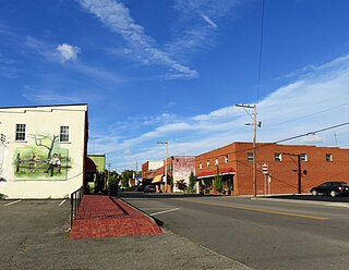
Mountain City is a town in and the county seat of Johnson County, Tennessee, United States. The population was 2,415 at the 2020 census. It is the northeasternmost county seat in Tennessee. In addition, at an elevation of 2,418 feet (737 m), it has the distinction of being the highest incorporated city in the state.

Clintwood is a town in Dickenson County, Virginia, United States. The population was 1,377 at the 2020 census. It is the county seat of Dickenson County.
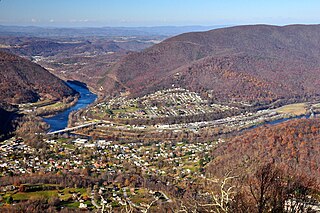
Narrows, named for the narrowing of the New River that flows through the town, is a town in Giles County, Virginia, United States. The population was 2,029 at the 2010 census, a decline of 3.9% from the 2000 count of 2,111. It is part of the Blacksburg–Christiansburg Metropolitan Statistical Area.

Pearisburg is a town in and the county seat of Giles County, Virginia, United States. The population was 2,909 at the time of the 2020 census. Pearisburg is part of the Blacksburg-Christiansburg metropolitan area.

Gate City is a town in Scott County, Virginia, United States. The population was 2,034 at the 2010 census. It is the county seat of Scott County.

Abingdon is a town in and the county seat of Washington County, Virginia, United States, 133 miles (214 km) southwest of Roanoke. The population was 8,376 at the 2020 census. The town encompasses several historically significant sites and features a fine arts and crafts scene centered on the galleries and museums along Main Street.
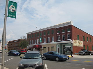
Wytheville is a town in, and the county seat of, Wythe County, Virginia, United States. It is named after George Wythe, a signer of the United States Declaration of Independence and mentor to Thomas Jefferson. Wytheville's population was 8,264 at the 2020 census. Interstate Highways 77 and 81 were constructed to intersect at the town.

Whitesville is a town and former coal town in Boone County, West Virginia, United States, along the Big Coal River. The population was 361 at the 2020 census. Whitesville was incorporated on August 15, 1935, by the Boone County Circuit Court. The town derives its name from B. W. White, a pioneer settler. Whitesville was formerly known as Jarrold's Valley and Pritchard City.

Ripley is a city in and the county seat of Jackson County, West Virginia, United States. The population was 3,074 at the 2020 census.

Mullens is a city in Wyoming County, West Virginia. The population was 1,475 at the time of the 2020 census.

Tazewell County is a county located in the southwestern portion of the U.S. state of Virginia. As of the 2020 census, the population was 40,429. Its county seat is Tazewell.
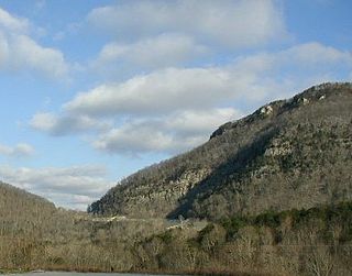
The Cumberland Gap is a pass in the eastern United States through the long ridge of the Cumberland Mountains, within the Appalachian Mountains and near the tripoint of Kentucky, Virginia, and Tennessee. At an elevation of 1,631 feet (497 m) above sea level, it is famous in American colonial history for its role as a key passageway through the lower central Appalachians.

The Rockfish River is a 28.7-mile-long (46.2 km) tributary of the James River in central Virginia in the United States. Via the James River, it is part of the watershed of the Chesapeake Bay.

Big Walker Lookout is a 100 feet (30 m) observation tower located in the Blue Ridge Highlands Region atop Big Walker Mountain in Bland County, Virginia.

Fort Edward Johnson was a series of Confederate States of America (CSA) military breastworks constructed in April 1862 by the four-thousand member brigade known as the "Army of the Northwest". The Army of the Northwest was a remnant of the Confederate Army of the Northwest which had been disbanded in February 1862. The Army of the Northwest was commanded by Colonel Edward "Alleghany" Johnson and had been ordered to secure a major roadway through the Appalachian Mountains known as the Staunton and Parkersburg Turnpike. Johnson ordered the construction of fortifications and breastworks at a high point along the turnpike on top of Shenandoah Mountain, which is in the U.S. state of Virginia, 26 miles (42 km) west of Staunton.
References
- ↑ "Walker Mountain". Geographic Names Information System . United States Geological Survey, United States Department of the Interior . Retrieved June 28, 2023.
- ↑ Proceedings, American Philosophical Society (vol. 24, 1887). American Philosophical Society. ISBN 9781422373668 . Retrieved April 19, 2023.
- ↑ Bolbert, Judy (August 26, 2019). Virginia Off the Beaten Path®. Globe Pequot. ISBN 9781493042661 . Retrieved April 19, 2023.
- ↑ Oliver, Lance (April 2003). "Peak Experience". American Motorcyclist. Retrieved April 19, 2023.