Bignamou

Last updated
Bignamou
Sub-prefecture and town
Guinea adm location map.svg
Red pog.svg
Bignamou
Location in Guinea
Coordinates: 7°16′N9°08′W / 7.267°N 9.133°W / 7.267; -9.133
CountryFlag of Guinea.svg  Guinea
Region Nzérékoré Region
Prefecture Yomou Prefecture
Time zone GMT (UTC+0)

Bignamou is a town and sub-prefecture in the Yomou Prefecture in the Nzérékoré Region of south-eastern Guinea. [1]

Town settlement that is bigger than a village but smaller than a city

A town is a human settlement. Towns are generally larger than villages but smaller than cities, though the criteria to distinguish them vary considerably between different parts of the world.

Sub-prefectures of Guinea

The sub-prefectures are the third-level administrative divisions in Guinea. As of 2009 there were 303 rural communes of Guinea and 38 urban communes, 5 of which compose the Conakry greater urban area; Kaloum, Dixinn, Matam, Ratoma and Matoto.

Yomou Prefecture Prefecture in Nzérékoré Region, Guinea

Yomou is a prefecture located in the Nzérékoré Region of Guinea. The capital and principal town of the prefecture is Yomou. The prefecture covers an area of 3,920 km.² and has an estimated population of 114,371.

Related Research Articles

Lola Prefecture Prefecture in Nzérékoré Region, Guinea

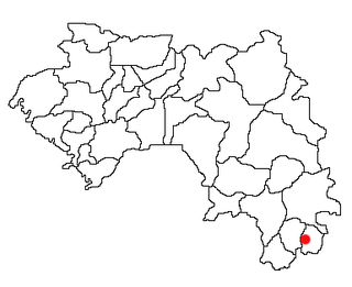
Lola is a prefecture located in the Nzérékoré Region of Guinea. The capital is Lola. The prefecture covers an area of 4,688 km.² and has a population of 171,561.

Macenta Prefecture Prefecture in Nzérékoré Region, Guinea

Macenta is a prefecture located in the Nzérékoré Region of Guinea. The capital is Macenta. The prefecture covers an area of 7,056 km.² and has an estimated population of 278,456.

Siguiri Prefecture Prefecture in Kankan Region, Guinea

Siguiri is a prefecture located in the Kankan Region of Guinea. The capital is Siguiri. The prefecture covers an area of 18,500 km2 (7,100 sq mi) and has a population of 687,002.

Kérouané Prefecture Prefecture in Kankan Region, Guinea

Kérouané is a prefecture located in the Kankan Region of Guinea. The capital is Kérouané. The prefecture covers an area of 7,020 km.² and has a population of 207,547.

Kobéla Sub-prefecture and town in Nzérékoré Region, Guinea

Kobéla is a town and sub-prefecture in the Nzérékoré Prefecture in the Nzérékoré Region of Guinea.

Mafara Sub-prefecture and town in Mamou Region, Guinea

Mafara is a town and sub-prefecture in the Dalaba Prefecture in the Mamou Region of western Guinea.

Falessade Sub-prefecture and town in Kindia Region, Guinea

Falessade is a town and sub-prefecture in the Dubréka Prefecture in the Kindia Region of western Guinea.

Kallia Sub-prefecture and town in Kindia Region, Guinea

Kallia is a town and sub-prefecture in the Forécariah Prefecture in the Kindia Region of western Guinea.

Kakony Sub-prefecture and town in Boké Region, Guinea

Kakony is a town and sub-prefecture in the Gaoual Prefecture in the Boké Region of north-western Guinea. As of 2014 it had a population of 33,204 people.

Balandougou, Guinea Sub-prefecture and town in Kankan Region, Guinea

Balandougou is a town and sub-prefecture in the Kankan Prefecture in the Kankan Region of eastern Guinea. As of 2014 it had a population of 27,554 people.

Sabadou-Baranama Sub-prefecture and town in Kankan Region, Guinea

Sabadou-Baranama is a town and sub-prefecture in the Kankan Prefecture in the Kankan Region of eastern Guinea. As of 2014 it had a population of 23,159 people.

Fermessadou-Pombo Sub-prefecture and town in Faranah Region, Guinea

Fermessadou-Pombo is a town and sub-prefecture in the Kissidougou Prefecture in the Faranah Region of Guinea. As of 2014 it had a population of 19,489 people.

Kiniéro Sub-prefecture and town in Kankan Region, Guinea

Kiniéro is a town and sub-prefecture in the Kouroussa Prefecture in the Kankan Region of eastern-central Guinea. As of 2014 it had a population of 22,267 people.

Damaro Sub-prefecture and town in Kankan Region, Guinea

Damaro is a town and sub-prefecture in the Kérouané Prefecture in the Kankan Region of south-eastern Guinea. As of 2014 it had a population of 27,422 people.

Garambé Sub-prefecture and town in Labé Region, Guinea

Garambé is a town and sub-prefecture in the Labé Prefecture in the Labé Region of northern-central Guinea.

Kouankan is a town and sub-prefecture in the Macenta Prefecture in the Nzérékoré Region of south-eastern Guinea

Kolangui Sub-prefecture and town in Labé Region, Guinea

Kolangui is a town and sub-prefecture in the Tougué Prefecture in the Labé Region of northern-central Guinea.

Santou Sub-prefecture and town in Kindia Region, Guinea

Santou is a town and sub-prefecture in the Télimélé Prefecture in the Kindia Region of western-central Guinea.

Sogolon Sub-prefecture and town in Kindia Region, Guinea

Sogolon is a town and sub-prefecture in the Télimélé Prefecture in the Kindia Region of western-central Guinea.

References

  1. "Subprefectures of Guinea". Statoids. Retrieved April 20, 2009.

Coordinates: 7°16′N9°08′W / 7.267°N 9.133°W / 7.267; -9.133

Geographic coordinate system Coordinate system

A geographic coordinate system is a coordinate system that enables every location on Earth to be specified by a set of numbers, letters or symbols. The coordinates are often chosen such that one of the numbers represents a vertical position and two or three of the numbers represent a horizontal position; alternatively, a geographic position may be expressed in a combined three-dimensional Cartesian vector. A common choice of coordinates is latitude, longitude and elevation. To specify a location on a plane requires a map projection.