Sitapur is a city and a municipal board in Sitapur district in the state of Uttar Pradesh, India. It is located 90 kilometres north of state capital, Lucknow. The traditional origin for the name is said to be by the King Vikramāditya from Lord Ram's wife Sita.

Sitapur district is one of the districts which is situated in Uttar Pradesh state of India, with Sitapur town as the district headquarters. Sitapur district is a part of Lucknow division.

Lakhimpur Kheri district is the largest district in Uttar Pradesh, India, on the border with Nepal. Its administrative capital is the city of Lakhimpur.

Lucknow district is a district located in the state of Uttar Pradesh in northern India. The city of Lucknow is the district headquarters and the district is part of Lucknow division. It is also the capital city of Uttar Pradesh. Lucknow is bounded on the east by Barabanki district, on the west by Unnao and Hardoi districts, on the south by Raebareli district and in the north by Sitapur district.
Behat is an ancient town, near Saharanpur and nagar panchayat of Saharanpur district on the northernmost tip of northwestern Uttar Pradesh, India. It is located on NH-709B on the banks of Eastern Yamuna Canal, about 30 km north of Saharanpur, 190 km from New Delhi, and 77 km from Haridwar. It has an average elevation of 345 m above sea level. It is famous for the production of fruits such as mangoes, guavas, moorhas, brass bells, and wrought iron handicrafts. It is home to the Mata Shakumbari Devi Temple.
Khairabad is a town in the Sitapur district of Uttar Pradesh state of India. It is 8 km from Sitapur on National Highway 24 in the Awadh region of India, about 80 km from the state capital Lucknow. A Municipal board conducts the affairs of the town.
Nanpara is a town & municipal board in Bahraich district in the Indian state of Uttar Pradesh. It is a region along the Nepal Border and includes tracts of dense forests. It is a city surrounded by many villages.

Mainahar Katra is a village in Bachhrawan block of Rae Bareli district, Uttar Pradesh, India. As of 2011, its population is 2,197, in 382 households. It historically formed a taluqdar estate.
Saidpur Behta is a village in Bachhrawan block of Rae Bareli district, Uttar Pradesh, India. As of 2011, its population is 612, in 118 households. It historically belonged to the taluqdars of Tirbediganj.

Atrehta is a village in Maharajganj block of Rae Bareli district, Uttar Pradesh, India. Located 1 km from Maharajganj, the block headquarters, it is the village whose lands the Maharajganj bazar was originally founded on. As of 2011, Atrehta has a population of 5,628, in 1,056 households. It has two primary schools and no healthcare facilities.

Inhauna is a village and corresponding in Singhpur block of Rae Bareli district, Uttar Pradesh, India. As of 2011, its population is 13,049, in 2,021 households. Located at the junction of the Raebareli-Rudauli and Lucknow-Jaunpur roads, Inhauna is an old town that once served as the seat of a pargana as well as (briefly) a tehsil, and it has the ruins of an old fort built under the Nawabs of Awadh. The old marketplace, known as Ratanganj, was built in 1863 by the tahsildar Ratan Narain. Markets are held twice per week, on Mondays and Thursdays, and most of the trade is in livestock.

Pahremau is a village in Amawan block of Rae Bareli district, Uttar Pradesh, India. Located 5 km from Maharajganj on the road to Nigohan, it is an old Muslim centre that historically served as the headquarters of a taluqdari estate. As of 2011, its population is 3,165, in 577 households. It has 3 primary schools and no healthcare facilities.

Rahi is a village and corresponding community development block in Rae Bareli district, Uttar Pradesh, India. It is located 7 km from Rae Bareli, the district headquarters, which according to one folk etymology is named after the village. Rahi was formerly the seat of a pargana before Rae Bareli replaced it in that capacity. As of 2011, Rahi has a population of 7,536 people, in 1,373 households. It has one primary school and one medical clinic.
Bhaon is a village in Rahi block of Rae Bareli district, Uttar Pradesh, India. It is located 9 km south of Rae Bareli, the district headquarters, on the road to Allahabad. It is located on level ground and the soil is very fertile. As of 2011, it has a population of 4,161 people, in 758 households. It has one primary school and no healthcare facilities.
Lodhwari is a village in Rahi block of Rae Bareli district, Uttar Pradesh, India. It is located 12 km from Rae Bareli, the district headquarters, on the left bank of the Sai river. The road to Parshadepur runs through the northeastern part of the village lands. As of 2011, Lodhwari has a population of 10,592 people, in 2,019 households.

Tonk is a village in Dalmau block of Rae Bareli district, Uttar Pradesh, India. It is located 10 km from Dalmau, the block headquarters. As of 2011, it has a population of 642 people, in 120 households. It has no schools and no healthcare facilities.

Sikandarpur is a village in Jagatpur block of Rae Bareli district, Uttar Pradesh, India. As of 2011, it has a population of 494 people, in 86 households. It has no schools and no healthcare facilities.
Sudamanpur is a village in Jagatpur block of Rae Bareli district, Uttar Pradesh, India. It is located off the main road, a bit north of the Ganges, and is in low-lying ground broken by ravines. As of 2011, it has a population of 6,986 people, in 1,278 households. It has 3 primary schools and no healthcare facilities.

Rasulpur is a village in Rohaniya block of Rae Bareli district, Uttar Pradesh, India. One of the largest villages in the historical pargana of Salon, it is located 48 km from Raebareli, the district headquarters. As of 2011, it has a population of 7,671 people, in 1,379 households. It has one primary school and no healthcare facilities.
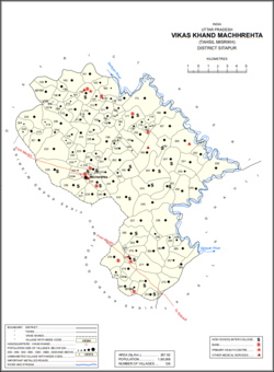
Anogi (अनोगी) located at 27°19'56.2"N 80°39'44.9"E is a village in Machhrehta block of Misrikh tehsil in Sitapur, Uttar Pradesh, India. It belongs to the Lucknow Division. As per 2009 stats, it is also a gram panchayat. The village pin code is 261403 and postal head office is Aurangabad (Sitapur).