Hart is the name of a village in Austria. It is part of the Gemeinde Lavamünd. It has an average altitude of 630 metres (2083 ft).
Tsogttsetsii is a sum (district) of Ömnögovi Province in southern Mongolia. The Tavan Tolgoi coal mine is 15 km southwest of the sum center.

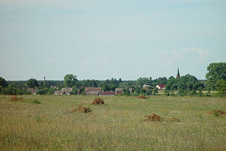
Blizawy is a village in the administrative district of Gmina Warlubie, within Świecie County, Kuyavian-Pomeranian Voivodeship, in north-central Poland. It lies approximately 11 kilometres (7 mi) north-west of Warlubie, 29 km (18 mi) north of Świecie, 71 km (44 mi) north of Toruń, and 71 km (44 mi) north-east of Bydgoszcz.
Szwecja is a village in the administrative district of Gmina Wałcz, within Wałcz County, West Pomeranian Voivodeship, in north-western Poland. It lies approximately 12 kilometres (7 mi) north-east of Wałcz and 133 km (83 mi) east of the regional capital Szczecin.
Makowo is a village in the administrative district of Gmina Kobylin-Borzymy, within Wysokie Mazowieckie County, Podlaskie Voivodeship, in north-eastern Poland. It lies approximately 22 kilometres (14 mi) north-east of Wysokie Mazowieckie and 34 km (21 mi) west of the regional capital Białystok.
Wojciechówka is a village in the administrative district of Gmina Tyszowce, within Tomaszów Lubelski County, Lublin Voivodeship, in eastern Poland.
Niemścice is a village in the administrative district of Gmina Staszów, within Staszów County, Świętokrzyskie Voivodeship, in south-central Poland. It lies approximately 5 kilometres (3 mi) west of Staszów and 49 km (30 mi) south-east of the regional capital Kielce.

Rabe is a village in the administrative district of Gmina Czarna, within Bieszczady County, Subcarpathian Voivodeship, in south-eastern Poland, close to the border with Ukraine. It lies approximately 5 kilometres (3 mi) north of Czarna, 10 km (6 mi) south-east of Ustrzyki Dolne, and 89 km (55 mi) south-east of the regional capital Rzeszów.
Stary Puznów is a village in the administrative district of Gmina Garwolin, within Garwolin County, Masovian Voivodeship, in east-central Poland. It lies approximately 4 kilometres (2 mi) north-east of Garwolin and 56 km (35 mi) south-east of Warsaw.
Niesadna-Przecinka is a village in the administrative district of Gmina Pilawa, within Garwolin County, Masovian Voivodeship, in east-central Poland.
Ługowa Wola is a village in the administrative district of Gmina Policzna, within Zwoleń County, Masovian Voivodeship, in east-central Poland.
Girgajny is a village in the administrative district of Gmina Zalewo, within Iława County, Warmian-Masurian Voivodeship, in northern Poland.
Kamionek is a village in the administrative district of Gmina Szczytno, within Szczytno County, Warmian-Masurian Voivodeship, in northern Poland.
Dobrogoszcz is a village in the administrative district of Gmina Szczecinek, within Szczecinek County, West Pomeranian Voivodeship, in north-western Poland. It lies approximately 9 kilometres (6 mi) north of Szczecinek and 144 km (89 mi) east of the regional capital Szczecin.
Pietrzykowo is a village in the administrative district of Gmina Szczecinek, within Szczecinek County, West Pomeranian Voivodeship, in north-western Poland. It lies approximately 20 kilometres (12 mi) north of Szczecinek and 147 km (91 mi) east of the regional capital Szczecin.

Srezovac is a village in the municipality of Aleksinac, Serbia. According to the 2002 census, the village has a population of 238 people.
Petruša is a village in the municipality of Knjaževac, Serbia. According to the 2002 census, the village has a population of 120 people.
Nehatu is a village in Lääneranna Parish, Pärnu County, in western Estonia.
Vranishta is a village in Municipality of Struga, Macedonia.

Karacaoğlan River is a small river in Erdemli ilçe (district) of Mersin Province, Turkey. Its headwaters are around Tepeköy in the Toros Mountains. It has a number of names depending on the villages around such as; Şahna, Müğlü, Dikiner, Sandal, Kargıpınarı. In the lower reaches in Çukurova (Cilician) plains it is used for irrigation. During the post-rainy seasons its excess water falls down over the cliffs to create an artificial waterfall to the east of Elvanlı. The waterfall is a popular excursion area for Mersin citizens. The river then flows between the towns of Kargıpınarı and Çeşmeli and discharges to Mediterranean Sea at 36°39′51″N34°25′42″E.


