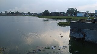
Bagpat district is one of the 75 districts of the Indian state of Uttar Pradesh with headquarters at the town of Baghpat.
Baghpat is a city in the Indian state of Uttar Pradesh. It is the administrative headquarters of Bagpat district, which was established in 1997. It is part of the National Capital Region.

Baraut is a city and municipal board, near the city of Baghpat in Baghpat district, Uttar Pradesh, India.
Tatiri is a town and a nagar panchayat in Baghpat district in the Indian state of Uttar Pradesh. The distance between Aggarwal Mandi Tatiri and Baghpat is 5 km. Tatiri is connected to two districts : Baghpat and Meerut, by road, via (NH-334B).Towards 5 km west SH-57 road which connects New Delhi- Baghpat - Baraut -Shamli - Saharanpur.
Doghat is a town and a Nagar Panchayat in Baghpat district in the state of Uttar Pradesh, India.
Jalalabad (Jalālābād) is a town and a nagar panchayat in Shamli district in the Indian state of Uttar Pradesh. It is a historical town situated on Delhi Saharanpur road. Dating back to the Mughal period, situated close to the borders of Haryana and Uttarakhand states, and surrounded by a very fertile agricultural region namely famous for plentiful yields in grains and fruits, Jalalabad is internationally famous for its wood carving work cottage industry. It is a thriving market of local agricultural produce, including basmati rice and mangoes. A variety of agro-based industrial enterprises - such as textile, sugar, paper and cigarette factories - are located around it. It is 41 km from Saharanpur and 40 km from Muzaffarnagar.
Kishanpur Baral is a village in Baghpat district, Uttar Pradesh, India. Kishanpur Baral is situated on the Delhi-Saharanpur Yamunotri Highway. This village is about 60 km from the New Delhi and also 60 km from Meerut. It is about 30 km from Bagpat.
Islamnagar is a Block and Nagar Panchayat in Badaun district in the Indian state of Uttar Pradesh. Its block code is 0174.
Sirsalgarh is a small village in Bagpat district, Uttar Pradesh, India, famous for its Garh, a hill of soil created due to earthquake a century before.
Kirthal is a large village in Baraut Tehsil, Uttar Pradesh State, India. It lies in the northwest of Bagpat District, near the border with Haryana State. Kirthal's village code is 1038000 and its main post office is in Chhaprauli.

Shamli is a district in the Indian state of Uttar Pradesh. This district was carved out from Muzaffarnagar District on 28 September 2011 as Prabudh Nagar and renamed Shamli in July 2012. Shamli is the headquarters of the district. Shamli is located along the Delhi–Saharanpur, Meerut-Karnal and Panipat-Khatima Highways.
Sarurpur Kalan, or Saroorpur Kalan, is a large village located about 10 km (6.2 mi) north of Baghpat, in Baghpat district, Uttar Pradesh state, India. It is located halfway between Baghpat and Baraut. Towns nearby include Murthal and Rai to the west, Kutana to the north, and Daula to the east. The closest airport and railway stations are Baraut Railway Station located approximately 11 km (6.8 mi) away, Sujra Railway Station located approximately 5 km (3.1 mi) away, and Indira Gandhi International Airport.
Noorpur Muzvita is a village in the Khekra Tehsil, Bagpat district of Uttar Pradesh, India. Having a population of more than 3,000, this village is 3 km (1.9 mi) from Khekra and 9.2 km (5.7 mi) from Bagpat, the main city of the district.
Janta Vedic College, also known as 'Jat College', is a college in Baraut in the Baghpat district in Uttar Pradesh, India. It is situated on the link road in Baraut. The College is managed by Jat Shiksha Sabha, a registered society established in 1920. It is affiliated to Chaudhary Charan Singh University.
Johri is a village in Bagpat district in Uttar Pradesh, India. It lies approximately 9 km from Baraut and 4 km from Binauli. Two more villages, namely Angadpur and Kheri, are close by. It is difficult to distinguish between three villages are no physical boundary is there as such.
Alawalpur is a small village situated in Baghpat District of Uttar Pradesh, India. It is about 60 km away from the Indian Capital New Delhi. It is known for its constituency Baghpat which is the main working area of RLD.
Singhawali Ahir is a village in the Baghpat District of Uttar Pradesh in India. It has a population of approximately 15,000 people. Singhawali Ahir also has a police station. the famous temple is Durga Devi.
Bali is a village in the Indian state of Uttar Pradesh. It is located in the Baghpat block of the Baghpat district.
Ughaiti is a Village or a Gram panchayat. It is located in the Sahaswan block and Bilsi tehsil in Badaun district of Uttar Pradesh state, India. It belongs to Bareilly Division and has two parts. One is Ughati Patti Garvi and the other is Ughaiti Patti Sarki. It is near Ughaiti patti sarki have twelve majra.
Jani Khurd is a large village in Meerut Tehsil and district in the Indian State of Uttar Pradesh. It is located on the bank of Ganga Canal. It is 8 km from Meerut City.


