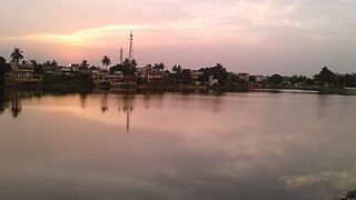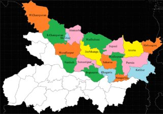
Darbhanga is the fifth-largest city and municipal corporation in the Indian state of Bihar situated centrally in Mithila region.

Saharsa is a city in the Saharsa District in the eastern part of the state of Bihar, India. It is situated near the eastern banks of the Kosi River. It serves as the administrative headquarters for Saharsa District and is also the Divisional Headquarter of the Kosi Division.

Darbhanga district is one of the thirty-eight districts of Bihar state in eastern India, and Darbhanga city is the administrative headquarters of this district and 5th largest city of Bihar as well. Darbhanga district is a part of Darbhanga Division. The district is bounded on the north by Madhubani district, on the south by Samastipur district, on the east by Saharsa district and on the west by Sitamarhi and Muzaffarpur districts. The district covers an area of 2,279 km2 (880 sq mi).

Supaul district is one of the thirty-eight districts of Bihar, India. The town Supaul is the district's administrative headquarters. The district, which was split from the former Saharsa district on 14 March 1991, occupies 2,410 km2 (931 sq mi).

Forbesganj is a city with municipality in the Araria District in the state of Bihar, India, situated at the border of Nepal.
Ratwara a village in Sitamarhi district of Bihar, India also known as Vishnupur Ratwara or Bishunpur Ratwara.
Dhabouli is a village located in Saharsa district of Bihar state, India.The total geographical area of village is 2555.92 hectares. Madhepura is nearest town to Dhabauli which is approximately 10km away. The primary occupation is farming, but now many people have migrated to places like Delhi and Mumbai for work. A number of people of this village are also working in offices of the state, central governments of India and Private sector. More than 25000 people have been living here since the origin of this area. The village has three panchayats and a population of more than 25,000. The village has good telecom connectivity. The village has also a branch of State Bank of India.
Jale is a Town in Darbhanga district, it named after Jaleshwari sthan which is a pilgrimage site in rural area of Darbhanga.
Kusheshwar Asthan Assembly constituency or Kusheshwar Asthan is an assembly constituency in Darbhanga district in the Indian state of Bihar. It is reserved for scheduled castes.

North Bihar is a term used for the region of Bihar, India, which lies north of the Ganga river.

The Barauni–Gorakhpur, Raxaul and Jainagar lines are a set of three lines connecting Barauni in the Indian state of Bihar with Gorakhpur in Uttar Pradesh. The lines run in an east–west direction between the Ganges and India-Nepal border, covering northern Bihar west of the Kosi river and eastern Uttar Pradesh. The southernmost of the lines connects via Hajipur Junction, Sonpur Junction and Chhapra. The central line connects via Muzaffarpur, Motihari and Sugauli. The northern line connects via Darbhanga, Sitamarhi and Raxaul. The lines have interconnections between them and the northern line has extensions to places near the India–Nepal border.
Uchhati is a village in the Biraul block of Biraul subdivision in Darbhanga district, Bihar, India. This is one of the populous villages in Biraul block. This is hardly one kilometer from Biraul block and two kilometers from Supaul Bazar (Darbhanga). Darbhanga is at the distance of 48 km from this village. The link road of Darbhanga-Saharsa via Biraul passes through this village.
Manik Chowk is a village in the Indian state of Bihar.

Uttar Bihar Gramin Bank is a regional rural bank (RRB) in the State of Bihar, India. It is under the ownership of Ministry of Finance, Government of India. It is one of the largest regional rural banks in India in terms of branch network, staff strength and area of operation.

Antour is a village in Benipur Subdivision, Alinagar Block under Darbhanga district in Bihar state, in northeastern India. It is located 28 km towards East from District headquarters Darbhanga. 5 km from Alinagar. 138 km from State capital Patna. Antour Pin code is 847103 and postal office in Antour itself. This Place is in the border of the Darbhanga District and Madhubani District. Madhubani District Lakhnaur is North towards this place. Antour is famous for Panchlal Mahadev Mandir - five Shivlings.

Majhaul is a large Village in Nauhatta Block in Saharsa District of Bihar State of India, with total 700-800 families residing. It belongs to Kosi Division.

Chhatwan is a village in Keotiranway Tehsil, Darbhanga District, Bihar, India.
Pokhraira is a village in Bokhra block of Sitamarhi District in Bihar state of India. It is surrounded by three main cities of Bihar, which are Muzaffarpur, Darbhanga and Sitamarhi. Pokhraira is 27 km distance from district main city Sitamarhi and 97 km distance from state capital Patna.

Mansurchak is a town in Mansurchak Block in Begusarai District of Bihar, India. It belongs to Darbhanga Division. It is located 36 km towards North from District headquarters Begusarai. It is a Block headquarter. Pincode 851128. It is situated at the bank of river Balan.

Mansurchak Block is one of the eighteen Blocks of Begusarai District of Bihar state, India. As per the government register, the block number of Mansurchak is 297. The block has 41 villages and one town of Mansurchak. It is the headquarters of Begusarai District.It is a part of Darbhanga Division.


