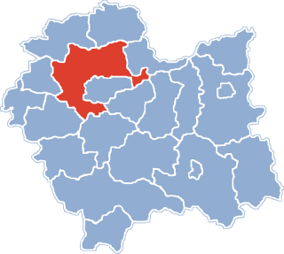
Racławice is a village located in Lesser Poland Voivodeship in southern Poland. It became famous after the victorious Battle of Racławice (1794) in the Kościuszko Uprising. It is the seat of a municipality within Miechów County. It lies approximately 15 kilometres (9 mi) east of Miechów and 37 km (23 mi) north-east of the regional capital Kraków.

Krobia is a town situated in the western part of Poland, in Greater Poland Voivodeship. Center of small folklore region - Biskupizna.

The Archdiocese of Warsaw is a Catholic ecclesiastical territory or diocese in Poland encompassing the Polish capital. It was erected on October 16, 1798. It was elevated to an Archdiocese on June 30, 1813.
Koźlice is a village in the administrative district of Gmina Rudna, within Lubin County, Lower Silesian Voivodeship, in south-western Poland. Prior to 1945 it was in Germany.

Dębowiec is a village in the administrative district of Gmina Dąbrowa Chełmińska, within Bydgoszcz County, Kuyavian-Pomeranian Voivodeship, in north-central Poland. It lies approximately 6 kilometres (4 mi) north of Dąbrowa Chełmińska, 24 km (15 mi) north-east of Bydgoszcz, and 31 km (19 mi) north-west of Toruń.
Złotniki is a village in the administrative district of Gmina Sulmierzyce, within Pajęczno County, Łódź Voivodeship, in central Poland.

Brończyce is a village in the administrative district of Gmina Słomniki, within Kraków County, Lesser Poland Voivodeship, in southern Poland. It lies approximately 3 kilometres (2 mi) south-east of Słomniki and 24 km (15 mi) north-east of the regional capital Kraków.

Samsonów-Dudków is a village in the administrative district of Gmina Zagnańsk, within Kielce County, Świętokrzyskie Voivodeship, in south-central Poland. It lies approximately 5 kilometres (3 mi) west of Zagnańsk and 12 km (7 mi) north of the regional capital Kielce.

Kamieniec is a village in the administrative district of Gmina Połaniec, within Staszów County, Świętokrzyskie Voivodeship, in south-central Poland. It lies approximately 5 kilometres (3 mi) north-west of Połaniec, 14 km (9 mi) south of Staszów, and 65 km (40 mi) south-east of the regional capital Kielce.
Czarzaste Małe is a village in the administrative district of Gmina Chorzele, within Przasnysz County, Masovian Voivodeship, in east-central Poland.
Janówek Duranowski is a village in the administrative district of Gmina Sochaczew, within Sochaczew County, Masovian Voivodeship, in east-central Poland.

Barce is a village in the administrative district of Gmina Kramsk, within Konin County, Greater Poland Voivodeship, in west-central Poland. It lies approximately 5 kilometres (3 mi) south-east of Kramsk, 14 km (9 mi) east of Konin, and 108 km (67 mi) east of the regional capital Poznań.
Borki is a village in the administrative district of Gmina Koło, within Koło County, Greater Poland Voivodeship, in west-central Poland.
Krasnolipka is a village in the administrative district of Gmina Rawicz, within Rawicz County, Greater Poland Voivodeship, in west-central Poland.
Koszuty-Huby is a settlement in the administrative district of Gmina Środa Wielkopolska, within Środa Wielkopolska County, Greater Poland Voivodeship, in west-central Poland.

Czyżowice is a village in the administrative district of Gmina Gorzyce, within Wodzisław County, Silesian Voivodeship, in southern Poland, close to the Czech border. It lies approximately 3 kilometres (2 mi) north of Gorzyce, 4 km (2 mi) south-west of Wodzisław Śląski, and 52 km (32 mi) south-west of the regional capital Katowice.

Halinowo is a settlement in the administrative district of Gmina Prabuty, within Kwidzyn County, Pomeranian Voivodeship, in northern Poland. It lies approximately 3 kilometres (2 mi) east of Prabuty, 21 km (13 mi) east of Kwidzyn, and 78 km (48 mi) south-east of the regional capital Gdańsk.
Woryty Morąskie is a settlement in the administrative district of Gmina Morąg, within Ostróda County, Warmian-Masurian Voivodeship, in northern Poland.

Króle is a settlement in the administrative district of Gmina Wierzchowo, within Drawsko County, West Pomeranian Voivodeship, in north-western Poland. It lies approximately 10 kilometres (6 mi) east of Wierzchowo, 31 km (19 mi) east of Drawsko Pomorskie, and 110 km (68 mi) east of the regional capital Szczecin.

Muzeum Przemysłu w Warszawie was a museum in Warsaw, Poland. It was established in 1982 and closed in 2008.


