
Ksawery is a village in the administrative district of Gmina Chrostkowo, within Lipno County, Kuyavian-Pomeranian Voivodeship, in north-central Poland. It lies approximately 3 kilometres (2 mi) south-west of Chrostkowo, 11 km (7 mi) north-east of Lipno, and 43 km (27 mi) east of Toruń.
Celiny is a village in the administrative district of Gmina Iwanowice, within Kraków County, Lesser Poland Voivodeship, in southern Poland. It lies approximately 5 kilometres (3 mi) north-east of Iwanowice and 23 km (14 mi) north of the regional capital Kraków.
Damice is a village in the administrative district of Gmina Iwanowice, within Kraków County, Lesser Poland Voivodeship, in southern Poland. It lies approximately 4 kilometres (2 mi) south of Iwanowice and 16 km (10 mi) north of the regional capital Kraków.
Domiarki is a village in the administrative district of Gmina Iwanowice, within Kraków County, Lesser Poland Voivodeship, in southern Poland. It lies approximately 5 kilometres (3 mi) east of Iwanowice and 19 km (12 mi) north of the regional capital Kraków.
Grzegorzowice Małe is a village in the administrative district of Gmina Iwanowice, within Kraków County, Lesser Poland Voivodeship, in southern Poland. It lies approximately 4 kilometres (2 mi) north of Iwanowice and 23 km (14 mi) north of the regional capital Kraków.
Grzegorzowice Wielkie is a village in the administrative district of Gmina Iwanowice, within Kraków County, Lesser Poland Voivodeship, in southern Poland. It lies approximately 4 kilometres (2 mi) north of Iwanowice and 22 km (14 mi) north of the regional capital Kraków.
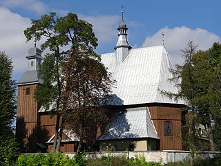
Iwanowice is a village in Kraków County, Lesser Poland Voivodeship, in southern Poland. It is the seat of the gmina called Gmina Iwanowice. It lies approximately 19 km (12 mi) north of the regional capital Kraków.
Iwanowice Dworskie is a village in the administrative district of Gmina Iwanowice, within Kraków County, Lesser Poland Voivodeship, in southern Poland. It lies approximately 2 kilometres (1 mi) south-east of Iwanowice and 18 km (11 mi) north of the regional capital Kraków.
Lesieniec is a village in the administrative district of Gmina Iwanowice, within Kraków County, Lesser Poland Voivodeship, in southern Poland. It lies approximately 3 kilometres (2 mi) north of Iwanowice and 21 km (13 mi) north of the regional capital Kraków.
Maszków is a village in the administrative district of Gmina Iwanowice, within Kraków County, Lesser Poland Voivodeship, in southern Poland. It lies approximately 4 kilometres (2 mi) south-east of Iwanowice and 16 km (10 mi) north of the regional capital Kraków.
Narama is a village in the administrative district of Gmina Iwanowice, within Kraków County, Lesser Poland Voivodeship, in southern Poland. It lies approximately 6 kilometres (4 mi) south of Iwanowice and 14 km (9 mi) north of the regional capital Kraków.
Poskwitów is a village in the administrative district of Gmina Iwanowice, within Kraków County, Lesser Poland Voivodeship, in southern Poland. It lies approximately 4 kilometres (2 mi) east of Iwanowice and 19 km (12 mi) north of the regional capital Kraków.

Sieciechowice is a village in the administrative district of Gmina Iwanowice, within Kraków County, Lesser Poland Voivodeship, in southern Poland. It lies approximately 1 kilometre (1 mi) north-east of Iwanowice and 20 km (12 mi) north of the regional capital Kraków.
Stary Krasieniec is a village in the administrative district of Gmina Iwanowice, within Kraków County, Lesser Poland Voivodeship, in southern Poland. It lies approximately 3 kilometres (2 mi) south-west of Iwanowice and 17 km (11 mi) north of the regional capital Kraków.
Widoma is a village in the administrative district of Gmina Iwanowice, within Kraków County, Lesser Poland Voivodeship, in southern Poland. It lies approximately 6 kilometres (4 mi) south-east of Iwanowice and 17 km (11 mi) north of the regional capital Kraków.
Władysław is a village in the administrative district of Gmina Iwanowice, within Kraków County, Lesser Poland Voivodeship, in southern Poland. It lies approximately 5 kilometres (3 mi) north of Iwanowice and 23 km (14 mi) north of the regional capital Kraków.
Osiek is a village in the administrative district of Gmina Olkusz, within Olkusz County, Lesser Poland Voivodeship, in southern Poland. It lies approximately 7 kilometres (4 mi) south-east of Olkusz and 30 km (19 mi) north-west of the regional capital Kraków.
Kowary is a village in the administrative district of Gmina Radziemice, within Proszowice County, Lesser Poland Voivodeship, in southern Poland. It lies approximately 4 kilometres (2 mi) south-east of Radziemice, 5 km (3 mi) north-west of Proszowice, and 31 km (19 mi) north-east of the regional capital Kraków.
Marianka Mroczeńska is a village in the administrative district of Gmina Baranów, within Kępno County, Greater Poland Voivodeship, in west-central Poland. It lies approximately 7 kilometres (4 mi) south-west of Baranów, 7 km (4 mi) south-west of Kępno, and 148 km (92 mi) south-east of the regional capital Poznań.
Nuny is a village in the administrative district of Gmina Bartoszyce, within Bartoszyce County, Warmian-Masurian Voivodeship, in northern Poland, close to the border with the Kaliningrad Oblast of Russia. It lies approximately 9 kilometres (6 mi) east of Bartoszyce and 58 km (36 mi) north-east of the regional capital Olsztyn.


