Bissikrima Bissikrimaka (in maninka) or Mö Bissi (in fulani) | |
---|---|
Town and sub-prefecture | |
Coordinates: 10°51′18″N10°56′33″W / 10.85500°N 10.94250°W | |
Country | |
Region | Faranah Region |
Population (2014) | |
• Total | 28,840 |
Bissikrima is a town and sub-prefecture in the Faranah Region of Guinea in Dabola prefecture. As of 2014 it had a population of 28,840 people. [1]
The Faranah Region is located in east-central Guinea. It is bordered by the countries of Sierra Leone and Mali and the Guinean regions of Kankan, Mamou, Nzérékoré, and Labé.
Guinea, officially the Republic of Guinea, is a west-coastal country in West Africa. Formerly known as French Guinea, the modern country is sometimes referred to as Guinea-Conakry in order to distinguish it from other countries with "Guinea" in the name and the eponymous region, such as Guinea-Bissau and Equatorial Guinea. Guinea has a population of 12.4 million and an area of 245,860 square kilometres (94,927 sq mi).
Dabola is a city in central Guinea. As of 2014 it had a population of 38,617 people. It grew around the railway line from Conakry to Kankan and is known for the Tinkisso Falls and for its important dam.
Bissikrima is located at the geographical centre of Guinea on the Tinkisso River, one of the tributaries of the Niger on which there is a hydro-electric dam supplying the towns of Faranah, Dabola and Dinguiraye. Bissikrima is the only sub-prefecture in Dabola which enjoys a supply of electric power. As a result, it is one of the top five sub-prefectures in Guinea. For some time, Bissikrima has been an important railway station on the line connecting Conakry and Kankan, the two largest towns in Guinea. It is also a major road hub on the RN1 and the RN30, the road north to Dinguiraye. The Fula, Mandinka and Susu peoples have cohabited peacefully in Bissikrima for an extended period. Bissikrima is said to be a miniature version of Guinea.[ citation needed ]
The Tinkisso River is a river in Guinea in west Africa. The river is sourced near Dabola in the Fouta Djallon mountain range, north of Mamou and snakes approximately north-east and then east across the plains of Guinea, until it runs into the River Niger at Siguiri. The river is approximately 400 kilometres in length.
The Niger River is the principal river of West Africa, extending about 4,180 km (2,600 mi). Its drainage basin is 2,117,700 km2 (817,600 sq mi) in area. Its source is in the Guinea Highlands in southeastern Guinea. It runs in a crescent through Mali, Niger, on the border with Benin and then through Nigeria, discharging through a massive delta, known as the Niger Delta or the Oil Rivers, into the Gulf of Guinea in the Atlantic Ocean. The Niger is the third-longest river in Africa, exceeded only by the Nile and the Congo River. Its main tributary is the Benue River.
Dinguiraye is a small town in northern Guinea, known for its large mosque which until recently was thatched. As of 2014 it had a population of 47,250 people.
Dinguiraye is a prefecture located in the Faranah Region of Guinea. The capital is Dinguiraye. The prefecture covers an area of 7,965 km.² and has a population of 195,662.
Dabola is a prefecture located in the Faranah Region of Guinea. The capital is Dabola. The prefecture covers an area of 6,350 km.² and has an estimated population of 182,951.
Arfamoussaya is a town and sub-prefecture in the Dabola Prefecture in the Faranah Region of western Guinea. As of 2014 it had a population of 16,561 people.
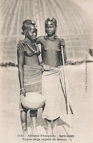
Banko is a town and sub-prefecture in the Dabola Prefecture in the Faranah Region of Guinea. As of 2014 it had a population of 23,638 people.
Dogomet is a town and sub-prefecture in the Dabola Prefecture in the Faranah Region of Guinea. As of 2014 it had a population of 29,040 people.
Kankama is a town and sub-prefecture in the Dabola Prefecture in the Faranah Region of Guinea. As of 2014 it had a population of 13,262 people.
Kindoyé is a town and sub-prefecture in the Dabola Prefecture in the Faranah Region of Guinea. As of 2014 it had a population of 6,495 people.
Konindou is a town and sub-prefecture in the Dabola Prefecture in the Faranah Region of Guinea. As of 2014 it had a population of 10,006 people.
N'Déma is a town and sub-prefecture in the Dabola Prefecture in the Faranah Region of Guinea. As of 2014 it had a population of 16,492 people.
Banora is a town and sub-prefecture in the Dinguiraye Prefecture in the Faranah Region of western Guinea. As of 2014 it had a population of 32,998 people.
Dialakoro is a town and sub-prefecture in the Dinguiraye Prefecture in the Faranah Region of western Guinea. As of 2014 it had a population of 14,735 people.
Diatiféré is a town and sub-prefecture in the Dinguiraye Prefecture in the Faranah Region of western Guinea. As of 2014 it had a population of 33,729 people.
Gagnakali is a town and sub-prefecture in the Dinguiraye Prefecture in the Faranah Region of western Guinea. As of 2014 it had a population of 12,774 people.
Kalinko is a town and sub-prefecture in the Dinguiraye Prefecture in the Faranah Region of western Guinea. As of 2014 it had a population of 31,797 people.
Sélouma is a town and sub-prefecture in the Dinguiraye Prefecture in the Faranah Region of western Guinea. As of 2014 it had a population of 13,188 people.
Beindou is a town and sub-prefecture in the Faranah Prefecture in the Faranah Region of Guinea. As of 2014 it had a population of 16,521 people.
Marela is a town and sub-prefecture in the Faranah Prefecture in the Faranah Region of Guinea. As of 2014 it had a population of 32,638 people.
Dialakoro, Guinea may refer to:
Coordinates: 10°51′18″N10°56′33″W / 10.854886°N 10.942383°W
A geographic coordinate system is a coordinate system that enables every location on Earth to be specified by a set of numbers, letters or symbols. The coordinates are often chosen such that one of the numbers represents a vertical position and two or three of the numbers represent a horizontal position; alternatively, a geographic position may be expressed in a combined three-dimensional Cartesian vector. A common choice of coordinates is latitude, longitude and elevation. To specify a location on a plane requires a map projection.