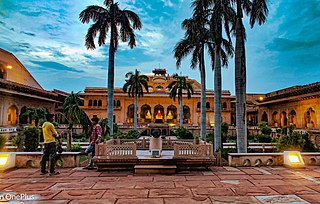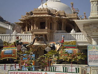
Bharatpur is a city in the Indian state of Rajasthan, 179.99 km (111.84 mi) south of India's capital, New Delhi, 178 km (111 mi) from Rajasthan's capital Jaipur, 55 km (34 mi) west of Agra of Uttar Pradesh and 38 km (24 mi) from Mathura of Uttar Pradesh. It is the administrative headquarters of Bharatpur District and the headquarters of Bharatpur Division of Rajasthan State. Bharatpur is part of National Capital Region of India. The city was the capital of the Bharatpur State. It became a municipal corporation with 65 wards in 2014.

Barmer District is a district in Rajasthan state of India. It is located in the western part of Rajasthan state forming a part of the Thar Desert. Barmer is the third largest district by area in Rajasthan and fifth largest district in India. Occupying an area of 28,387 km2. Being in the western part of the state, it includes a part of the Thar Desert. Jaisalmer is to the north of this district while Jalore is in its south. Pali and Jodhpur form its eastern border and it shares a border with Pakistan in the west. Partially being a desert, this district has a large variation in temperature. The temperature in summer can rise up to 51 °C and falls near to 0 °C in winter. Luni is the longest river in Barmer district. After travelling a length of almost 500 km, it passes through Jalore and merges in the marshy land of Runn of Kutch. District headquarters is in the town of Barmer. The other major towns in the district are: Balotra, Guda Malani, Baytoo, Siwana, and Chohatan. Recently, a large onshore oil field has been discovered and made functional in Barmer district. Now Barmer is also famous for Pomegrante. A village near Balotra name, Budiwada is named by Anar village. For reference check map of budiwada..It is a place of mystery.

Nakoda Mewanagar is a village in the Barmer District of Indian state of Rajasthan. The village name is Mewanagar in the Rajasthan state Government records.

Balotra is a city situated in the Balotra district within the state of Rajasthan, India. Previously, it was located in the Barmer district of the Indian state of Rajasthan. It is known for its historical and cultural significance, as well as its role as a commercial and trading center in the region.
Samdari is a city and tehsil headquarters in Balotra District in Rajasthan, northern India.

Asotra is a village located in Balotra district of Rajasthan, near the city of Balotra which is at a distance of 10 km. Pachpadra is 17 km to the north, Umarlai is 17 km to the north-east and Meli is 18 km to the east of Asotra. Balotra Junction Railway Station is the nearest railhead. Jodhpur Airport at a distance of 100 km, serves Asotra. It is the site of world's second Brahma temple built by the saint Khetaram.
Tilwara, historically known as Khedgarh is a village in Pachpadra tehsil of Balotra district of Rajasthan state in India. Tilwara is situated on the Luni River and is a railway station on Jodhpur-Balotra route. The village is famous for Mallinath Fair, which is the most ancient animal fair of Rajasthan, held between eleventh of Krishna paksh to eleventh of Shukla paksh of Chaitra month of Hindu calender every year. Also called Tilwara cattle fair, it lasts for two weeks. Tilwara is also an archeological site from where evidence for the Mesolithic culture have been excavated. Tilwara has a total population of 1,487 peoples according to Census 2011.
Sonakhali is a village within the jurisdiction of the Basanti police station in the Basanti CD block in the Canning subdivision of the South 24 Parganas district in the Indian state of West Bengal.
Chhiyali is a village in Balotra district, Rajasthan, India. Cheeyali has a total population according to Census 2011.
Moothali is a village in the suburb of Siwana, Balotra District, India. Rajput, Rajpurohit, Nai, Suthar, Jain, Meghwal and many other castes live in this village. According to Census 2011 information the location code or village code of Moothali village is 087522. Moothali village is located in Siwana Tehsil of Barmer district in Rajasthan, India. It is situated 20 km away from sub-district headquarter Siwana and 120 km away from district headquarter Barmer. As per 2009 stats, Moothali village is also a gram panchayat.
Khed/Kher is a village in Balotra District, of Rajasthan, India. It is 9 km from Balotra and situated on Baytu-Balotra Road. Kher has a total population of 1,163 peoples according to Census 2011.
Baytu is a tehsil in Balotra district of Rajasthan state of India. It is a tehsil headquarters. It is also spelled as Bayatu, Baitu or Baytoo.
Rameswarpur is a census town within the jurisdiction of the Maheshtala police station in the Thakurpukur Maheshtala CD block in the Alipore Sadar subdivision of the South 24 Parganas district in the Indian state of West Bengal.
Umarlai Khalsa is a village in Barmer District of Rajasthan state in India. It is about 100 km from Jodhpur. The town is famous for farming, Mata Nagnechiyaa Temple and Akhada, The town is well connected with Jodhpur by buses at frequent intervals. From Umarlai Khalsa towards Jalore there is India's Third Brahma Temple in the village of Asotra. From Umarlai Khalsa towards Barmer there is Ancient Temple of Lord Shri Vishnu named as Shri Ranchore Ray, Khed Mandir in the village of Khed The name Umarlai Khalsa derived from all the religious people of this village. About 13 km from Balotra is located the famous Jain Temple Nakoda. The place receives religious devotees from across India. The town is located near on the coast of the river Luni. The village of Umarlai Khalsa is mainly popular for housing the famous Ancient Temples of Lord Shiva. It is one of the most revered pilgrimage destinations for the Hindu community. The temple is an excellent example of fine architecture and many sculptures are carved inside the temple. Apart from this temple, a number of other temples are located in the town which include the Pabuji Rathord Mandir, Jog Maya Matha Mandir, Gogaji Mandir, Bhomiyaji Mandir, Hanuman Mandir and more.
Uttar Kasipur is a village within the jurisdiction of the Bhangar police station in the Bhangar II CD block in the Baruipur subdivision of the South 24 Parganas district in the Indian state of West Bengal.
Baribhanga Abad is a village within the jurisdiction of the Raidighi police station in the Mathurapur II CD block in the Diamond Harbour subdivision of the South 24 Parganas district in the Indian state of West Bengal.
Deuli is a village and a gram panchayat within the jurisdiction of the Jibantala police station in the Canning II CD block in the Canning subdivision of the South 24 Parganas district in the Indian state of West Bengal.
Uttar Kusum is a census town and a gram panchayat within the jurisdiction of the Usthi police station in the Magrahat I CD block in the Diamond Harbour subdivision of the South 24 Parganas district in the Indian state of West Bengal.

Newada is a village in Unchahar block of Raebareli district, Uttar Pradesh, India. It is located 29 km from Raebareli, the district headquarters. As of 2011, it has a population of 814 people, in 137 households.

Gopali Khera is a village in Sareni block of Rae Bareli district, Uttar Pradesh, India. It is located 14 km from Lalganj, the tehsil headquarters. As of 2011, it has a population of 610 people, in 123 households. It has no healthcare facilities and does not host a weekly haat or a permanent market. It belongs to the nyaya panchayat of Sagar Khera.


