
Primorje – Gorski Kotar County is a county in western Croatia, most of it based in the historical and cultural region called Croatia proper and some of it in Istria, including the Bay of Kvarner, the surrounding Northern Croatian Littoral, and the mountainous region of Gorski Kotar. Its center is Rijeka. The county's population was 296,195 at the 2011 census.

The Kupa or Kolpa river, a right tributary of the Sava, forms a natural border between north-west Croatia and southeast Slovenia. It is 297 kilometres long, with a length of 118 km (73 mi) serving as the border between Croatia and Slovenia and the rest located in Croatia.

Delnice is a town in western Croatia, the largest settlement in the mountainous region of Gorski Kotar, in the Primorje-Gorski Kotar County. The town has a population of 4,379, and total municipality population is 5,952 (2011). Delnice is Gorski Kotar's main town.

Lake Cerknica is an intermittent lake in the southern part of the Cerknica Polje, a karst polje in Inner Carniola, a region in southwestern Slovenia.

Brod na Kupi is a village located 12 km north of Delnice, in the western part of Gorski Kotar in Croatia. A bridge connects it with Petrina in Slovenia. Its population is 207.

Mrkopalj is a village and a municipality in the mountainous part of Croatia in the region of Gorski Kotar, located south-east of Delnice and some 50 km east of Rijeka and 831 meters above sea level.
Čabar is a town in Primorje-Gorski Kotar County in western Croatia. There are 3,770 inhabitants, in the following settlements:

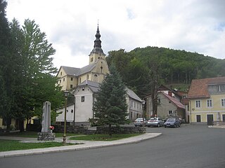
Skrad is a village and a municipality in the Primorje-Gorski Kotar County in western Croatia.
The Velika Kapela is a large mountain range in the east of Gorski Kotar, Croatia.

Snežnik is a wide karst limestone plateau with an area of about 85 km2 (33 sq mi) in the Dinaric Alps. It can also be viewed as a southern extension of the Julian Alps. The main part of the plateau is in Slovenia, while the southern part extends into Croatia and connects to the mountain region of Gorski Kotar.

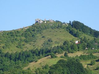
Risnjak is a mountain in the Risnjak National Park, in Gorski Kotar, Croatia. It belongs to the Dinaric Alps mountain range. The name of the massif probably comes from ris, the Croatian word for lynx. Another interpretation suggests that it comes from the local word risje, which is a name for a type of grass.

Lokve is a Croatian municipality of Primorje–Gorski Kotar County. With an area of 42 km2, it has a population of 1,049.

Prezid is a Croatian village in Primorje-Gorski Kotar County. It is connected by the D32 highway.
Gerovo is a Croatian village in Primorje-Gorski Kotar County. It is connected by the D32 highway.

Plešce is a village in Gorski Kotar region in western Croatia.
Viševica is a mountain in Gorski Kotar, Croatia. Its highest peak is the eponymous Viševica at 1,428 m.a.s.l.

Tuhobić is a mountain in Gorski Kotar, Croatia. Its highest peaks are at 1,109 and 1,106 m.a.s.l.

Lič is a village in Primorje-Gorski Kotar, western Croatia. It is located 2 km to the south of Fužine, which it is also a part of administratively. As of 2021, it had a population of 446. Lič is located not far from Viševica mountain and Lake Bajer. The village is connected by the M202 railway.

Petər Klepəc is a legendary character in the Slavic folklore of the Kupa river valley. The most prominent stories involve Klepəc being granted supernatural strength, with which he uses a log as a weapon during a battle. The more historical accounts from Mali Lug have an 18th-century setting, but the more legendary accounts match are set in the 16th or 15th century, possibly indicating narrative conflation.
An extensive bibliography was previously given in Moric and Perinić Lewis 2019, A more detailed bibliography focusing on Petər Klepəc in magazines before WWI had been published by Marko Smole.


