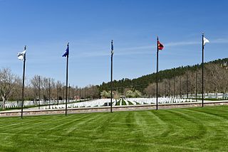
Meade County is a county in the U.S. state of South Dakota. As of the 2020 census, the population was 29,852, making it the 6th most populous county in South Dakota. Its county seat is Sturgis. The county was created in 1889 and named for Fort Meade, which was garrisoned as a United States military post in the area in 1878 and itself named for General George Meade.

Silver Bow County is a county in the U.S. state of Montana. As of the 2020 census, the population was 35,133. Its county seat is Butte. In 1977, the city and county governments consolidated to form the single entity of Butte-Silver Bow. Additionally, the town of Walkerville is a separate municipality from Butte and is within the county.

Shag Rocks are barren rocks situated 8 nautical miles offshore of Custom House Tower in downtown Boston, in the Boston Harbor Islands National Recreation Area and within the city limits of Boston. The rocks are northeast of Little Brewster Island and east of Great Brewster Island and have been the site of several shipwrecks. Boston Light on Little Brewster Island warns mariners to steer clear of the rocks. Public access is impractical.

Lanfair Valley is located in the Mojave Desert in southeastern California near the Nevada state line. It is bounded on the north by the New York Mountains and Castle Mountains, on the east by the Piute Range, and on the south by the Woods Mountains and Vontrigger Hills. Joshua Trees can be found in most of the valley. Elevation is 4,045 feet.

Black Butte is an extinct stratovolcano in the U.S. state of Oregon. Located in Jefferson County, it is part of Deschutes National Forest. Black Butte forms part of the Cascade volcanic arc. The butte lies just south of the Metolius Springs, which merge to form the headwaters of the Metolius River. The Metolius River's basin sustains a wide array of plant life, large and small mammals, and more than 80 bird species.

Steffenville is an unincorporated community in southwestern Lewis County, Missouri, United States. It is located on Missouri Supplemental Route D, approximately 22 miles southwest of Canton. The community is part of the Quincy, IL–MO Micropolitan Statistical Area.
St. Dunstan's Episcopal High School was a K-12 on St. Croix, United States Virgin Islands.
Jerry and Pleasant View are two adjacent unincorporated communities in Tyrrell County, North Carolina, United States; Jerry lies southeast of Pleasant View. Both communities lie at an elevation of 3 feet. Jerry is located at 35°52′56″N76°13′37″W, while Pleasant View is located at 35°53′22″N76°13′58″W.

Ouled Sellam council "Commune" is situated in north-eastern Algeria, about 70 km on the RN77 way north-west of Batna province by the borders with "Setif". The main village is called M'cil, where the local council and schools are, also a hospital and a football stadium.
Mena is a small town and commune in the Cercle of Kolondieba in the Sikasso Region of southern Mali. In 1998 the commune had a population of 5014.
Designated in 1991, the Chesapeake Bay National Estuarine Research Reserve - Virginia (CBNERR-VA) is one of 29 protected areas that make up the National Estuarine Research Reserve System (NERRS). Established to promote informed management of the nation's estuaries and coastal habitats.

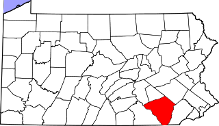
Rawlinsville is an unincorporated community containing a hotel, restaurant, fire dept, and town store. Rawlinsville is located within Martic Township in Lancaster County, Pennsylvania, United States.

Rio Grande Dam is a dam in Hinsdale County, Colorado impounding the Rio Grande. Built between 1910 and 1914 by the San Luis Valley Irrigation District to store water for agriculture in the San Luis Valley, Rio Grande Dam is an earth and rock fill dam 111 ft (34 m) high and 550 ft (170 m) long. The dam impounds the Rio Grande Reservoir, with a capacity of 52,000 acre⋅ft (64,000,000 m3).
Port Harford is a former town in San Luis Obispo County, California, US. It was established in 1871 after John Harford built a pier and a horse drawn railroad to span the two miles between his pier and Avila. In the 1880s the Pacific Coast Railway stopped in Port Harford on its route from San Luis Obispo to Santa Maria. All that remains of the original town are the 1919 pier and a wooden warehouse canopy that now houses Olde Port Inn Restaurant.

462 Broadway (also known as the Mills & Gibb Building, 120-132 Grand Street and 30 Crosby Street) is a commercial building on Broadway between Crosby and Grand Streets in the SoHo neighborhood of Lower Manhattan, New York City Featuring polished red granite on the ground floor, it was built of cast iron in the French Renaissance style in 1879–1880 to a design by John Correja.

Mesquite Valley is a valley in Clark County, Nevada and Inyo County and San Bernardino County, California. Mesquite is an endorheic basin with Mesquite Lake at is lowest point at an elevation of 2,536 feet/773 meters. This valley trends northwest and southeast with a head at 35°40′07″N115°29′09″W to the southeast near State Line Pass and another head at 35°53′50″N115°46′55″W at the southwestern end of Pahrump Valley, at an elevation of 2,808 feet/856 meters, between the Kingston Range and Black Butte to the northwest. It is bounded on the northeast by the Spring Mountains, by the Mesquite Mountains to the southwest and the Clark Mountains to the southeast.

Chambersburg Township is a township in Iredell County, North Carolina, United States. The 2010 United States Census reported a total population of 11,344.
The Salton Buttes are a group of volcanoes in Southern California, on the Salton Sea. They consist of a 7-kilometer (4.3 mi)-long row of five lava domes, named Mullet Island, North Red Hill, Obsidian Butte, Rock Hill and South Red Hill. They are closely associated with a fumarolic field and a geothermal field, and there is evidence of buried volcanoes underground. In pre-modern times Obsidian Butte was an important regional source of obsidian.

The West Elk Loop Scenic and Historic Byway is a 205-mile (330 km) National Forest Scenic Byway and Colorado Scenic and Historic Byway located in Delta, Garfield, Gunnison, Montrose, and Pitkin counties Colorado, USA. The byway reaches its zenith at Kebler Pass, elevation 10,007 feet (3,050 m), between Crested Butte and Paonia.


