
The Wildlife Trusts, the trading name of the Royal Society of Wildlife Trusts, is an organisation made up of 46 local Wildlife Trusts in the United Kingdom, the Isle of Man and Alderney. The Wildlife Trusts, between them, look after more than 2,300 nature reserves, covering around 98,500 hectares. As of 2020, the Trusts have a combined membership of over 870,000 members.
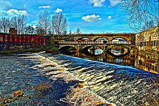
The 5-mile-long (8 km) Five Weirs Walk runs alongside the River Don in Sheffield, England. From Lady's Bridge in Sheffield City Centre, it heads downstream, northeast, over the Cobweb Bridge, through Attercliffe to Meadowhall.

Hathersage is a village and civil parish in the Peak District in Derbyshire, England. It lies slightly to the north of the River Derwent, approximately 10 miles (16.1 km) south-west of Sheffield.

The Devon Wildlife Trust is a member of The Wildlife Trusts partnership covering the county of Devon, England. It is a registered charity, established in 1962 as the Devon Naturalists Trust, and its aim is to safeguard the future of the county's urban, rural and marine wildlife and its environment.
The Avon Wildlife Trust aims to protect and promote wildlife in the area of the former county of Avon — now Bath and North East Somerset, Bristol, North Somerset and South Gloucestershire, in England. It has its headquarters in Bristol and runs wildlife centres at Folly Farm, Somerset and Grow Wilder, Frenchay, North Bristol.
Ecclesfield is a village and civil parish in the City of Sheffield, South Yorkshire, England, about 4 miles (6 km) north of Sheffield City Centre. Ecclesfield civil parish had a population of 32,073 at the 2011 Census. Ecclesfield wards of the City of Sheffield had a population of 35,994 in 2011. The population of Ecclesfield village stood at 7,163 in the most recent census.

Burngreave ward—which includes the districts of Burngreave, Fir Vale, Grimesthorpe, Pitsmoor, and Shirecliffe—is one of the 28 electoral wards in City of Sheffield, England. It is located in the northern part of the city and covers an area of 2.8 square miles. The population of this ward in 2011 was 27,481 people in 9,906 households. It is one of the wards that make up the Sheffield, Brightside and Hillsborough constituency. Most of the ward is served by a free community newspaper, the Burngreave Messenger.

The Yorkshire Wildlife Trust is a charitable non-governmental organisation, one of the UK's 46 county-based Wildlife Trusts. Its focus is nature conservation and it works to achieve a nature-rich Yorkshire with healthy and resilient ecosystems that support both Yorkshire's wildlife and its people.

Agden Reservoir is a water storage reservoir, situated at grid reference SK260925, 6.5 miles (10 km) west of the centre of Sheffield, South Yorkshire, England. It is owned by Yorkshire Water / Kelda Group. The reservoir covers an area of 25 hectares (62 acres) and has a capacity of 559 million gallons (2.11x10⁹ litres) of water, the dam wall has a width of approximately 380 feet (120 m) with a height of 100 feet (30 m). 'Agden' means 'Valley of the Oak Trees'.

Hathersage Road is a road in Sheffield South Yorkshire, England and Derbyshire. It leads south-west from the suburb of Whirlow over the border between Hathersage and Sheffield, before becoming Sheffield Road at the point called Surprise View. The road begins at a bridge on the Limb Brook, the former boundary between Yorkshire and Derbyshire. There the road changes name from Ecclesall Road South to Hathersage Road.

Ecclesall Road is a road in Sheffield, South Yorkshire, England, that runs for about 3.6 miles (5.8 km) south-west from Sheffield's city centre under the number A625. At Banner Cross, where the house numbers reach 1001, the road name changes to Ecclesall Road South and numbering restarts. Ecclesall Road, as a named road, finishes at Whirlow, although the course of the road continues as Hathersage Road.

The Old Hay Brook is a small river in Sheffield, South Yorkshire, England. It is formed from the Redcar Brook, Blacka Dike and another stream, which rise on moors to the south of Sheffield, and is joined by Needham's Dyke near Totley Grange. At Totley Rise it joins Totley Brook, to become the River Sheaf. Water from the river was used to power mills processing lead, corn and paper from at least the 17th century, which were later used for grinding scythes as the Sheffield metal industry expanded. All the mills were defunct by 1900, although some remnants including weirs and dams are still visible.

Gun is a hill at the southern end of the Peak District, overlooking the town of Leek in the Staffordshire Moorlands. The hill is mainly moorland with some small wooded areas. Neighbouring peaks to the east are The Roaches, Hen Cloud and Ramshaw Rocks. It is a nature reserve of the Staffordshire Wildlife Trust.

The Wyming Brook is a river in the City of Sheffield, England. Its source is the Redmires Reservoirs near the Hallam Moors. It flows in a north-easterly direction for over 0.6 miles (1 km) down quite steep terrain into an underground chamber where it joins the Rivelin tunnel before it flows into the lower of the Rivelin Dams. The river flows almost its entire length within the Wyming Brook Nature Reserve, a Site of Special Scientific Interest which is managed by the Wildlife Trust for Sheffield and Rotherham.

The Redmires Reservoirs are a group of three reservoirs in Fulwood, Sheffield, South Yorkshire, England. They are fed from the Hallam Moors by various small streams including Fairthorn Clough. The three reservoirs are named Upper, Middle and Lower and were built between 1833 and 1854 to provide clean drinking water via an open water course which led to the Hadfield Dam situated in Crookes, following the devastating Sheffield cholera epidemic of 1832. The dams were built as part of the Sheffield Water Works continuing expansion to meet the ever growing population of Sheffield.

Breney Common is a nature reserve and Site of Special Scientific Interest, noted for its biological characteristics, in mid Cornwall, England, UK. It is located mainly in Lanlivery civil parish, with the Saints' Way footpath running through it.

Sheffield & Rotherham Wildlife Trust is a charitable non-governmental organisation, covering Sheffield and Rotherham, South Yorkshire, England. It owns or manages 15 nature reserves with its base in Sheffield.

Helman Tor is a granite hill in mid Cornwall, UK with several separated tors, and is designated as a (non-statutory) County Geology Site. The hill also has a Scheduled Ancient Monument. Helman Tor is also the name of the largest nature reserve managed by the Cornwall Wildlife Trust which includes Breney Common and Red Moor. The Wildlife Trust aims to rewild the reserve, including potentially releasing beavers, as well as long-horn cattle and Cornish black pigs. Helman Tor, along with Breney Common, Red Moor and Belowda Beacon, is part of the Mid Cornwall Moors Site of Special Scientific Interest. It lies on the Saints' Way, a long-distance footpath completed in 1986.

Totley Moor is an open moorland hill to the west of the Sheffield suburb of Totley, in the Derbyshire Peak District. The summit is 395 metres (1,296 ft) above sea level.

Fox Hagg is a small nature reserve in the Rivelin Valley area of Sheffield, England. The Allen Sike flows along the north edge of the reserve and the River Rivelin flows through the reserve from Rivelin Dams to the west. The Wyming Brook Nature Reserve borders Fox Hagg to the west. The site is managed by the Wildlife Trust for Sheffield and Rotherham.

