Related Research Articles
Boycott is a hamlet in the parish of Stowe in north Buckinghamshire, England.
Combe is a small village in the English county of Herefordshire. The village lies 4 km (2 mi) east of Presteigne near the confluence of the Hindwell Brook and the River Lugg.

Waldridge is an ancient village in the civil parish of Dinton-with-Ford and Upton in Buckinghamshire, England. Although little of the village survives today, the Waldridge Manor in the nearby village of Meadle shows the approximate location of the original settlement of Waldridge Village.

Woodhouse, often known to locals as Old Woodhouse, is a small village and civil parish in the heart of Charnwood, England. The population of the civil parish at the 2011 census was 2,319, including around 300 term-time boarders at the Defence College. The parish includes the larger village of Woodhouse Eaves. The parish of Woodhouse was formed in 1844. The village is located between the larger Woodhouse Eaves and Quorn villages, the village contains a mixture of small cottages and large modern houses. It is a commuter village for both Leicester and Loughborough, as well as further afield.

Known as the Hagley Road in Birmingham, the A456 is a main road in England running between Central Birmingham and Woofferton, Shropshire, south of Ludlow. Some sections of the route, for example Edgbaston near Bearwood, are also the route of the Elan Aqueduct which carries Birmingham's water supply from the Elan Valley.

Weston Beggard is a small civil parish and hamlet in Herefordshire, England. It is located between the villages of Shucknall and Bartestree and lies approximately 6 km east of Hereford. It is on the north bank of the River Frome. The population of this parish at the 2011 Census was 214.
Stoke Prior is a village in the civil parish of Ford and Stoke Prior in Herefordshire, England, and is 2 miles (3 km) south-east from Leominster.
Pipe and Lyde is a village and civil parish in Herefordshire, England. The parish includes Pipe and Lyde itself, Lower Lyde and Upper Lyde. The population of the civil parish as taken at the 2011 census was 344. Parts of the church of St Peter date from the 13th century including the south door which features Transitional moulding. James Honeyman-Scott (1956-1982), the Pretenders guitarist, is buried in the churchyard.

Breinton is a civil parish in Herefordshire, England. Breinton lies just to the west of Hereford. The population of this civil parish was at the 2011 Census 836. The name Breinton appears to be a modernised form of the word Bruntone, meaning a village near a flowing stream.
Grafton is a village and civil parish in Herefordshire, England. The population of this civil parish was 258 at the 2011 census. The parish includes the villages of Grafton and Bullinghope, and is immediately to the south of Hereford city.

Dinedor is a hill, village and civil parish in Herefordshire, England. Dinedor is situated 5 km (3.1 mi) south east of Hereford. The hilltop is the site of Dinedor Camp, an Iron Age fort.

Byford is a village and civil parish on the River Wye in Herefordshire, England, about 11 km (7 mi) west of Hereford. According to the 2001 census it had a population of 119, increasing to 201 at the 2011 Census.
Warham is a place in the English county of Herefordshire. It is situated about 3 km west of the city of Hereford, close to the north bank of the River Wye. The population of the village at the 2011 census was 193.
Great Hanwood is a civil parish in Shropshire, England.

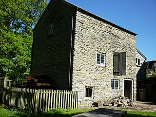
Mortimer's Cross Water Mill is an 18th-century watermill located on the River Lugg, 11 km (7 mi) northwest of Leominster, Herefordshire, England. It is owned by Historic England and is in partial working order.

The River Kenwater is a short tributary of the River Lugg. It is also an offshoot of that river, separating from it about 2 kilometres north-west of Leominster at 52.2371807°N 2.7580419°W; it flows through the town and re-joins the Lugg just outside Leominster's east boundary, at 52.2304265°N 2.7315747°W.

Marden is a village and civil parish in the English county of Herefordshire.

Much Birch is a village and civil parish in Herefordshire, England, between Hereford and Ross-on-Wye. The parish includes the settlements of Kings Thorn, Much Birch and parts of Wormelow.

Stretton Grandison is a hamlet and small civil parish in Herefordshire, England. The population of the civil parish at the 2011 census was 175.

Dinmore Hill rises steeply above the River Lugg in Herefordshire, England and is effectively the prominent eastern ridge of an area of high ground which reaches a height of 236m at Birley Hill some 4 to 5km to the west. It lies roughly midway between the town of Leominster to the north and the city of Hereford to the south, the A49 road which links them climbing the hill in a series of sweeping bends.
References
- ↑ Ordnance Survey: Landranger map sheet 149 Hereford & Leominster (Bromyard & Ledbury) (Map). Ordnance Survey. 2009. ISBN 9780319229538.
- ↑ Bateaux, Victoria. "Archaeological assessment of Blackwardine Roman settlement, Hereford and Worcester" (PDF). www.archaeologydataservice.ac.uk. Retrieved 1 April 2016.