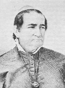
Blas de Hinojos was a military commander of New Mexico who was killed by a force of Navajo warriors led by Narbona in 1835.

New Mexico is a state in the Southwestern region of the United States of America; its capital and cultural center is Santa Fe, which was founded in 1610 as capital of Nuevo México, while its largest city is Albuquerque with its accompanying metropolitan area. It is one of the Mountain States and shares the Four Corners region with Utah, Colorado, and Arizona; its other neighboring states are Oklahoma to the northeast, Texas to the east-southeast, and the Mexican states of Chihuahua to the south and Sonora to the southwest. With a population around two million, New Mexico is the 36th state by population. With a total area of 121,590 sq mi (314,900 km2), it is the fifth-largest and sixth-least densely populated of the 50 states. Due to their geographic locations, northern and eastern New Mexico exhibit a colder, alpine climate, while western and southern New Mexico exhibit a warmer, arid climate.

Narbona was a Navajo chief who participated in the Navajo Wars. He was killed in a confrontation with U.S. soldiers on August 30, 1849.
Capitan Blas de Hinojos married Maria de Jesus Trujillo.[ citation needed ] His men were poorly paid. In 1834 he received a complaint from the detachment at San Miguel del Bado that they were not able to support themselves or their families. [1] In 1834 he decided to commit his troops to supporting the centralist Plan of Cuernavaca, and received an effusive letter from José Antonio Laureano de Zubiría, Bishop of Durango, praising his decision. [2]
The Plan of Cuernavaca was a declaration made in Cuernavaca, Mexico on 25 May 1834 in opposition to reform measures by the liberal administration of Vice President Valentín Gómez Farías. Presumably the declaration was orchestrated by President Antonio López de Santa Anna in agreement with the high clergy. After the triumph of the Plan of Cuernavaca, all laws enacted by the progressives during ten months in office were repealed, the Pontifical and National University of Mexico was reopened, Congress was dissolved and the officials who implemented the reform measures were dismissed. Santa Anna's first dictatorship began. A year later, the conservative faction of the Congress approved the basis for the new constitution that gave rise to the centralist regime in Mexico.
José Antonio Laureano de Zubiría y Escalante was Bishop of Durango in Mexico from 28 August 1831 until his death. He was a supporter of the Centralist Republic of Mexico, and was strongly opposed to the United States, which took control of the northern part of his diocese in 1846, due to its tolerance of faiths other than Catholicism.
Hinojos led a slaving expedition into Navajo country between 13 October and 17 November 1834, killing sixteen warriors but taking only three captives. On 8 February 1835 Hinojos left Santa Fé on a second slaving expedition with a force of almost 1,000 armed men. [3] Narbona heard news of the invasion and collected 250 of the best warriors, who made for the 8,000 feet (2,400 m) high Beesh Lichii'l Bigiizh, or Copper Pass, in the Chuska Mountains on the route that the Mexicans were sure to take. The Mexican force, although large, was composed of poorly disciplined and inexperienced men who took no precautions. [4] On 28 February 1835 they straggled into Copper Pass. [3]
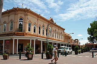
Santa Fe is the capital of the U.S. state of New Mexico. It is the fourth-largest city in the state and the seat of Santa Fe County.

The Chuska Mountains are an elongate range on the southeast Colorado Plateau and within the Navajo Nation whose highest elevations approach 10,000 feet. The range is about 80 by 15 km. It trends north-northwest and is crossed by the state line between Arizona and New Mexico. The highlands are a dissected plateau, with an average elevation of about 2,740 m (8,990 ft), and subdued topography. The highest point is Roof Butte at 2,994 m (9,823 ft), near the northern end of the range in Arizona. Other high points include the satellite Beautiful Mountain at 2,861 m (9,386 ft) and Lukachukai Mountains at 2,885 m (9,465 ft), both also near the northern end, and Matthews Peak at 2,911 m (9,551 ft). The San Juan Basin borders the Chuskas on the east, and typical elevations in nearby parts of that basin are near 1,800 m (5,900 ft). The eastern escarpment of the mountains is marked by slumps and landslides that extend out onto the western margin of the San Juan Basin. To the north, the Chuskas are separated from the Carrizo Mountains by Red Rock Valley, which is today commonly referred to as Red Valley.
Narbona held back his forces, who hiding on both sides of the pass. He told them that when the time was right and not before they would cut the long file of men into small pieces, like cutting a long tree trunk into firewood. When the signal was given, the Navajos poured arrows into the column, those who had guns fired, and some threw stones or rolled rocks into the gorge. Taken completely by surprise, both men and horses panicked and were routed. [4] Hinojos and most of his force died. The survivors made their way beck to Santa Fe, returning on 13 March 1835. [3] Hinojos was succeeded by Albino Pérez. [5] The pass was later renamed Washington Pass, after Colonel John M. Washington, who killed Narbona in 1849. Today it is called Narbona Pass.
Albino Pérez was a Mexican soldier and politician who was appointed Governor of New Mexico by the Centralist Republic of Mexico. He pursued unpopular policies, suffered a revolt in July 1837, and in August 1837 was killed by rebel sympathizers.

John MacRae Washington was a United States artillery officer who became military governor of New Mexico shortly after the end of the Mexican–American War of 1846-1848.

Narbona Pass is a pass through the natural break between the Tunicha and Chuska Mountains, an elongated range on the Colorado Plateau on the Navajo Nation. A paved road, New Mexico Highway 134, crosses the range through Narbona Pass, connecting Sheep Springs to Crystal. Contrary to Navajo tradition of not naming monuments after people, the pass was given the name Narbona to celebrate his victory over an invading Mexican army that was sent to destroy the Navajo in 1835. Known in the Navajo Language as So Sila, the pass was lately named in English for Colonel John M. Washington in 1859. He was a New Mexico military governor who led an expedition into Navajo country in 1849 in which he was accused of walling up a Navajo Spring, and whose troops later shot Navajo leader Narbona.


