Related Research Articles

Alexander Island, which is also known as Alexander I Island, Alexander I Land, Alexander Land, Alexander I Archipelago, and Zemlja Alexandra I, is the largest island of Antarctica. It lies in the Bellingshausen Sea west of Palmer Land, Antarctic Peninsula from which it is separated by Marguerite Bay and George VI Sound. The George VI Ice Shelf entirely fills George VI Sound and connects Alexander Island to Palmer Land. The island partly surrounds Wilkins Sound, which lies to its west. Alexander Island is about 390 kilometres (240 mi) long in a north–south direction, 80 kilometres (50 mi) wide in the north, and 240 kilometres (150 mi) wide in the south. Alexander Island is the second-largest uninhabited island in the world, after Devon Island.

The Prince Charles Mountains are a major group of mountains in Mac. Robertson Land in Antarctica, including the Athos Range, the Porthos Range, and the Aramis Range. The highest peak is Mount Menzies, with a height of 3,228 m (10,591 ft). Other prominent peaks are Mount Izabelle and Mount Stinear. These mountains, together with other scattered peaks, form an arc about 420 km (260 mi) long, extending from the vicinity of Mount Starlight in the north to Goodspeed Nunataks in the south.
The George VI Ice Shelf is an extensive ice shelf that occupies George VI Sound which separates Alexander Island from Palmer Land in Antarctica. The ice shelf extends from Ronne Entrance, at the southwest end of the sound, to Niznik Island, about 30 nautical miles (56 km) south of the north entrance between Cape Brown and Cape Jeremy. It was named by the UK Antarctic Place-Names Committee in association with George VI Sound.
On the continent of Antarctica, the Aramis Range is the third range south in the Prince Charles Mountains, situated 11 miles southeast of the Porthos Range and extending for about 30 miles in a southwest–northeast direction. It was first visited in January 1957 by Australian National Antarctic Research Expeditions (ANARE) southern party led by W.G. Bewsher, who named it for a character in Alexandre Dumas' novel The Three Musketeers, the most popular book read on the southern journey.
Neptune Glacier is a glacier on the east coast of Alexander Island, Antarctica, 12 nautical miles (22 km) long and 4 nautical miles (7 km) wide, flowing east into George VI Sound and the George VI Ice Shelf to the south of Triton Point. Although Neptune Glacier is not located within the mountain range Planet Heights, the glaciers name derives from the mountain range along with many other nearby glaciers named after planets of the Solar System. There are also other nearby landforms named in association with these glaciers. The glacier was first sighted from the air by Lincoln Ellsworth on November 23, 1935, and roughly mapped from photos obtained on that flight by W.L.G. Joerg. The mouth of the glacier was positioned in 1936 by the British Graham Land Expedition (BGLE). Named by the United Kingdom Antarctic Place-Names Committee (UK-APC) for the planet Neptune following a Falkland Islands Dependencies Survey (FIDS) survey in 1949. The head of the glacier was mapped from air photos taken by the Ronne Antarctic Research Expedition (RARE), 1947–48, by Searle of the FIDS in 1960.
Copland Peak is a peak 3 nautical miles (6 km) northeast of the Mussorgsky Peaks and about 1.2 miles (2 km) south of Mazza Point near the tip of Derocher Peninsula, in the north central area of Beethoven Peninsula, situated in southwest Alexander Island, Antarctica. It was mapped by the United States Geological Survey from U.S. Navy aerial photographs taken 1967–68 and from Landsat imagery taken 1972–73. In association with names of composers in the area, it was named by the Advisory Committee on Antarctic Names after Aaron Copland, the American composer (1900–90).
Jupiter Glacier is a glacier on the east coast of Alexander Island, Antarctica, 10 nautical miles (19 km) long and 5 nautical miles (9 km) wide at its mouth, which flows east into George VI Sound to the south of Ablation Valley. It was first photographed from the air on November 23, 1935, by Lincoln Ellsworth and mapped from these photos by W.L.G. Joerg. It was roughly surveyed in 1936 by the British Graham Land Expedition, and was named for the planet Jupiter by the Falkland Islands Dependencies Survey following their surveys in 1948 and 1949.
Tumble Glacier is a glacier extending along the east side of Alexander Island, Antarctica, 7 nautical miles (13 km) long and 3 nautical miles (6 km) wide, which flows east from the cliffs of Mount Egbert, Mount Ethelwulf and Mount Ethelred of the Douglas Range into the west side of the George VI Ice Shelf that occupies George VI Sound immediately south of Mount King. The glacier was first roughly surveyed in 1936 by the British Graham Land Expedition under Rymill. Resurveyed in 1948 by the Falkland Islands Dependencies Survey, and so named by them because of the extremely broken condition of the lower reaches of the glacier.
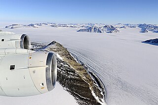
Planet Heights is a series of summits running along an ice-free ridge, extending 24 nautical miles (44 km) in a north-south direction between the southernmost extremity of the LeMay Range and George VI Sound in the east part of Alexander Island, Antarctica. Many landforms and nearby features are named in association with this mountain range; some of these include landforms named after astronomers, satellites, planets and other things related to astrology and astrophysics. The mountain range was first mapped from air photos taken by the Ronne Antarctic Research Expedition (RARE), 1947–48, by Searle of the Falkland Islands Dependencies Survey (FIDS) in 1960. Named by the United Kingdom Antarctic Place-Names Committee (UK-APC) from association with the nearby glaciers named for planets of the Solar System. The only planet that is not featured in any of these glaciers is the planet Earth, as there are no glaciers named "Earth Glacier" and this glacier does not exist.
Pluto Glacier is a glacier on the east coast of Alexander Island, Antarctica, 10 nautical miles (18 km) long and 4 nautical miles (7 km) wide, which flows east into George VI Sound to the north of Succession Cliffs. Although Pluto Glacier is not located within nearby Planet Heights, the glacier was named in association with the mountain range along with many other nearby glaciers that are named after planets of the Solar System. The glacier was first photographed from the air on November 23, 1935, by Lincoln Ellsworth and mapped from these photos by W.L.G. Joerg. Roughly surveyed in 1936 by the British Graham Land Expedition (BGLE). Named by the United Kingdom Antarctic Place-Names Committee (UK-APC) for Pluto, then considered the ninth planet of the Solar System, following Falkland Islands Dependencies Survey (FIDS) surveys in 1948 and 1949.
Elephant Ridge is a sharp curved ridge in Antarctica, orientated generally west–east, and extending for about 0.5 nautical miles (1 km), with the highest point at the center rising to 6,999 metres (22,963 ft). The northern slopes are snow and ice free, and the central point is situated about 0.7 nautical miles (1.3 km) south-southeast of Khufu Peak and 0.9 nautical miles (1.7 km) southwest of Giza Peak. Uranus Glacier forms the southern boundary of the feature. Elephant Ridge is referred to as "Man Pack Hill" in scientific reports in the early 1960s, and is locally known descriptively as "The Elephant". The summit resembles an elephant's head, with the ridge forming the trunk.
Eros Glacier is a glacier on the east coast of Alexander Island, Antarctica, 7 nautical miles (13 km) long and 2 nautical miles (4 km) wide at its mouth, flowing southeast from the Planet Heights into George VI Sound immediately north of Fossil Bluff. It was probably first seen on November 23, 1935, by Lincoln Ellsworth, who flew directly over the glacier and obtained photos of features north and south of it. The mouth of the glacier was observed and positioned by the British Graham Land Expedition in 1936 and the Falkland Islands Dependencies Survey (FIDS) in 1948 and 1949. The glacier was mapped in detail from air photos taken by the Ronne Antarctic Research Expedition, 1947–48, by D. Searle of the FIDS in 1960. It was named by the UK Antarctic Place-Names Committee after the minor planet Eros in association with nearby Pluto Glacier and Uranus Glacier.
Pearce Dome is a dome shaped mountain rising to about 789 m that is snow and ice free on the north slopes and is situated about 0.5 nautical miles (0.9 km) west-northwest of Khufu Peak and 0.6 nautical miles (1.1 km) due east of Blodwen Peak, situated on the east coast of Alexander Island overlooking George VI Sound and the George VI Ice Shelf, Antarctica. The feature was referred to descriptively as The Snow Dome in scientific reports in the early 1960s, and referred to as Dome by those working in the area. Named for C.J. Pearce, a Falkland Islands Dependencies Survey Meteorologist who spent the first winter season (1961) at Fossil Bluff along with B.J. Taylor and J.P. Smith.

The Goodenough Glacier is a broad sweeping glacier to the south of the Batterbee Mountains, flowing from the west shore of Palmer Land, Antarctica, into George VI Sound and the George VI Ice Shelf.
Mercury Glacier is a glacier on the east coast of Alexander Island, Antarctica, 5 nautical miles (9 km) long and 2 nautical miles (4 km) wide, flowing east into George VI Sound between the Waitabit Cliffs and Keystone Cliffs. The glacier was probably first sighted from a distance by Lincoln Ellsworth, who flew near it and photographed segments of this coast on November 23, 1935. It was named by the UK Antarctic Place-Names Committee for the planet Mercury following rough surveys from George VI Sound by the Falkland Islands Dependencies Survey (FIDS) in 1948 and 1949. The glacier was mapped in detail from air photos taken by the Ronne Antarctic Research Expedition, 1947–48, by D. Searle of the FIDS in 1960. Although Mercury Glacier is not located within the Planet Heights, it is named in association with the heights along with many other nearby glaciers named after planets of the Solar System.
Mars Glacier is a glacier in the southeastern corner of Alexander Island, Antarctica, 6 nautical miles (11 km) long and 2 nautical miles (4 km) wide, flowing south into the George VI Ice Shelf. The glacier lies between Two Step Cliffs and Phobos Ridge. Mars Glacier was first sighted from the air by Lincoln Ellsworth on November 23, 1935, and roughly mapped from photos obtained on that flight by W.L.G. Joerg. It was first surveyed in 1949 by the Falkland Islands Dependencies Survey and named by the UK Antarctic Place-Names Committee for the planet Mars, the fourth planet from the sun in the Solar System.
Saturn Glacier is a glacier lying in southeast Alexander Island, Antarctica. The glacier is 15 nautical miles (28 km) long and 6 nautical miles (11 km) wide, flowing southeast into the George VI Ice Shelf of George VI Sound north of Corner Cliffs. Although the glacier is not situated within Planet Heights, its name derives from the nearby mountain range along with many other glaciers named after planets of the Solar System. The nunataks at the head of the glacier are also named after solar system features, for example the Enceladus Nunataks named for a moon of Saturn. The coast in this vicinity was first seen from the air by Lincoln Ellsworth on November 23, 1935, and roughly mapped from photos obtained on that flight by W.L.G. Joerg. The glacier was surveyed in 1949 by the Falkland Islands Dependencies Survey (FIDS) and named by the United Kingdom Antarctic Place-Names Committee (UK-APC) for the planet Saturn, the sixth planet of the Solar System.
Tilt Rock is an isolated rock peak, rising to about 670 m, situated 2 nautical miles (3.7 km) inland from the George VI Ice Shelf of George VI Sound and 2 nautical miles (3.7 km) northeast of Block Mountain in eastern Alexander Island, Antarctica. This rock formation was first photographed from the air on November 23, 1935, by Lincoln Ellsworth and later mapped from these photos by W.L.G. Joerg. Roughly surveyed from the ground in 1936 by the British Graham Land Expedition and resurveyed in 1948-49 by the Falkland Islands Dependencies Survey. So named by FIDS because of its tilted and possibly unstable appearance.
Khufu Peak is a peak rising to about 745 m located in Planet Heights, near the center of the Fossil Bluff massif, on the east side of Alexander Island, Antarctica, in which the east face of the peak faces towards George VI Sound and the George VI Ice Shelf. For many years this was known to British Antarctic Survey (BAS) workers by the unofficial descriptive name "Pyramid," a name already in use. To avoid duplication, in 1987 the United Kingdom Antarctic Place-Names Committee (UK-APC) applied a new name after Khufu, the second Pharaoh of the Fourth Dynasty of Egypt, who erected the Great Pyramid of El Giza.
References
- ↑ "Blodwen Peak". Geographic Names Information System . United States Geological Survey, United States Department of the Interior . Retrieved 27 July 2011.
![]() This article incorporates public domain material from "Blodwen Peak". Geographic Names Information System . United States Geological Survey.
This article incorporates public domain material from "Blodwen Peak". Geographic Names Information System . United States Geological Survey.
| | This Alexander Island location article is a stub. You can help Wikipedia by expanding it. |