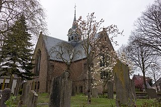
Friesland, historically known as Frisia, is a province of the Netherlands located in the country's northern part. It is situated west of Groningen, northwest of Drenthe and Overijssel, north of Flevoland, northeast of North Holland and south of the Wadden Sea. As of January 2020, the province had a population of 649,944 and a total area of 5,749 km2 (2,220 sq mi).

Leeuwarden is a city and municipality in Friesland, Netherlands. It is the provincial capital and seat of the Provincial Council of Friesland. In 2019, the municipality had a population of 123,107.

North Holland is a province of the Netherlands in the northwestern part of the country. It is located on the North Sea, north of South Holland and Utrecht, and west of Friesland and Flevoland. In November 2019, it had a population of 2,877,909 and a total area of 4,092 km2 (1,580 sq mi), of which 1,430 km2 (550 sq mi) is water.

Alkmaar is a city and municipality in the Netherlands, located in the province of North Holland. Alkmaar is well known for its traditional cheese market. For tourists, it is a popular cultural destination. The municipality has a population of 109,896 as of 2021.

het Bildt is a former municipality in the province of Friesland in the northern Netherlands; its capital was Sint Annaparochie. The population was in 2019. On 1 January 2018 it merged with the municipalities of Franekeradeel, Menameradiel and parts of Littenseradiel to form the new municipality Waadhoeke.

Vlieland is a municipality and island in the northern Netherlands. The municipality of Vlieland is the second most sparsely populated municipality in the Netherlands, after Schiermonnikoog.

Heerhugowaard is a city in the Netherlands, in the province of North Holland and the region of West Friesland.

Heiloo is a municipality and town in the Netherlands, located in the province of North Holland. The community is part of the cooperation region Kennemerland and is located in the historical region of West Friesland. Heiloo had a population of 23,464 in 2019.

Hoorn is a city and municipality in the northwest of the Netherlands, in the province of North Holland. It is the largest town and the traditional capital of the region of West Friesland. Hoorn is located on the Markermeer, 20 kilometers (12 mi) east of Alkmaar and 35 kilometers (22 mi) north of Amsterdam. The municipality has just over 73,000 inhabitants and a land area of 20.38 km2 (7.87 sq mi), making it the third most densely populated municipality in North Holland after Haarlem and Amsterdam. Apart from the city of Hoorn, the municipality includes the villages of Blokker and Zwaag, as well as parts of the hamlets De Bangert, De Hulk and Munnickaij.

Schagen is a city and municipality in the northwestern Netherlands. It is located between Alkmaar and Den Helder, in the region of West Friesland and the province of North Holland. It received city rights in 1415. In 2013, Schagen merged with Zijpe and Harenkarspel. Together they have formed a new municipality, which is also called Schagen. The townhall is located in the main town of Schagen.

West Friesland is a contemporary region in the Northwest of the Netherlands, in the province of North Holland.

Franeker is one of the eleven historical cities of Friesland and capital of the municipality of Waadhoeke. It is located north of the Van Harinxmakanaal and about 20 km west of Leeuwarden. As of 1 January 2014, it had 12,781 inhabitants. The Eise Eisinga Planetarium, established in 1781, is located in the city.

Grijpskerk is a village in the Dutch province of Groningen. It is located in the municipality of Westerkwartier, about 18 km west of the city of Groningen.

Koedijk is a village in the Netherlands, in the province of North Holland. It is now a part of Alkmaar and of Dijk en Waard, but before 1972 those two parts were a separate municipality first mentioned in the 14th century. Koedijk is most famous for its annual Gondelvaart. This gondelvaart is held every year on the 3rd Saturday in August.

Julianadorp, is a town in North Holland, Netherlands. It is part of the municipality of Den Helder. It lies about 6 kilometres south of the town of Den Helder, north of the municipality of Schagen and west of Hollands Kroon.

Sint Pancras is a town in the northwestern Netherlands. It is located in the municipality of Dijk en Waard, North Holland, about 5 km northeast of Alkmaar.
Jacob Roelofs van Deventer was a Netherlandish cartographer of the Renaissance. He is today best known for his work in systematically cartographing all towns and cities of the Habsburg Netherlands of his time. Van Deventer was among the first to make systematic use of triangulation, a technique whose theory was described by Gemma Frisius, one of his teachers at the University of Leuven.

Fatahillah Square is the historical center of the old Batavia. The square is located at the center of Jakarta Old Town. Today the square is a tourist area home to the Jakarta History Museum, Wayang Museum and Fine Art and Ceramics Museum in Kota, Jakarta.

Dijk en Waard is a municipality in the province of North Holland and the region of West-Frisia, the Netherlands, formed from the merger of Heerhugowaard and Langedijk. The municipality came into existence on 1 January 2022.


