
Dartmoor is an upland area in southern Devon, England. The moorland and surrounding land has been protected by National Park status since 1951. Dartmoor National Park covers 954 km2 (368 sq mi).

The Lyke Wake Walk is a 40-mile (64 km) challenge walk across the highest and widest part of the North York Moors National Park in North Yorkshire, England. Its associated club has a social structure, culture and rituals based on the walk and Christian and folklore traditions from the area through which it passes.

The River Wharfe is a river in Yorkshire, England. For much of its length it is the county boundary between West Yorkshire and North Yorkshire.
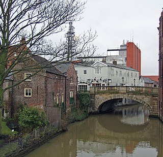
The River Foss is in North Yorkshire, England. It is a tributary of the River Ouse. It rises in the Foss Crooks Woods near Oulston Reservoir close to the village of Yearsley and runs south through the Vale of York to the Ouse in the centre of York. The name most likely comes from the Latin word Fossa, meaning ditch. It is mentioned in the Domesday Book. The York district was settled by Norwegian and Danish people, so parts of the place names could be old Norse. Referring to the etymological dictionary "Etymologisk ordbog", ISBN 82-905-2016-6 dealing with the common Danish and Norwegian languages – roots of words and the original meaning. The old Norse word Fos (waterfall) meaning impetuous. The River Foss was dammed, and even though the elevation to the River Ouse is small, a waterfall was formed. This may have led to the name Fos which became Foss.
Bleaklow is a high, largely peat-covered, gritstone moorland, just north of Kinder Scout, across the Snake Pass (A57), in the Derbyshire High Peak near the town of Glossop. Much of it is nearly 2,000 feet (610 m) above sea level and the shallow bowl of Swains Greave on its eastern side is the source of the River Derwent.

Swaledale is one of the northernmost dales (valleys) in Yorkshire Dales National Park, located in northern England. It is the dale of the River Swale on the east side of the Pennines in North Yorkshire.
Ballynahone Bog is a raised bog, situated in County Londonderry, Northern Ireland, about 3 km south of Maghera, on low-lying ground immediately north of the Moyola River about 14 km from its mouth at Lough Neagh. It is one of the largest lowland raised bogs in Northern Ireland.
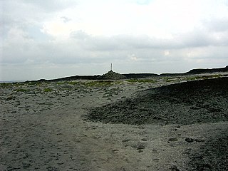
Urra Moor is the highest moor in the North York Moors at 1,490 feet (454 m) above sea level, in the national park in North Yorkshire, England. The name is a mix of Old English and Old Norse which means The Dirty Hill. The name of Urra Moor applies to the moor as a whole; the summit itself is known as Round Hill.

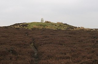
Cringle Moor, at 432 m (1,417 ft), is the third highest hill in the North York Moors, England, and the highest point west of Clay Bank.

Grosmont is a village and civil parish situated in Eskdale in the North York Moors National Park, within the boundaries of the Scarborough district of the county of North Yorkshire, England.

Gisborough Moor is a moor in England's North York Moors, lying to the south of the town of Guisborough. The summit is a broad flat ridge, with the highest point at the southern end, some 1-mile (1.5 km) south of a trig point. It is crossed by a number of footpaths leading between the Cleveland Way and Commondale and other settlements to the south. Highcliff Nab, near the moor's north-western corner, overlooks Guisborough from the edge of the scarp.

The A171 is a road in England that links the North Yorkshire towns of Middlesbrough, Whitby, and Scarborough. Locally it is known as The Moor Road. The road is mostly single carriageway but has some sections of dual carriageway. The distance between the two towns is 47 miles (75 km)

Conistone is a small village in the Craven district of North Yorkshire, England. It lies 3 miles (5 km) north of Grassington, 3 miles (5 km) south of Kettlewell and 12 miles (19 km) north of Skipton beside the River Wharfe, in Upper Wharfedale.
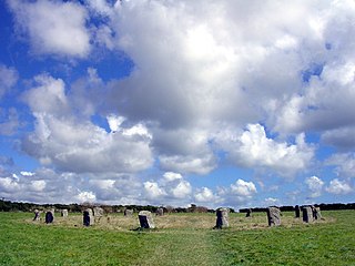
The Merry Maidens, also known as Dawn's Men is a late neolithic stone circle located 2 miles (3 km) to the south of the village of St Buryan, in Cornwall, United Kingdom. A pair of standing stones, The Pipers is associated both geographically and in legend.

Stanton Moor is a small upland area in the Derbyshire Peak District of central and northern England, lying between Matlock and Bakewell near the villages of Birchover and Stanton-in-Peak. It is known for its megaliths – particularly the Nine Ladies stone circle – and for its natural, wind-eroded sandstone pillars. The Peak District Boundary Walk runs across the moor.
The Quinnipiac Trail is a 24-mile (39 km) Blue-Blazed hiking trail in New Haven County, Connecticut. It is the product of the evolution and growth of the first 10.6-mile (17.1 km) trail designated in Connecticut's Blue-Blazed Hiking Trail system, with its light-blue rectangular vertical painted blazes.

The Hambleton Hills are a range of hills in North Yorkshire, England. They form the western edge of the North York Moors but are separated from the moors by the valley of the River Rye. They are the eastern boundary of the low-lying Vale of Mowbray which they abut with a precipitous escarpment.

Easby Moor is a hill located in the North York Moors national park within the Cleveland Hills, North Yorkshire, England. At the peak, at 324 metres (1,063 ft) above sea level, is a monument to Captain James Cook, who was native to the area. The Cleveland Way runs over the moor. The moor overlooks the villages of Easby and Great Ayton.

Machrie Moor Stone Circles is the collective name for six stone circles visible on Machrie Moor near the settlement of Machrie on the Isle of Arran, Scotland.

Aire Gap is a pass through the Pennines in England formed by geologic faults and carved out by glaciers. The term is used to describe a geological division, a travel route, or a location that is an entry into the Aire river valley.

