Dease Lake is a small community located in the Cassiar Country of the Northern Interior of British Columbia, Canada. Located a few hours south of the Yukon border, it is located on Highway 37 at the south end of the lake of the same name. Dease Lake is the last major centre before the Alaska Highway, and also the junction to Telegraph Creek and the Grand Canyon of the Stikine. Dease Lake Indian Reserve No. 9 is located nearby and is under the governance of the Tahltan First Nation band government.
The Bonaparte Plateau, in British Columbia, Canada, is a subarea of the larger Cariboo Plateau which extends to the Quesnel River and lies between the Cariboo Mountains on the east and the Fraser River on the west. The Cariboo Plateau is a subarea of the Interior Plateau, aka the Fraser Plateau.

Boya Lake Provincial Park is a provincial park in British Columbia, Canada, located 120 km north-by-northwest of the community of Dease Lake, British Columbia near BC Highway 37. Boya Lake is named for Charlie Boya, a First Nations man from the area.
Conkle Lake Provincial Park is a provincial park in British Columbia, Canada, located west of the confluence of the Kettle and West Kettle Rivers. The park size is 587 hectares.
Finn Creek Provincial Park is a provincial park in British Columbia, Canada, north of Avola and Blue River in the valley of the North Thompson River.
Goat Range Provincial Park is a provincial park in British Columbia, Canada.
Mount Blanchet Provincial Park is a provincial park in British Columbia, Canada, located on the west side of the southern end of Takla Lake, north of Smithers.
Mud Lake Delta Provincial Park is a provincial park in British Columbia, Canada, located in the North Thompson Country due east of Blue River, 230km from Kamloops on BC Highway 5.
Pennask Lake Provincial Park is a provincial park in British Columbia, Canada, located on the easternmost heights of the Thompson Plateau, 50km to the northwest of the Okanagan town of Peachland.
Pritchard Provincial Park is a provincial park in British Columbia, Canada, located on the north side of the South Thompson River between the communities of Monte Creek (W) and Chase (E). The Park is actually split into two sections. The best access to the actual Park is from the water; as you would need Private Land owners permission to access from the land. The area in between the Park's boundaries is supposedly under the Province of British Columbia's jurisdiction, but is not part of the Provincial Park itself.
Pyramid Creek Falls Provincial Park is a provincial park in British Columbia, Canada, located on the east side of the North Thompson River between the towns of Blue River (S) and Valemount (N).

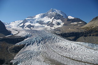
The Robson Glacier is the primary source of the short Robson River, one of the uppermost tributaries of the Fraser River. Located on the British Columbia-Alberta Boundary and the Continental Divide to the east of Berg Lake in Mount Robson Provincial Park, it sits on the northeast flank of Mount Robson in Mount Robson Provincial Park, British Columbia in the Canadian Rockies. Its meltwater feeds unofficially named Robson Lake, whose outlet marks the start of the Robson River.
The Kitwanga River is a tributary of the Skeena River near Hazelton in northwestern British Columbia, Canada, joining that stream at the community of Kitwanga (Gitwangak), which means "people of the place of rabbits".

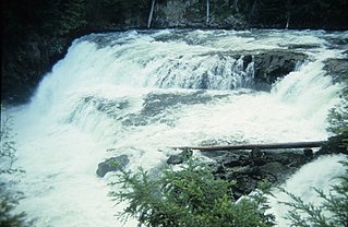
McDougall Falls is a waterfall on the Murtle River in Wells Gray Provincial Park, east-central British Columbia, Canada.

Meadow Falls is one of seven waterfalls on the Murtle River west of Murtle Lake in Wells Gray Provincial Park, east-central British Columbia, Canada. Meadow Falls is 8 m (26 ft) high.
Wedge Pass, also known as Billygoat Pass, 1430 m (4692 ft), is a mountain pass in the northern Garibaldi Ranges, the southwesternmost subdivisions of the Pacific Ranges of the Coast Mountains in British Columbia, Canada. Located immediately on the southern flank of Wedge Mountain and to the immediate north of the Spearhead Range, site of the Blackcomb half of the Whistler Blackcomb Ski Area, it connects the head of Wedge Creek (W), a tributary of the Green River with those of Billgoat Creek (E), a tributary of the Lillooet River. The pass is within Garibaldi Provincial Park and has no road access.
The Cottonwood River is a tributary of the Dease River in the Cassiar Country of the Northern Interior of British Columbia, Canada. Rising in the northern Stikine Ranges just east of Toozaza Peak, and just south of the origins of the Jennings and Little Rancheria River near the border with Yukon, it flows south along the east flank of the Tuya Range to meet the Dease just north of that river's source at Dease Lake, between the north end of that lake and McDame Creek and the former mining centre and community of McDame Post.
The Tuya River is a major tributary of the Stikine River in far northwestern British Columbia, Canada. Rising at Tuya Lake, which is on the south side of Tuya Mountains Provincial Park, it flows south to meet the Stikine River where that river bisects the Tahltan Highland. Its main tributary is the Little Tuya River.
Murtle Lake is a lava dammed lake located in Wells Gray Provincial Park, east-central British Columbia, Canada. It is fed primarily by the Murtle River which rises from a large unnamed glacier in the Cariboo Mountains at an elevation of 2,300 m (7,546 ft) and flows southwest for 18 km (11 mi) to the lake. The Murtle River also drains Murtle Lake then flows southwest for 36 km (22 mi) into the Clearwater River.


