Blythe Intake

Last updated
Blythe Intake
Palo Verde Diversion Dam.jpg
Palo Verde Dam site of the Blythe Intake
Location Palo Verde Dam
Coordinates 33°43′54″N114°30′57″W / 33.7318°N 114.5158388°W / 33.7318; -114.5158388
Built1887
DesignatedMarch 1, 1982
Reference no.948
USA California location map.svg
Red pog.svg
Location of Blythe Intake in California
Thomas Henry Blythe ThomasHenryBlythe.jpg
Thomas Henry Blythe
Palo Verde Valley aerial Palo Verde Valley aerial.jpg
Palo Verde Valley aerial

The Blythe Intake is the place of the first irrigation canal to feed water to the Palo Verde Valley in 1877. It is located just north of Blythe, California in Riverside County, California. The Blythe Intake was designated a California Historic Landmark (No.948) on March 1, 1982. The site of the Blythe Intake is currently at the Palo Verde Dam. [1]

Contents

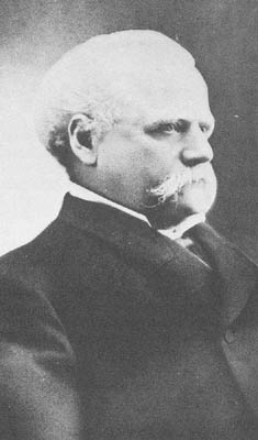
In the early or mid-1870s, William Calloway (known as Oliver Calloway in some sources), an engineer and a former captain of the 1st California Infantry Regiment, explored an area across the Colorado River from Ehrenberg, Arizona and found its potential for development. Calloway made preliminary surveys and filed land claims under the Swamp Land Act of 1850. He interested the wealthier Thomas Henry Blythe (1882-April 4, 1883), born Thomas Williams in Mold, Wales, to undertake development and settlement of an "empire" located next to the Colorado. On July 17, 1877, Blythe filed his first claim for Colorado River water on what was to become the "Blythe Intake". [2] [3] [4] [5] Blythe appointed another man named George Irish as manager to assist Calloway in building an irrigation system. Calloway died in a Chemehuevi attack on March 28, 1880, and was replaced by C.C. Miller, the father of Frank Augustus Miller. [6] [7] Thomas Blythe died on April 4, 1883; his only revisit to the valley was in November 1882. [7] [8] [9] [10]

The Blythe Intake feed water to the Palo Verde Valley which is located in the Lower Colorado River Valley, next to the eastern border of Southern California with Arizona, United States. [11] It is located on the Colorado Desert within the Sonoran Desert south of the Parker Valley. Most of the valley is in Riverside County, with the southern remainder in Imperial County. La Paz County borders to the east on the Colorado River. The Palo Verde Valley is part of the Sonoran Desert's Colorado Desert. The Big Maria Mountains are north of the valley, and the Colorado River forms the valley's boundaries to the east and south. Other mountains nearby are the McCoy Mountains to the west (north in Interstate 10), the Chocolate Mountains to the south, the Little Maria Mountains to the northwest, and the Dome Rock Mountains to the east.

Marker

A California Historical Landmark is located is on U.S. Route 95 at milepost 10.5, on the right when traveling north. Marker on the site reads: [12]

See also

Related Research Articles

<span class="mw-page-title-main">Blythe, California</span> City in California, United States

Blythe is a city in eastern Riverside County, California, United States. It is in the Palo Verde Valley of the Lower Colorado River Valley region, an agricultural area and part of the Colorado Desert along the Colorado River, approximately 224 miles (360 km) east of Los Angeles and 150 miles (240 km) west of Phoenix. Blythe was named after Thomas Henry Blythe, a San Francisco financier, who established primary water rights to the Colorado River in the region in 1877. The city was incorporated on July 21, 1916. The population was 18,317 at the 2020 census.

<span class="mw-page-title-main">Low Desert</span> Informal term for certain areas in California, US

The Low Desert is a common name for any desert in California that is under 2,000 feet in altitude. These areas include, but are not exclusive to, the Colorado Desert and Yuha Desert, in the Southern California portion of the Sonoran Desert. These areas are distinguished in biogeography from the adjacent northern High Desert or Mojave Desert by latitude, elevation, animal life, climate, and native plant communities.

<span class="mw-page-title-main">Colorado Desert</span> Subdivision of the larger Sonoran Desert, California

Colorado Desert is a part of the larger Sonoran Desert located in California, United States and Baja California, Mexico. It encompasses approximately 7 million acres, including the heavily irrigated Coachella, Imperial and Mexicali valleys. It is home to many unique flora and fauna.

<span class="mw-page-title-main">Turtle Mountains (California)</span> Mountain range in California, United States

The Turtle Mountains, are located in northeastern San Bernardino County, in the southeastern part of California. The colorful Turtle Mountains vary from deep reds, browns, tans and grays, to black. The area has numerous springs and seeps. The Turtle Mountains are also a National Natural Landmark, with two mountain sections of entirely different composition.

<span class="mw-page-title-main">Colorado River Indian Tribes</span> Federally recognized Native American tribe in Arizona and California

The Colorado River Indian Tribes is a federally recognized tribe consisting of the four distinct ethnic groups associated with the Colorado River Indian Reservation: the Mohave, Chemehuevi, Hopi, and Navajo. The tribe has about 4,277 enrolled members. A total population of 9,485 currently resides within the tribal reservation according to the 2012-2016 American Community Survey data.

Ripley is a census-designated place community in east Riverside County. It is located along State Route 78 (SR78) between Palo Verde and Blythe. The area is mostly agricultural lands irrigated by Colorado River water. The elevation is 249 feet (76 m). The population was 692 at the 2010 census.

<span class="mw-page-title-main">Palo Verde College</span> Public community college in California, US

Palo Verde College, formerly Palo Verde Junior College, is a public community college in Blythe, California.

Path 46, also called West of Colorado River, Arizona-California West-of-the-River Path (WOR), is a set of fourteen high voltage alternating-current transmission lines that are located in southeast California and Nevada up to the Colorado River.

Today's Bradshaw Trail is a historic overland stage route in the western Colorado Desert of Southern California. It is a remnant of the much longer Bradshaw Road, also known as the Road to La Paz, or Gold Road, established in 1862 by William D. Bradshaw. It was the first overland route to connect the gold fields near La Paz in the U.S. New Mexico Territory, later the Arizona Territory, to Southern California's more populated west coast. Once in La Paz, additional roads provided access to the mining districts of the central New Mexico/Arizona Territory, near Wickenburg and Prescott.

<span class="mw-page-title-main">Lower Colorado River Valley</span> Landform in Arizona and California

The Lower Colorado River Valley (LCRV) is the river region of the lower Colorado River of the southwestern United States in North America that rises in the Rocky Mountains and has its outlet at the Colorado River Delta in the northern Gulf of California in northwestern Mexico, between the states of Baja California and Sonora. This north–south stretch of the Colorado River forms the border between the U.S. states of California/Arizona and Nevada/Arizona, and between the Mexican states of Baja California/Sonora.

<span class="mw-page-title-main">U.S. Route 95 in California</span> Highway in California

U.S. Route 95 (US 95) is a United States Numbered Highway, stretching from the Mexican border in San Luis, Arizona to the Canadian border near Eastport, Idaho. The California portion of US 95 traverses through the far eastern edges of both Riverside and San Bernardino counties. US 95 serves Blythe and Needles and junctions with SR 62 at Vidal Junction.

<span class="mw-page-title-main">Parker Valley</span> Landform within the Lower Colorado River Valley

The Parker Valley is located along the Lower Colorado River within the Lower Colorado River Valley region, in southwestern Arizona and southeastern California.

<span class="mw-page-title-main">Deserts of California</span> Region of California

The deserts of California are the distinct deserts that each have unique ecosystems and habitats. The deserts are home to a sociocultural and historical "Old West" collection of legends, districts, and communities, and they also form a popular tourism region of dramatic natural features and recreational development. Part of this region was even proposed to become a new county due to cultural, economic and geographic differences relative to the rest of the more urban region.

The Mopah Range is a desert mountain range, in the Lower Colorado River Valley region, in southeastern San Bernardino County, California.

<span class="mw-page-title-main">Palo Verde Dam</span> Dam in Arizona / Riverside County, California

The Palo Verde Dam is a diversion dam on the Colorado River in La Paz County, Arizona, and Riverside County, California, in the southwestern United States, approximately 9 miles (14 km) northeast of Blythe. The dam is earthen and rockfill, built solely to divert water into irrigation canals serving the Palo Verde Irrigation District. It measures 1,850 feet (560 m) long at its crest, which is at an elevation of 283.5 feet (86.4 m), and stands 46 feet (14 m) high above the riverbed, containing approximately 175,000 cubic yards (134,000 m3) of material. Construction of the dam, which began in 1956 and ended in 1958, was authorized by the U.S. Bureau of Reclamation. The dam was constructed to raise the water level of the river because the upstream Hoover and Davis Dams blocked sediment, causing significant degradation of the riverbed that hampered water diversion.

<span class="mw-page-title-main">Riverside County, California</span> County in California, United States

Riverside County is a county located in the southern portion of the U.S. state of California. As of the 2020 census, the population was 2,418,185, making it the fourth-most populous county in California and the 10th-most populous in the United States. The name was derived from the city of Riverside, which is the county seat.

<span class="mw-page-title-main">Vidal Valley</span> Valley in the far eastern Colorado Desert

Vidal Valley is a 20-mile (32 km) long valley in the far eastern Colorado Desert bordering the Colorado River. Most of the valley is in eastern San Bernardino County, California, but the outfall on the Colorado River is in northeast Riverside County. Vidal Valley forms the large border of the south side of the east-west block of the Whipple Mountains massif, the landform that forces the Colorado to flow southeast, then back southwest. The southeast exit of the valley into Parker Valley on the Colorado River skirts the north end of the Riverside Mountains. The Colorado River Aqueduct crosses the midpoint of the valley at Vidal Junction, California. The Vidal Valley also lies due east of the Danby Dry Lake landform.

<span class="mw-page-title-main">Palo Verde Valley</span>

The Palo Verde Valley is located in the Lower Colorado River Valley, next to the eastern border of Southern California with Arizona, United States. It is located on the Colorado Desert within the Sonoran Desert south of the Parker Valley. Most of the valley is in Riverside County, with the southern remainder in Imperial County. La Paz County borders to the east on the Colorado River.

<span class="mw-page-title-main">Thomas Henry Blythe</span> Welsh-born American businessman

Thomas Henry Blythe, was a Welsh-born American businessman; he became a successful self-made capitalist and tycoon after emigrating to San Francisco in the United States. Blythe is most remembered for purchasing, developing, and subdividing the Palo Verde Valley in southern California, and obtaining primary rights to Colorado River water to irrigate the valley. The city of Blythe, California, the largest city in the Palo Verde Valley, is named for him.

References

  1. California Parks, Blythe Intake
  2. An historical marker for the intake was placed by the Palo Verde Valley Historical Society and Riverside County Parks and Recreation in 1986. Johnson, Marael (1995). Why Stop? A Guide to California Roadside Historical Markers. Houston, TX: Gulf Publishing Company. p. 213. ISBN   978-0884159230. OCLC   32168093.
  3. "Blythe resided in San Francisco and focused in real estate investments. Among his investments was a patch of undeveloped land within what is now downtown San Francisco. Development in the purchased site within Market Street, Geary Street, and Grant Street, called the "Blythe Block", and being in the center of downtown, made Blythe wealthy. The Blythe Block was sold off in portions in 1901 and 1902". Sandiegohistory.org. Retrieved 2017-03-25.
  4. "Blythe Block Changes Hands". San Francisco Call . 1901-08-02.
  5. "Blythe Block Sold". Los Angeles Herald. 1902-01-07. p. 1.
  6. Roth, George (1977). "The Calloway Affair of 1880: Chemehuevi Adaptation and Chemehuevi-Mohave Relations". Journal of California Anthropology. 4 (2).
  7. 1 2 Woodward, Arthur (1939). "Empire on the Colorado". Desert Magazine . 2 (4): 22–24, 39–40.
  8. "Palo Verde Irrigation District History". Palo Verde Irrigation District. February 2005. Archived from the original on 17 February 2015. Retrieved 11 February 2015.
  9. archive.org, Probate of Thomas Henry Blythe
  10. hesocialhistorian.com Part Two: 129 Claimants Battle for Thomas Henry Blythe’s Estate
  11. "Blythe Area Chamber of Commerce - Visitor's Guide" . Retrieved 2014-11-13.
  12. californiahistoricallandmarks.com 948 , Blythe Intake