
Veracruz, formally Veracruz de Ignacio de la Llave, officially the Free and Sovereign State of Veracruz de Ignacio de la Llave, is one of the 31 states which, along with Mexico City, comprise the 32 Federal Entities of Mexico. It is located in eastern Mexico and is bordered by seven states, which are Tamaulipas, San Luis Potosí, Hidalgo, Puebla, Oaxaca, Chiapas, and Tabasco. Veracruz is divided into 212 municipalities, and its capital city is Xalapa-Enríquez.

Copper Canyon is a group of six distinct canyons in the Sierra Madre Occidental in the southwestern part of the state of Chihuahua in northwestern Mexico that is 65,000 square kilometres (25,000 sq mi) in size. The canyons were formed by six rivers that drain the western side of the Sierra Tarahumara. All six rivers merge into the Rio Fuerte and empty into the Gulf of California. The walls of the canyon are a copper/green color, which is the origin of the name.

Orizaba is a city and municipality in the Mexican state of Veracruz. It is located 20 km west of its sister city Córdoba, and is adjacent to Río Blanco and Ixtaczoquitlán, on Federal Highways 180 and 190. The city had a 2005 census population of 117,273 and is almost coextensive with its small municipality, with only a few small areas outside the city. The municipality's population was 117,289 and it has an area of 27.97 km2.

The Sierra Madre Oriental is a mountain range in northeastern Mexico. The Sierra Madre Oriental is part of the American Cordillera, a chain of mountain ranges (cordillera) that consists of an almost continuous sequence of mountain ranges that form the western "backbone" of North America, Central America, South America, and Antarctica.
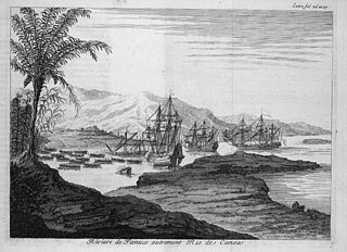
The Pánuco River, also known as the Río de Canoas, is a river in Mexico fed by several tributaries including the Moctezuma River and emptying into the Gulf of Mexico. The river is approximately 510 kilometres (320 mi) long and passes through or borders the states of Mexico, Hidalgo, Querétaro, San Luis Potosí, Tamaulipas, and Veracruz. According to the Atlas of Mexico, it is the fourth-largest river in Mexico by volume of runoff, and forms the sixth-largest river basin in Mexico by area.
The Sierra Gorda is an ecological region centered on the northern third of the Mexican state of Querétaro and extending into the neighboring states of Guanajuato, Hidalgo and San Luis Potosí. Within Querétaro, the ecosystem extends from the center of the state starting in parts of San Joaquín and Cadereyta de Montes municipalities and covering all of the municipalities of Peñamiller, Pinal de Amoles, Jalpan de Serra, Landa de Matamoros and Arroyo Seco, for a total of 250 km2 of territory. The area is extremely rugged with high steep mountains and deep canyons. As part of the Huasteca Karst, it also contains many formations due to erosion of limestone, especially pit caves known locally as sótanos. The area is valued for its very wide diversity of plant and animal life, which is due to the various microenvironments created by the ruggedness of the terrain and wide variation in rainfall. This is due to the mountains’ blocking of moisture coming in from the Gulf of Mexico, which generally makes the east side fairly moist and the west semiarid scrub brush. Most of the region has been protected in two biosphere reserves, with the one centered in Querétaro established in 1997 and the one centered in Guanajuato established in 2007. The Sierra Gorda is considered to be the far west of the La Huasteca region culturally and it is home to the Franciscan Missions in the Sierra Gorda World Heritage Site.

The Necaxa River is one of the main rivers of the Mexican state of Puebla. It is a tributary of the Tecolutla River. Beginning south of Huauchinango with the name Totolapa, it runs through tall mountains and deep canyons of the Sierra Madre Oriental, forming the waterfalls known as Salto Chico y Salto Grande. Its flow is also used to generate hydroelectric power.

The Sierra Madre de Oaxaca pine–oak forests is a tropical and subtropical coniferous forests ecoregion in Southern Mexico.

The Petén–Veracruz moist forests is an ecoregion of the tropical and subtropical moist broadleaf forest biome found in Belize, Guatemala, and Mexico.

The Veracruz moist forests is a tropical moist broadleaf forests ecoregion in eastern Mexico.

Tecolutla is a town and municipality located on the Tecolutla River on the eastern coast of the state of Veracruz in Mexico. It has the closest beaches to Mexico City, and much of its economy is based on tourism, as it is only a four- or five-hour drive from the capital. It is the northern end of a tourist corridor along the Gulf of Mexico called the "Emerald Coast," which extends down to the city of Veracruz.

The Trans-Mexican Volcanic Belt pine–oak forests is a subtropical coniferous forest ecoregion of the Trans-Mexican Volcanic Belt of central Mexico.
Nautla is a settlement in the Mexican state of Veracruz.

San Rafael Municipality is a municipality located in northern Veracruz state in central Mexico. The municipal seat is San Rafael, Veracruz.
The Guadarrama is a river in Spain. A tributary of the Tagus, the longest river on the Iberian Peninsula, Guadarrama has its source in the Siete Picos, part of the Sierra de Guadarrama, in the Community of Madrid, in the central part of the country, at an altitude of 1,900 metres (6,200 ft).
Las Minas is a municipality in the Mexican state of Veracruz, located 28 kilometres (17 mi) northeast of the state capital Xalapa.

Cañón del Río Blanco National Park is protected natural area in Mexico's Veracruz state.

The Blanco River is a river of central Veracruz state in eastern Mexico.
The Sierra de Chiconquiaco is a coastal mountain range in Veracruz state of eastern Mexico.
