
The Via Postumia was an ancient Roman road of northern Italy constructed in 148 BC by the consul Spurius Postumius Albinus Magnus. It ran from the coast at Genua through the mountains to Dertona, Placentia and Cremona, just east of the point where it crossed the Po River. From Cremona the road ran eastward to Bedriacum, the current town of Calvatone, where it forked, one branch running to the right to Mantua, the other to the left to Verona, crossing the Adige river on the Ponte Pietra, the only bridge on the Adige river at that time, and then traversing the Venetian plain, crossing the Piave River at Maserada sul Piave until finally reaching Aquileia, an important military frontier town founded by Rome in 181 BC. The Roman conquest of Liguria depended upon this road, and several of the more important towns owed their origin largely to it. Cremona was its central point, the distance being reckoned from it both eastwards and westwards.

The Giovi Pass is a pass in Italy in the northwestern Ligurian Apennines north of Genoa.

Monte delle Figne is a mountain in Liguria, northern Italy, part of the Ligurian Appennines. It lies at an altitude of 1172 metres.

Monte Frontè is a mountain in Liguria, northern Italy, part of the Alps. It is located in the province of province of Imperia. It lies at an altitude of 2,152 metres. After Monte Saccarello it is the second highest peak in the Ligurian region.
Monte Leco is a mountain in Liguria, northern Italy, part of the Ligurian Appennines. It is located in the provinces of Genoa and Alessandria. It lies at an altitude of 1072 metres.

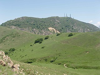
Monte Penello is a mountain in Liguria, northern Italy, part of the Ligurian Appennines. It is located in the province of Genoa. It lies at an altitude of 995 metres.

Piani di Praglia is a mountain in Liguria, northern Italy, part of the Ligurian Appennines.

Monte Reixa is a mountain in Liguria, northern Italy, part of the Ligurian Appennines.

Monte Taccone is a mountain located between Liguria and Piedmont in north-western Italy. It is part of the Ligurian Appennines.

Colle del Melogno (1028 m) is a mountain pass in the Province of Savona in Italy. It is located on the main chain of the Alps and connects Ceva and Calizzano with Magliolo and Finale Ligure, on the coast of Ligurian Sea.

Colle di Nava (934 m) is a mountain pass in the Province of Imperia in Italy. It is located on the main chain of the Alps and connects Ormea and the Tanaro Valley (CN) with Pieve di Teco and Imperia, the latter on the coast of Ligurian Sea.

Colle San Bernardo (957 m) is a mountain pass in the Province of Cuneo (Italy).

The Alta Via dei Monti Liguri is a long-distance waymarked hiking trail in the Italian region of Liguria. In about 440 kilometres (270 mi) and 44 day hikes, it runs through the arc formed by Ligurian Alps and Ligurian Apennines from Ventimiglia to Ceparana.

Cima Garlenda is a 2141 m mountain of the Ligurian Alps, in Italy. After Monte Saccarello and Monte Frontè it is the third Ligurian summit.

Passo Garlenda or Passo di Garlenda(2021 m) is a mountain pass in the Province of Imperia (Italy). It connects Verdeggia, located in the Argentina Valley, with Monesi di Triora, located in Tanaro Valley.

Passo Frontè (2081 m) is a mountain pass in the Province of Imperia (Italy). It connects Montegrosso Pian Latte, located in the Arroscia Valley, with Monesi di Triora.

Bric del Dente is a 1107 metres high mountain of the Apennines located in the Italian region of Liguria.

Passo del Faiallo (1044 m) is a mountain pass between the Province of Savona (SV) and the Metropolitan City of Genoa (GE). It connects Urbe (SV) with Passo del Turchino (GE), both in Liguria.

Monte Monega is a 1,882-metre (6,175 ft) mountain of the Ligurian Alps, in Italy.

Monte Alpesisa is a 989 metres high mountain in the Ligurian Apennines, in Italy.

