
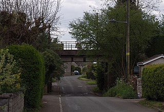
Boddington is a village and parish near Cheltenham. The population taken at the 2011 census was 266. [1] It is home to RAF Boddington.
Boddington is a village and parish near Cheltenham. The population taken at the 2011 census was 266. [1] It is home to RAF Boddington.
Hanham is a suburb of Bristol. It is located in the south east of the city. Hanham is in the unitary authority of South Gloucestershire. It became a civil parish on 1 April 2003.
Oldbury-on-Severn is a small village near the mouth of the River Severn in South Gloucestershire. The parish, which includes the village of Cowhill had a population at the 2011 census of 780. It is home to the nearby Oldbury nuclear power station, a Magnox power station which opened in 1967 and ceased operation on 29 February 2012.

Boddingtons Brewery was a regional brewery in Manchester, England, which owned pubs throughout the North West. Boddingtons was best known for Boddingtons Bitter (Boddies), a straw-golden, hoppy bitter which was one of the first beers to be packaged in cans containing a widget, giving it a creamy draught-style head. In the 1990s, the beer was promoted as The Cream of Manchester in a popular advertising campaign credited with raising Manchester's profile. Boddingtons became one of the city's most famous products after Manchester United and Coronation Street.
Tytherington is a village in South Gloucestershire, England. The quarry to the west belongs to Hanson plc. The parish population taken at the 2011 census was 666.
St Paul's Walden is a village about 5 miles (8 km) south of Hitchin in Hertfordshire, England. The civil parish of St Paul's Walden also includes the village of Whitwell and the hamlet of Bendish. At the 2011 Census the population of the civil parish was 1,293.

Rangeworthy is a semi-rural farming village in South Gloucestershire, England, nearby communities include Falfield and Charfield. The village population taken at the 2011 census was 675.

Bitton is a village and civil parish in South Gloucestershire, England, to the east of the Greater Bristol area on the River Boyd.
Bengeo Rural is a civil parish in the East Hertfordshire district of Hertfordshire, England. According to the 2001 census it had a population of 601, increasing at the 2011 Census to 644. The parish includes the villages of Tonwell and Chapmore End.
Boddington is a civil parish in South Northamptonshire, England, about 5 miles (8 km) north-east of Banbury off the A361 road.

Buckland is a village and civil parish in the East Hertfordshire district of Hertfordshire, England. According to the 2011 census it had a population of 274. The civil parish containing the village had a population of 1,853 at the 2011 census. The village is about 4½ miles south of Royston on the A10 road.
Tring Rural is a civil parish in Hertfordshire, England. It is composed of the villages of Long Marston, Wilstone, Puttenham, and the hamlets of Gubblecote and Astrope. It is largely situated the north of the town of Tring. The town of Tring itself is not part of the parish.
Pamber is a civil parish located in the north of Hampshire, England, near the border with Berkshire. The parish population at the 2011 Census was 2,613, It contains four settlements, Pamber Heath, Pamber Green, Pamber End and Little London.
Marradong is a former town located 8 kilometres (5 mi) south of Boddington along the road from Pinjarra to Williams.

Nolton and Roch is a community in the Hundred of Roose, Pembrokeshire, Wales. The community consists essentially of the villages of Nolton and Roch and a number of hamlets including Cuffern and Druidston. The western part of the community is in the Pembrokeshire Coast National Park. Its population (2001) was 746, increasing to 825 at the 2011 census.

Ambleston is a village, parish, and community in Pembrokeshire, Wales, lying 7 miles (11 km) north-northeast of Haverfordwest. The parish includes the hamlets of Wallis and Woodstock.

Brawdy is a village and community in Pembrokeshire, Wales.
Wymondley is a civil parish in Hertfordshire, England.
Langley is a hamlet and civil parish in the North Hertfordshire District, in the county of Hertfordshire. The population had increased to 175 at the 2011 Census. It is located four miles south of Hitchin, on the B656 road near the large town of Stevenage. It was formerly a detached part of Hitchin parish. Minsden Chapel lies within the parish.

Great Munden is a village and civil parish in Hertfordshire, England. The parish, in the district of East Hertfordshire, spans 3,758 acres (5.872 sq mi), of which 1,895.75 acres (2.96211 sq mi) are arable land, 927.5 acres (1.4492 sq mi) are permanent grass and 97 acres (0.152 sq mi) are wood. It has a population of 477, reducing to 339 at the 2011 Census, and is situated 6 miles (9.7 km) north of the town of Ware. The village includes the church of St Nicholas, Munden Bury, and a rectory that includes the remains of a moat. Other settlements in the parish include Nasty and Levens Green. A detached portion of Little Munden was added to the parish in 1888.

Sandon is a village and civil parish in the North Hertfordshire district, in the county of Hertfordshire, England. Sandon is located near the towns of Baldock and Buntingford. The parish also includes the hamlets of Green End and Roe Green, and Blagrove Common, a nature reserve. At the 2011 Census the population of the civil parish was 495.
![]()
Coordinates: 51°55′28″N2°09′20″W / 51.92432°N 2.15555°W
| This Gloucestershire location article is a stub. You can help Wikipedia by expanding it. |