Bodie Mine

Last updated

Bodie Mine
Location
USA Washington location map.svg
Schlaegel und Eisen nach DIN 21800.svg
Bodie Mine
Location Okanogan County, Washington
Coordinates 48°49′50″N118°53′26″W / 48.83056°N 118.89056°W / 48.83056; -118.89056
Production
Productsgold
History
Opened1896
Closed1941

The Bodie Mine is an inactive, privately owned gold mine in Okanogan County, Washington, United States. It is located within a triangle formed by the town of Wauconda, Washington the original town of Bodie, Washington, and the later ghost town of Bodie, on Toroda Road.

Contents

History

The Bodie Mine played an historically important part of the Okanogan gold rush. Founded by Henry Dewitz after the Northern Colville Reservation was opened for mining in 1896. The Bodie Mine was started in 1897 to mine a block of five patented claims (Bodie, Bodie #2, West Cliff, Crystal Bluff, and Little George). Dewitz sold the claim to his brother Ben who in 1902 sold to the Wrigley family. [1] The Wrigleys, famous for their gum and Chicago baseball team, built the steam-powered mill and established what became The Bodie Mining Company. A stock certificate signed in 1903 by then president L.S. Kurtz indicates the mine's net worth to be US $1,500,000. [2]

Mined continuously until 1916, the claim produced a reported $130,000 of gold at the then-price of $20.67 an ounce. During that period, ownership passed through a series of companies including Bodie Mining and Transportation Co (1907–09), Duluth-Toroda Mining Co (1910–12) and the Toroda Development Co (1915–16). After being shut down until 1934, the Northern Gold Company took over operations and rebuilt the mill in 1935. Employing as many as 40 miners working three shifts a day, an estimated 50,000 short tons of ore were mined, producing another $280,000 (13,500 ozt) in gold. All mining ceased in 1941 during World War II, as extraction of essential wartime metals took priority by Government Order L-208 of the War Production Board. [3]

In 1970 the Geomineral Corporation acquired the five patented claims, including The Bodie Mine and remains the owner. Several lease-option agreements occurred in the late 1970s, and early 1980s during the related spike in gold prices, but no mining or development has transpired on the property since that time.

Geology

The mine consists of hard rock stopes and tunnels, exploring a mineralized vein which runs the length of the ridge rising from Toroda Creek, experts suspect may be up to a half mile wide, and over a mile deep. Approximately 4,500 feet (1,400 m) of tunnels and shafts were dug into the hill side at its 100, 200, 250, 400 and 700-foot (210 m) levels. Several openings remain but all are extremely hazardous and should not be approached or entered under any circumstances. The Washington State Department of Natural Resources did an in-depth report on The Bodie Mine and other properties in the region. [4] This site was found to be similar to epithermal hot spring type gold deposits found in Stevens and Ferry Counties, and has been compared in magnitude to the newly reopened Buckhorn Mountain mine, near the Canada–US border. The Bodie vein is a series of parallel quartz stringers or veinlets separated by narrow bands of highly altered and pyritized andesite/dacite. The ore consists of microscopic particles of free gold and/or electrum, gold selenide, and gold-bearing sulfides found in a banded quartz vein five to 22 feet (6.7 m) wide. In some places, the quartz is chalcedonic in structure; in others, it is crustiform and contains late-stage calcite. Recent chemical analyses of the Bodie ore indicate that the mineralization is more complex than previously imagined, and assays have shown favorable results of several precious metals throughout the property.

Washington State Geologist Wayne Moen, [5] in his 1980 report, notes:

The Bodie vein is a persistent quartz fissure gold-bearing that has been partially mined. Although gold has been mined for up to a thousand feet along the strike of the vein, the vein has yet to be tested over its total length, which is excess of 6,000 feet. Based on past mining and sampling by mining companies, remaining parts of the vein in existing underground workings will probably average 0.15 ounces per ton in gold and 0.75 ounce in silver, but higher value can be expected in near surface parts of the vein. The Bodie Breccia which may exceed 50 million tons, is mineralized with gold and silver. Assays of the breccia in the upper levels of the mine have run as high as 0.23 ounce per ton in gold.

The potentially large quantity of ore posited by Moen remains unverified beneath fifteen hundred feet.

Surface facilities

Though once a thriving (relocated) town of 300 people supporting an array of mines, nothing beyond a few ruined upper buildings and block foundations remain on the property of its extensive mill, once a 1962 fire destroyed the mine's working infrastructure. Remnants of its picturesque, eponymous ghost town, including the bunkhouse, school, kitchen and assay office, are bisected by Torada Road. Toroda Creek, which runs through the property, has been tested by the D.O.E. and the water has determined to be of good quality, possessing rare bullhead trout, and rich in micronutrients. [6] Well established cottonwood trees and a thick stands of grass and now cover the 6.5 acres (26,000 m2) of stable tailings. The surrounding area remains sparsely populated, controlled by the B.L.M., the Washington Department of Natural Resources and a few private holdings. The property has two caretakers living on or near the site, and has supported grazing stock for decades.

Related Research Articles

<span class="mw-page-title-main">Hillsboro, New Mexico</span> Unincorporated community & CDP in New Mexico, United States

Hillsboro is an unincorporated community in Sierra County, New Mexico, United States, located in the southwestern part of the state. It was founded in 1877, following the discovery of gold. The community was the county seat of Sierra County from 1884 until 1936, when Hot Springs became the county seat.

<span class="mw-page-title-main">Empire Mine State Historic Park</span> State-protected site in California

Empire Mine State Historic Park is a state-protected mine and park in the Sierra Nevada mountains in Grass Valley, California, U.S. The Empire Mine is on the National Register of Historic Places, a federal Historic District, and a California Historical Landmark. Since 1975 California State Parks has administered and maintained the mine as a historic site. The Empire Mine is "one of the oldest, largest, deepest, longest and richest gold mines in California". Between 1850 and its closure in 1956, the Empire Mine produced 5.8 million ounces of gold, extracted from 367 miles (591 km) of underground passages.

<span class="mw-page-title-main">Monte Cristo Gold Mine</span> Gold mine in California, United States

The Monte Cristo Gold Mine is a gold mine in the San Gabriel Mountains near Los Angeles, California, USA.

<span class="mw-page-title-main">Vein (geology)</span> Sheetlike body of crystallized minerals within a rock

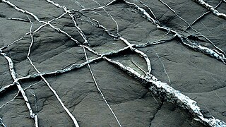
In geology, a vein is a distinct sheetlike body of crystallized minerals within a rock. Veins form when mineral constituents carried by an aqueous solution within the rock mass are deposited through precipitation. The hydraulic flow involved is usually due to hydrothermal circulation.

U.S. Silver & Gold Inc. was a mining company based in Wallace, Idaho near Coeur d'Alene, Idaho. The chairman of the company was Bobby E. Cooper, the CEO was Tom Parker.

<span class="mw-page-title-main">Stratton's Independence Mine and Mill</span> United States historic place

Stratton's Independence Mine and Mill is a historic gold mining site near Victor, Colorado on the south slope of Battle Mountain. Between late 1893 and April 1899, approximately 200,000 ounces (6200 kg) of gold was removed from the Independence Mine.

<span class="mw-page-title-main">Gold mining in the United States</span>

In the United States, gold mining has taken place continually since the discovery of gold at the Reed farm in North Carolina in 1799. The first documented occurrence of gold was in Virginia in 1782. Some minor gold production took place in North Carolina as early as 1793, but created no excitement. The discovery on the Reed farm in 1799 which was identified as gold in 1802 and subsequently mined marked the first commercial production.

<span class="mw-page-title-main">Silver mining in the United States</span>

Silver mining in the United States began on a major scale with the discovery of the Comstock Lode in Nevada in 1858. The industry suffered greatly from the demonetization of silver in 1873 by the Coinage Act of 1873, known pejoratively as the "Crime of 73", but silver mining continues today.

Silver mining in Arizona was a powerful stimulus for exploration and prospecting in early Arizona. Cumulative silver production through 1981 totaled 490 million troy ounces. However, only about 10% of Arizona's silver production came from silver mining. More than 80% of the state's silver was a byproduct of copper mining; other silver came as a byproduct of lead, zinc, and gold mining.

Silver mining in Nevada, a state of the United States, began in 1858 with the discovery of the Comstock Lode, the first major silver-mining district in the United States. Nevada calls itself the "Silver State." Nevada is the nation's second-largest producer of silver, after Alaska. In 2014 Nevada produced 10.93 million troy ounces of silver, of which 6.74 million ounces were as a byproduct of the mining of gold. The largest byproducers were the Hycroft Mine, the Phoenix Mine, the Midas Mine and Round Mountain.

<span class="mw-page-title-main">Sunshine Mine</span> Silver mine in Silver Valley, Idaho, USA

The Sunshine Mine is located between the cities of Kellogg and Wallace in northern Idaho. It has been one of the world's largest and most profitable silver mines, having produced over 360 million ounces of silver by 2001.

Gold mining in Alaska, a state of the United States, has been a major industry and impetus for exploration and settlement since a few years after the United States acquired the territory in 1867 from the Russian Empire. Russian explorers discovered placer gold in the Kenai River in 1848, but no gold was produced. Gold mining started in 1870 from placers southeast of Juneau, Alaska.

Gold was discovered in the Yentna-Cache Creek Mining District in the U.S. state of Alaska of the upper Susitna River Valley in 1898, soon followed by claim staking. Placer mining was reported in the Cache Creek drainage of the Dutch Hills by 1906. Quaternary glaciofluvial deposits, alluvial deposits, and Cenozoic conglomeratic white quartz-breccia units have been mined in the Dutch Hills. About 200,000 oz of gold has been produced from these placer deposits. By 1927, a road from Talkeetna was constructed into the mining area, known today as The Petersville Road. The mining camp of Petersville, Alaska served as the area Post Office for several years in the late 1920s and early 1930s. Two areas have been set aside for recreational gold mining, the North and South units of the Petersville State Recreation Mining Areas. Many smaller one-man and family placer mining operations continue today.

<span class="mw-page-title-main">Shafter, Texas</span> Ghost town in Texas, United States

Shafter is a ghost town in Presidio County, Texas, United States. The Texas Attorney General's Office listed a population of 11 as of the 2000 Census. It was named in honor of General William R. Shafter, who at one point commanded the nearby Fort Davis. As of 2012, at least one silver mine, La Mina Grande, had been reopened by Aurcana Corporation.

Coeur Mining, Inc. is a precious metals mining company listed on the New York Stock exchange. It operates five mines located in North America. Coeur employs 2,200 people and in 2012 it was the world's 9th largest silver producer. In 2013 the company changed its name to Coeur Mining, Inc. from Coeur d'Alene Mines and moved its head office to Chicago, Illinois from Coeur d'Alene, Idaho.

<span class="mw-page-title-main">Bodie, Washington</span> Ghost town in Washington, United States

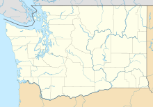
Bodie is a ghost town in Okanogan County, Washington, United States.

<span class="mw-page-title-main">Castle Dome Mountains</span> Landform in Yuma County, Arizona, US

The Castle Dome Mountains are a mountain range in Yuma County, Arizona, within the Kofa National Wildlife Refuge. Castle Dome Peak, the high point of the range, is a prominent butte and distinctive landmark. The peak is 3,780 feet (1,152 m) high, and is located at 33°05′04″N 114°08′36″W. Castle Dome was named by American soldiers at old Fort Yuma in the 1880s. Early Spanish explorers called the same peak Cabeza de Gigante, "Giant's Head."

<span class="mw-page-title-main">Cripple Creek & Victor Gold Mine</span>

The Cripple Creek & Victor Gold Mine, formerly and historically the Cresson Mine, is an active gold mine located near the town of Victor, in the Cripple Creek mining district in the US state of Colorado. The richest gold mine in Colorado history, it is the only remaining significant producer of gold in the state, and produced 322,000 troy ounces of gold in 2019, and reported 3.45 million troy ounces of Proven and Probable Reserves as at December 31, 2019. It was owned and operated by AngloGold Ashanti through its subsidiary, the Cripple Creek & Victor Gold Mining Company (CC&V), until 2015, when it sold the mine to Newmont Mining Corporation.

<span class="mw-page-title-main">Orex Exploration</span>

Orex Exploration is a former Canadian gold mining company that conducted exploration work on mining properties it owned in the Goldboro and Guysborough County areas of Nova Scotia. The properties owned by Orex were the sites of the former Boston Richardson Mine, Dolliver Mountain Mine, West Goldbrook Mine, and East Goldbrook Mine which operated between 1892 and 1912. Headquartered in Rouyn-Noranda, Quebec, the company was founded in 1987 and raised funds for exploration work, in part, by issuing stocks traded on the Montreal Stock Exchange and then the TSX Venture Exchange. It became a subsidiary of Anaconda Mining Inc. after Anaconda acquired the company in a stock swap deal in 2017.

<span class="mw-page-title-main">Kingston, New Mexico</span> Census-designated place in New Mexico, United States

Kingston is a census-designated place (CDP) in Sierra County, New Mexico, United States. Its population was 32 as of the 2010 census. The community is located in the Black Range along New Mexico State Road 152.

References

  1. Kettle River History Club: The Osiris Press, (1976). Reflections of the Kettle River Region
  2. Geo-Mineral Exploration Inc. Website Archived September 1, 2010, at the Wayback Machine
  3. "FindLaw's United States Supreme Court case and opinions".
  4. Wolff, Fritz; Matthew Brookshier, Donald McKay Jr., David Norman (November 2007). "INACTIVE AND ABANDONED MINE LANDS—Bodie Mine, Wauconda Mining District, Okanogan County, Washington". Washington Division of Geology and Earth Resources. Information circular 106.
  5. Publications of Wayne S. Moen: https://openlibrary.org/a/OL146697A/Wayne-S.-Moen
  6. Department of Natural Resources, Geology Division, Inactive Mines Circular 106, Appendix B