The national flag of the United States, often referred to as the American flag or the U.S. flag, consists of thirteen horizontal stripes, alternating red and white, with a blue rectangle in the canton bearing fifty small, white, five-pointed stars arranged in nine offset horizontal rows, where rows of six stars alternate with rows of five stars. The 50 stars on the flag represent the 50 U.S. states, and the 13 stripes represent the thirteen British colonies that won independence from Great Britain in the American Revolutionary War.

The United States Capitol, often called the Capitol or the Capitol Building, is the seat of the United States Congress, the legislative branch of the federal government. It is located on Capitol Hill at the eastern end of the National Mall in Washington, D.C. Although no longer at the geographic center of the national capital, the U.S. Capitol forms the origin point for the street-numbering system of the district as well as its four quadrants. Like the principal buildings of the executive and judicial branches, the Capitol is built in a neoclassical style and has a white exterior.

The United States secretary of education is the head of the United States Department of Education. The secretary serves as the principal advisor to the president of the United States, and the federal government, on policies, programs, and activities related to all education in the United States. As a member of the Cabinet of the United States, the secretary is sixteenth in the line of succession to the presidency.

The East Coast of the United States, also known as the Eastern Seaboard, the Atlantic Coast, and the Atlantic Seaboard, is the region encompassing the coastline where the Eastern United States meets the Atlantic Ocean. The Thirteen Colonies, which formed the United States in 1776 were located on this coast, and it has played an important role in the development of the United States.

Okanogan County is a county located in the U.S. state of Washington along the Canada–U.S. border. As of the 2020 census, the population was 42,104. The county seat is Okanogan, while the largest city is Omak. Its area is the largest in the state.
Washington most commonly refers to:

Washington, D.C., formally the District of Columbia and commonly known as Washington or D.C., is the capital city and federal district of the United States. The city is on the Potomac River, across from Virginia, and shares land borders with Maryland to its north and east. It was named for George Washington, the first president of the United States. The district is named for Columbia, the female personification of the nation.

Oroville is a city located in the northern bulk of the Okanogan Highlands in north-central Washington, United States. Oroville is a member municipality of Okanogan County, Washington, situated between Omak and Penticton. The population was 1,795 at the 2020 census.

The Dictionary of American Naval Fighting Ships (DANFS) is the official reference work for the basic facts about ships used by the United States Navy.
The Territory of Washington was an organized incorporated territory of the United States that existed from March 2, 1853, until November 11, 1889, when the territory was admitted to the Union as the State of Washington. It was created from the portion of the Oregon Territory north of the lower Columbia River and north of the 46th parallel east of the Columbia. At its largest extent, it also included the entirety of modern Idaho and parts of Montana and Wyoming, before attaining its final boundaries in 1863.

The 1976 United States House of Representatives elections were elections for the United States House of Representatives on November 2, 1976, to elect members to serve in the 95th United States Congress. They coincided with Jimmy Carter's election as president. Carter's narrow victory over Gerald Ford had limited coattails, and his Democratic Party gained a net of only one seat from the Republican Party in the House. The result was nevertheless disappointing to the Republicans, who were hoping to win back some of the seats they lost in the wake of the Watergate scandal two years earlier.

The Northwestern United States, also known as the American Northwest or simply the Northwest, is an informal geographic region of the United States. The region consistently includes the states of Oregon, Washington, Idaho, Montana and Wyoming. Some sources include Southeast Alaska in the Northwest. The related but distinct term "Pacific Northwest" generally excludes areas from the Rockies eastward, whereas the term "Inland Northwest" excludes areas west of the Cascades.

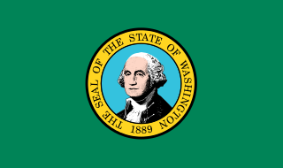
Washington, officially the State of Washington, is the northernmost state in the Pacific Northwest region of the United States. It is often referred to as Washington state to distinguish it from the national capital, both named for George Washington. Washington borders the Pacific Ocean to the west, Oregon to the south, Idaho to the east, and shares an international border with the Canadian province of British Columbia to the north. The state was formed from the western part of the Washington Territory, which was ceded by the British Empire in the Oregon Treaty of 1846. It was admitted to the Union as the 42nd state in 1889. Olympia is the state capital, and the most populous city is Seattle.

In the United States, a state is a constituent political entity, of which there are 50. Bound together in a political union, each state holds governmental jurisdiction over a separate and defined geographic territory where it shares its sovereignty with the federal government. Due to this shared sovereignty, Americans are citizens both of the federal republic and of the state in which they reside. State citizenship and residency are flexible, and no government approval is required to move between states, except for persons restricted by certain types of court orders.
Bolster is a ghost town in Okanogan County, Washington, USA. In 1899, the town was plotted by J.S. McBride, who named it for the Spokane financier Herman Bolster. He sold lots in the new town and at one time there were several stores, a post office and three saloons. The small town of some thirty families traded with Chesaw, each calling the other a 'suburb'. The town's newspaper, The Bolster Drill, could not make any money, and eventually went out of business. In 1909, the post office closed. There was a school in Bolster in 1910, but it was open for only that year.

The following outline is provided as an overview of and topical guide to the U.S. state of Washington:


