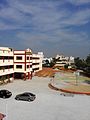
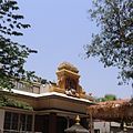
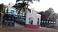
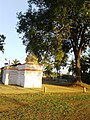
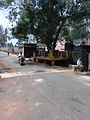
Mysore, officially Mysuru, is the second-most populous city in the southern Indian state of Karnataka. It is the headquarters of Mysore district and Mysore division. As the traditional seat of the Wadiyar dynasty, the city functioned as the capital of the Kingdom of Mysore for almost six centuries. Known for its heritage structures, palaces, and its culture, Mysore has been called the "City of Palaces", the "Heritage City", and the "Cultural Capital of Karnataka". It is one of the cleanest cities in India according to the Swachh Survekshan.

Mandya is a city in the state of Karnataka. It is the headquarter of Mandya district and is located 45 kilometres (28 mi) from Mysore and 100 kilometres (62 mi) from Bangalore.

Mysore district, officially Mysuru district, is an administrative district located in the southern part of the state of Karnataka, India. It is the administrative headquarters of Mysore division. Chamarajanagar District was carved out of the original larger Mysore District in the year 1998. The district is bounded by Chamrajanagar district to the southeast, Mandya district to the east and northeast, Kerala state to the south, Kodagu district to the west, and Hassan district to the north.

Kushalanagar or Kushalanagara is a city located in the Kodagu district of the Indian state of Karnataka. Surrounded by Kaveri river, it is the gateway to Kodagu district. It also serves as the headquarters of Kushalanagar Taluk. By population, Kushalanagar is the second largest town in Kodagu district after Madikeri and the fastest developing town in the district. Kushalnagar is an important commercial centre in Kodagu.

Bannur is a municipality in T.Narasipura Taluk, Mysore district in the state of Karnataka, India. It is located at 12.33°N 76.86°E. It has an average elevation of 654 metres (2,146 ft) T.Narasipura Taluk Near Somanathapur Temple. It is about 25 kilometers from the city of Mysuru and around 30 kilometres (19 mi)30 kilometers from Mandya

Gonikoppal is a census town in the Kodagu district of the Indian state of Karnataka.
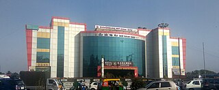
Kengeri is a western suburb of Bangalore city, located along Mysore Road.It is bordered by Nagarbhavi and Ullal to the north, Rajarajeshwari Nagar to the east, Kumbalgodu to the west and Uttarahalli to the south.
Tarikere is a town, a taluk and is one of the two Subdivisional headquarter in the Chikmagalur district of Karnataka state, India. It is popularly known as gateway of Malnad because the Malnad area starts from here. The town's name is derived from the number of water tanks which surround it.

Tirumakudalu Narasipura the temple city of Karnataka, commonly known as T. Narasipura or T.N. Pura, is a town in Mysore district in the Indian state of Karnataka. The first name refers to the land at the confluence, (trimakuta in Sanskrit at the confluence of the Kaveri, Kabini and Spatika Sarovara. The city is a Taluk of Mysore district and 32 km south-east of the district headquarters and has five Hobli centers. This taluk is bordered by Chamarajanagar district to the south and Mandya districts to the north with an area of 598 sq km. Agriculture is the main occupation of the people here. Rice is the main food crop and silk is the main commercial crop. Fossils of Neolithic age have been found by excavation in some lands of this Taluk. Vyasatirtha, the guru of Purandara Dasa, and T Chowdiah, the unique violinist, were born in this Taluk. Talakad, the capital of the Western Ganga dynasty, is in this Taluk.

Hinkal is a Census town situated at the intersection of Hunsur Road aka NH275 and Ring Road aka NH 275K in Mysore city outskirts of Karnataka, India. It is the most populous census town in Mysore district. The nearest railway station located is Mysore Junction railway station.

Manathana is a village in Peravoor Grama Panchayat of Kannur district, Kerala, India.
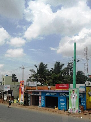
Kadakola is a Town and a suburb of Mysuru metropolitan area in the southern state of Karnataka, India. It is located in the Mysore taluk of Mysore district. In November 2020, Kadakola was upgraded from a Gram Panchayat to a Town Panchayat and a gazetted notification was passed on November 26, 2020.2. The combined population of the newly formed town is 19,969.

Rammanahalli is a Town and a suburb of Mysore in the Mysuru metropolitan area of Karnataka, India. It is located in the Mysore taluk of Mysore district. In November 2020, Kadakola was upgraded from a Gram Panchayat to a Town Panchayat and a gazetted notification was passed on November 26, 2020. The notification combines Rammanahalli GP villages, Nadanahalli and Alanahalli of Alanahalli GP, Hanchya and Sathagalli villages of Hanchya GP, covering a total area of 22.81 sq. km. The combined population of the town according to 2011 census was 20,804.

The MysoreUrban Development Authority (MUDA) of Mysore, India, is a governmental organization that oversees planning and development of infrastructure, provision of development-related sites and services, and the housing needs of underprivileged citizens in Mysore.

Mysuru City Corporation (MCC) is the administrative body responsible for civic amenities and infrastructural assets of Mysuru in Karnataka, India. It is the third-largest municipal corporation in Karnataka, serving a population of 1,000,000 in an area of 235 km2. The city's boundaries have expanded more than twice between 2010 and 2020.
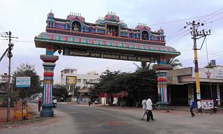
Srirampura is a town and residential suburb of Mysore city in India. It is located in the Southern part of the city. It has a population of approximately 11,000 according to the 2011 census. The main landmarks of this area are Brahmarahbha Choultrey, SBM park, Madhuvana Park. There are several schools in and around this area. North of Srirampura is Vivekananda Nagar and Kuvempunagar. West of Srirampura is Ramakrishnanagar, East of Srirampura is Asokapuram. South of Srirampura is the Mananthavady-Mysore Highway. In November 2020, a gazetted notification was passed upgrading the census town to a town panchayat. The notification combines towns and villages of Srirampura, Lingambudhipalya, Gurur, Koppalur and Kalalavadi villages coming under Srirampura GP, covering a total area of 17.99 km2. According to 2011 census, the town has a combined population of 18,511.

Sagara is a city located in the Indian state of Karnataka. It is also a sub divisional and a taluk headquarters. Located in the Sahyadri Mountain range on the banks of river Varada, it is known for its proximity to Jog Falls and to the historical places of Ikkeri, Keladi and Varadamoola. The river Varada originates near Varada-moola. Sagara subdivision consists of Sagara, Soraba, Hosanagara and Shikaripur taluks.

Yelwala or Ilvaala is a Census town in the city of Mysore in Karnataka, India. This place is located between Mysore and Hunsur. Yelwala is a hobli headquarter and a Gram Panchayat. The population of Yelwala in census 2011 was 9,826.

Hootagalli or Hutagalli is a city and a Suburb of Mysore, situated in Mysuru metropolitan area ಮೈಸೂರು ಜಿಲ್ಲೆ of Karnataka, India. Hootagalli is located in the outskirts of the city of Mysuru and forms a continuous urban area. Hootagalli city municipal council consists of previous census towns of Hinkal, Hootagalli and Gram Panchyats of Koorgalli and Belavadi totally covering an area of 28.48 square km. In November 2020, the government of Karnataka approved the formation of Hootagalli City Municipal Council by merging four gram panchayats. The initial plan was to include it with MCC to form Greater Mysuru City Corporation (BMMP) however, due to MCC disputing the proposal, a separate body was created. According to 2011 census, the city municipal council has combined population of 56,876. On November 26, 2020, a gazetted notification was passed making the CMC official.
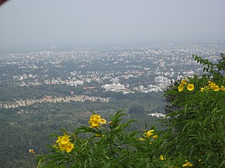
Mysuru Local Planning Area is the metropolitan area limit defined in City Development Plan 2031 by Mysore Urban Development Authority. Mysuru Planning Area is divided into 45 planning districts spanning across the Taluks of Mysore, Nanjangud and Srirangapatna of Mandya district. As per City Development Plan 2031, this metropolitan area covers 509sq.km of area and has a population of 1,696,577.



 India
India