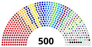
The National Assembly is the lower house and main legislative political body of the Parliament of the Democratic Republic of the Congo. It is one of the two legislative bodies along with the Senate. The National Assembly is composed of deputies who are elected by the citizens of the DRC. The deputies serve as the voice of the people and are responsible for enacting legislation, representing their constituents' interests, and overseeing the executive branch of government. The National Assembly is responsible for deliberating and passing laws that impact the nation and its citizens. It was established by the 2006 constitution, which provided for a bicameral parliament consisting of the National Assembly and the Senate. It is located at the People's Palace in Kinshasa.

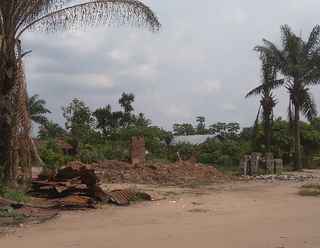
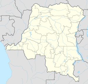
Yumbi is a town and territory of Mai-Ndombe in the Democratic Republic of the Congo. It lies on the eastern bank of the Congo River between Bolobo and Lukolela. The town of Yumbi is the headquarters of Yumbi Territory and has a population of approximately 30,000.
Kungu is a town and capital of one of the four territories of Sud-Ubangi Province, Democratic Republic of the Congo. The Ubangi River forms the western boundary of Kungu Territory, separating it from the Republic of the Congo. The Ngiri River, which flows southward through the Ngiri Reserve, originates near the town of Kungu.

The provinces of the Democratic Republic of the Congo were divided into 26 districts. Those in turn were divided into territories or communes.
Popokabaka Territory is a territory of the Democratic Republic of the Congo. It is located in the Kwango province. The territory is divided into three sectors: Yonso, Popokabaka and Lufuna. The Kwango River runs through the territory. The administrative center is the city of Popokabaka.
Bagata is a town in the Kwilu Province of the Democratic Republic of the Congo. It is the administrative headquarters of Bagata Territory, and is situated on the Kwilu River between Kikwit and Bandundu.
Kasongo Lunda is a town and seat of Kasongo Lunda Territory, in the Kwango Province of the Democratic Republic of the Congo. The town lies near the border with Angola to the east, here defined by the Kwango River. As of 2012 the town was estimated to have a population of 23,820.
Ikela Territory an administrative division of Tshuapa Province of the Democratic Republic of the Congo. The headquarters of the Territory is the town of Ikela. The territory is divided into Loile Sector, Lofome Sector, Lokina Sector, Tumbenga Sector and Tshuapa Sector.

Bas-Uélé is one of the 21 new provinces of the Democratic Republic of the Congo created in the 2015 repartitioning. Bas-Uélé, Haut-Uélé, Ituri, and Tshopo provinces are the result of the dismemberment of the former Orientale Province. Bas-Uélé was formed from the Bas-Uele District whose town of Buta was elevated to capital city of the new province.

Haut-Uélé is one of the 21 new provinces of the Democratic Republic of the Congo created in the 2015 repartitioning. Haut-Uélé, Bas-Uélé, Ituri, and Tshopo provinces are the result of the dismemberment of the former Orientale province. Haut-Uélé was formed from the Haut-Uélé district whose town of Isiro was elevated to capital city of the new province.

Tshopo is one of the 21 new provinces of the Democratic Republic of the Congo created in the 2015 repartitioning. It is situated in the north central part of the country on the Tshopo River, for which it is named.

Bas-Fleuve District was a district located in the Kongo Central province, in the Democratic Republic of the Congo. It included the Tshela, Lukula and Seke-Banza territories.

Kwango is a province of the Democratic Republic of the Congo. It's one of the 21 provinces created in the 2015 repartitioning. Kwango, Kwilu, and Mai-Ndombe provinces are the result of the dismemberment of the former Bandundu province. Kwango was formed from the Kwango district whose town of Kenge was elevated to capital city of the province.

The Plateaux District was a former district located in the current Mai-Ndombe Province, but until the 2015 repartitioning it was part of the former Bandundu Province.
Bagata Territory is an administrative region in the Kwilu Province of the Democratic Republic of the Congo. The headquarters are in the town of Bagata. The territory is divided into five sectors: Kidzweme, Kwango-Kasai, Kwilu-Ntobere, Manzasay and Wamba-Fatunda.
Bulungu is a community in the Kwilu Province of the Democratic Republic of the Congo. The town lies on the southwestern bank of the Kwilu River, downstream from Kikwit. Bulungu is the headquarters of the Bulungu Territory. As of 2012 the population was estimated to be 57,168.
Masi-Manimba Territory is an administrative area of Kwilu province, Democratic Republic of the Congo. Its headquarters are in the town of Masi-Manimba, on the Lukula River, a tributary of the Kwilu River. The Luie and Kafi rivers also run from south to north through the territory, tributaries of the Lukula. The territory is divided into ten sectors: Bindungi, Kibolo, Kinzenga, Kinzenzengo, Kitoy, Masi-Manimba, Mokamo, Mosango, Pay-Kongila and Sungu.

Masi-Manimba is a town in Kwilu Province, Democratic Republic of the Congo, the headquarters of the Masi-Manimba Territory. As of 2012 the population was estimated to be 31,802.
Rungu is a territory and a locality of Haut-Uele province in the Democratic Republic of the Congo.
The Bayanzi are an ethnic group in the Democratic Republic of the Congo who live in the southwest of the country and number about seven million. They speak Kiyansi Bantu language. The largest political unit is the chieftainship, of which there are about 120 under 3 traditional kings of which the most prominent is the Kinkie or Binkie King whose latest figurehead was Mfum' ngol' or Mfumu ngolo as pronounced by Europeans from kidzweme territory and recently his successor Mfum' Ntwàl Moka Ngol' Mpat', a harvard trained economist. The Bayanzi are matrilineal, so a child belongs to the clan of the mother. The Belgian colonial travelers first encountered them at Bolobo on the Congo River, as traders up and down the river. They employed them from 1883 as bodyguards mainly. Later the Bayanzi were forced to labor on the palm oil plantations and later used as clerks or translators.


